Eastern USA, Routes, Trip Reports » USA-PA-North/South Route
 PA N-S Mixed Surface Route
Background
The idea for this route was hatched in this thread. Three of us (Jeff, Ron and Ruth) scouted the complete route in 2012. The goal was to begin piecing together what could be a long distance backcountry route in the east.
The Route
Summary
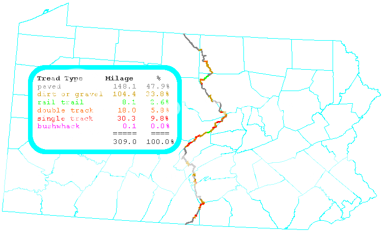
The following image shows the route.
The elevation profile of the route: 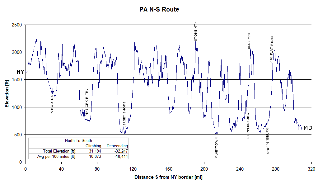
Along the Route
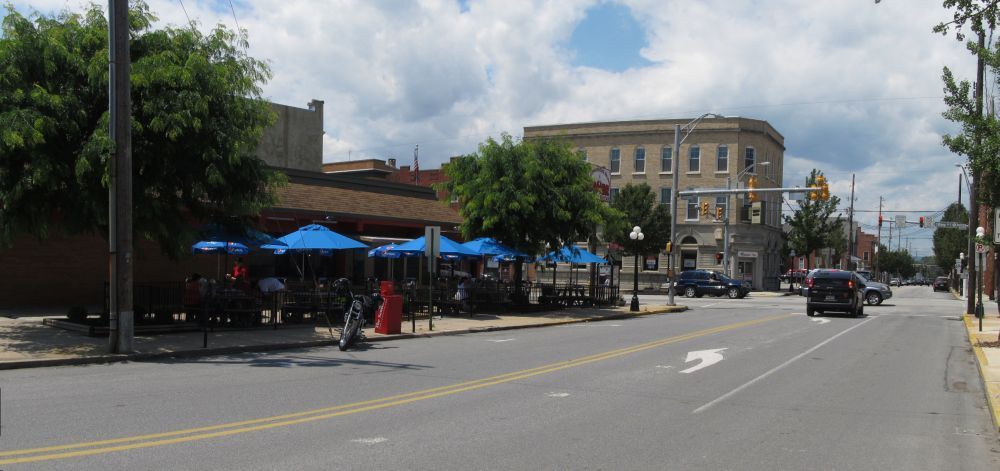
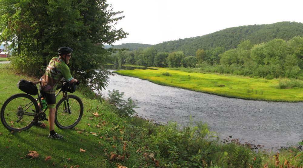
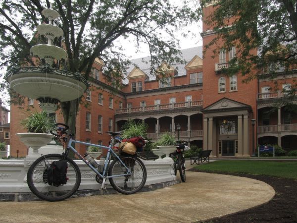
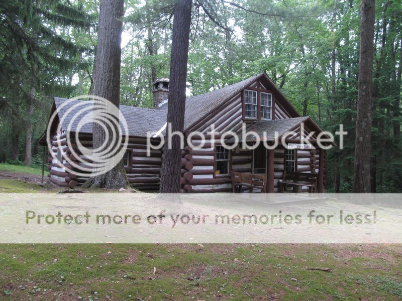
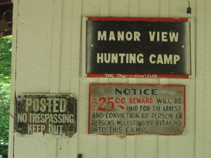
The route includes a mix of paved road, dirt road, double track, rail trail, single track, and for good measure, a short bushwhack. The route connects blocks of PA State Forest land located in central PA. Along the way the route encounters small towns, farming communities, forested ridges, hunting camps and state parks.
Regarding singletrack, the route goes through both Rothrock and Michaux State Forests which are arguably the top two single track destinations for PA mountain bikers. In addition, there are additional single track sections in Bald Eagle SF and Tiadaghton SF. Several of the sections are used as race routes throughout the year (Michaux Series, Wilderness 101, Stupid 50, Iron Cross, etc..)
For the most part, water (that should be treated) can be easily found along the route in numerous streams and springs. Food sources (grocery stores, convenience stores and restaurants) are less frequent. Full service grocery stores are located along the route in Jersey Shore and
Shippensburg. No permits are required for single night, primitive camping in PA state forests.
Bicycle shops are “few and far between”. Although there are no bike shops directly on the route, there are shops in close proximity (within 10 miles or so) that can be good resources for emergency spare parts or route information. In the southern section, Gettysburg Bicycle is nearby to the Michaux State Forest. FreezeThaw Cycles, The Bicycle Shop and Eddies Cycles are located in State College and are all good contacts for the Rothrock and Bald Eagle sections of trail. In the northern end, Oswald Cycle Works in Mansfield is a good stretch from
the route but familiar with the area.
Connections
The PA N-S is connector between the proposed Triple Divide Trail, and an unscouted connector through MD that connects to the VA Mountain Bike Route. As of this writing (March 2013), there does not seem to be an official public domain map of the VA Mountain Bike Route. The Google Map linked to this document contains a ‘best guess’ of the VA route.
Google Map Link
Google Map Link (also shows connections, waypoints and photos)
Maps and GPS Data
Are found at this link. The map downloads include options for complete sets of printable, topographic maps in PDF format.
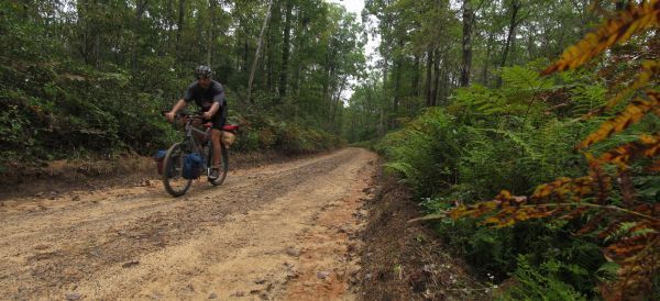
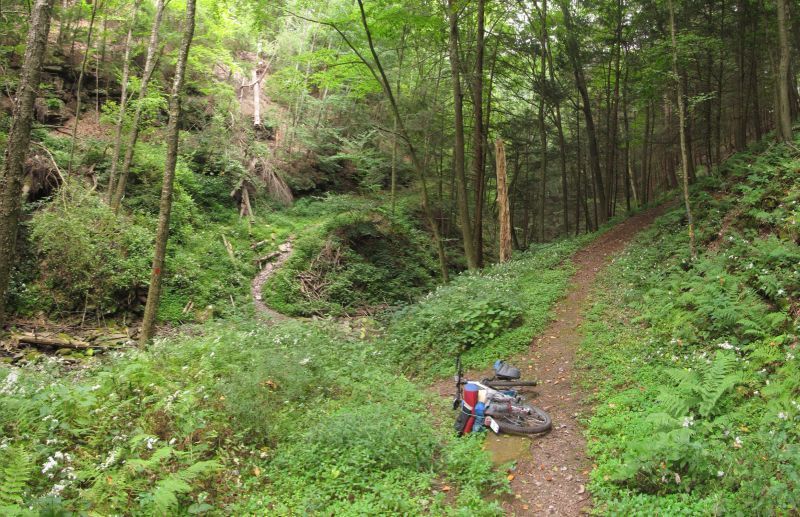
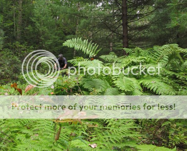
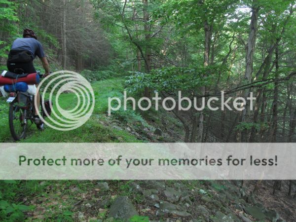
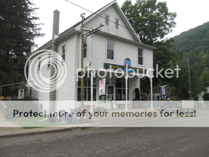
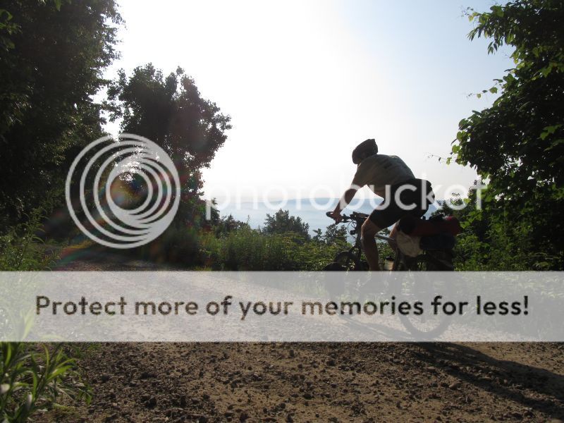
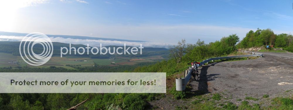
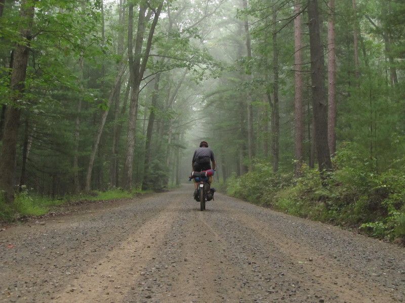
Photos along Route
Note: photos where taken during multiple trips, which spanned multiple seasons!
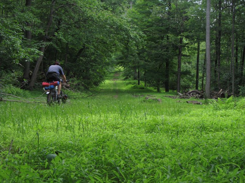
Grassy, Gated, Forest Road


Five Way


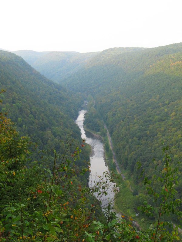
Pine Creek Gorge
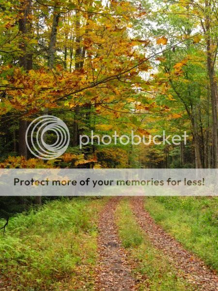
Forest Road
This is great!!! I grew up in Williamsport (east of Jersey Shore) and I have been wondering about a route like this for a while. I live in Colorado now but love to get back on the country roads, forest roads, and rail-trails that I grew up with when I go back home. The Pine Creek rail-trail is a GREAT stretch to include in this ride, as is Rothrock. I’ll have to bring my touring rig home with me sometime (which I bought from Freeze Thaw!) to check out the route. Well done and thanks for sharing!
awesome summary and data JHL!!!
I like. Will add this to the bucket list. Great job Mr. Shlr (et al). Inspiration is what I call stuff like this.
Soon we will have our own TD here on the east coast. 🙂
Great last photo in your lineup there. Nice way to end it.
Very very cool .
Thom
Fantastic! As a Pennsylvania native, this makes me long for home (though New Mexico doesn’t suck. I just miss all that green). I did a multi-day paddle down Pine Creek Gorge (the Grand Canyon of PA!) once as a kid. One of the best family vacations ever. Gorgeous setting, good fishing and super chill atmosphere. Thanks for posting and a great, useful write-up on the details. Ride on!
Thank you Jeff, Ron and Ruth for your work in creating an incredible route. The detail of the map is mind-boggling, and really takes it to a new level. As a western PA native, this route is definitely going on my 5 year bucket list!
Thank you for compiling and sharing all this great data. Looks worth a drive up from South Florida.
Thanks for the positive comments. I wonder how many PA expats are out there? We had to add a detour to the route… the only tunnel on the route is closed until the state can make some repairs (it was an old railroad tunnel that was blasted through rock and the rock is falling from the ceiling)…two detour alternatives have been added to the documentation.
After hearing about the GDMBR for the first time several years ago, I thought that smaller, regional routes and races would be a good idea. I certainly don’t have the time or money for 2700 miles all at once. But a cross-state route I could do. I got as far as collecting maps from DCNR and drawing some lines.
Next week I’ll be spending a few days bikepacking around Michaux, and I’m definitely going to incorporate your route into my trip.
Thanks a bunch for putting this together!
Great report, another PA expat here. Grew up in Allentown, but moved west to AZ over 20 years ago. Now that I’ve been consumed by the bikepacking bug, I want to head east for some exploration.
thinking about giving this a go next spring.
i live in philly. any thoughts as to transportation up to the beginning (northern end)? look really sparse up there but i was wondering if any buses or trains would get us anywhere near there? maybe car rental dropoffs near there? hoping to avoid having to have someone drive us 9+ hours up only to turn around and drive all the way home.
pickup from the southern end should be MUCH easier.
Do you have a detailed map of this with ques? Me an at least one other are thinking of tackling this route this summer. Thanks for putting it together, it really looks like a great adventure.
One more question. What is your thoughts on doing this trip in a cross bike like a CAADX?
Amazing. Has anyone else taken this route?
Any updates to this?
Can this be done on a Salsa Vaya?
A re-alignment of the Triple Divide Trail route through Potter and Tioga Counties was negotiated last summer (6-2015) that provides an improved (and fully useable) connection between the Pine Creek Trail in Ansonia, PA, and the WAG Trail along the Genesee River at the NY/PA state line in Genesee, PA. The new route for this link takes advantage of state park and state forest roads near Colton Point State Park and Lyman Run State Park and also takes one directly into the mountain biking network in the Denton Hill State Park area (maps of the local network at the DCNR Forestry station there). Regrettably, this new connecting link alignment has not yet been incorporated into the electronic map on the “Triple Divide Greenway” page of the Genesee River Wilds Project website because it is going to be part of the overhaul of the entire website that is due in the next few months (www.geneseeriverwilds.org). But a PDF of the updated route through Potter and Tioga Counties (along with explanations for the changes) is on that page next to the provisional electronic map from 6-2011. The same webpage also includes a summary of the entire trail route (dated March 2015) with a new map of the Genesee-Susquehanna Greenway plan concept (ca. 400 miles from Lake Ontario in Rochester, NY, to Chesapeake Bay in Havre de Grace, MD, via the Genesee River, triple continental divide, Pine Creek, and Susquehanna River). You may also want to look at the Facebook page of the Genesee River Wilds to see photos of the fantastic work being done just over the state line in NY along the WAG Trail (along the Genesee River from Wellsville, NY, to the NY/PA state line at Genesee, PA). Further north, the Genesee Valley Greenway continues to be improved and a new nature center is being built in Letchworth State Park, so the cycling infrastructure in the corridor continues to be improved. Much appreciation to those who keep posting photos of their trips up in these areas.
Hi there, I was just up at Little Mountain yesterday and I am lovnig all the improvements! Just one little request: could you post this new map? I would have loved to see it at the Darvil trail head! I had a few reluctant hikers with me, and we didn’t take the best trail. Maybe you could use the ski system (green & blue dots, black diamonds, etc) to rate the trails?
Noticing now that the link on the “Maps and GPS” section takes you to a defunct link. Anybody else have this information? I have one of the Google Map links bookmarked but that GPS data would be good to look at.
New location for documentation.
Google Map (Corrected 4/15/16):
https://www.google.com/maps/d/edit?mid=z8Zofn0TZHpM.kzSb_06xdPXI&usp=sharing
Was this link, which is Eastern Divide through PA:
https://www.google.com/maps/d/edit?mid=z8Zofn0TZHpM.kAFLNR3gFKLE&usp=sharing
As of 4/2/2016, this Google Drive Folder:
https://drive.google.com/folderview?id=0Bx33lLkX0pjbdFNpc0hyejYtdlE&usp=sharing
Contains:
A copy of the orginal Bikepacking.net posting
GPX Files (REV 01 and REV02)
Detours for the Poe Paddy Tunnel, (not sure if it is reopened or not as of 4/2/2016)
Two sets of Topo Route maps:
*_M.pdf = Medium Resolution (don’t bother, use the higher resolution)
*_H.pdf = High Resolution (use these)
I like the reroute too, easier to actually accomplish, a lot less dirt it looks like. An even trade off I suppose. I can’t wait to do it.
Recent progress on the NY side of the emerging ECD/Triple Divide Greenway for those planning a trip further north: All the bridges on the WAG Trail on the NY side from Genesee, PA, to Wellsville, NY, are now rehabilitated and the surface is much improved (no high grass as in photos from a few years ago; still need to go on road to get around the bridge in Genesee, PA). New gates and new signs will be on WAG Trail this year and crushed stone surface maybe next year (photos on Facebook page of Genesee River Wilds). Genesee Valley Greenway between Belfast, NY, and Letchworth State Park is also much better since a few years ago. Park Road on west side of Genesee River in Letchworth State Park is main route through the park, but single-track alternative on east side of the Genesee River through Letchworth is available via the Finger Lakes Trail (only section of FLT open to cyclists). There are also some good single-track trails at the northern end in the Rochester area, including along east side of Genesee River in the last leg through the city to Lake Ontario (see the Genesee Regional Off-Road Cyclists website). Probably most know that Erie Canalway can take one from Rochester area to Adirondacks.
Am I missing something? That google map posted on 4/2/16 seems to be a completely different route than the original and what is included in the google drive. Much further west.
I posted the wrong Google Map link. Here is the correct link:
https://www.google.com/maps/d/edit?mid=z8Zofn0TZHpM.kzSb_06xdPXI&usp=sharing
(I also finally noticed that the original article can be edited, so those links are now also fixed)
This route is amazing and really tough! Q and I did the whole route (with a few modifications) in 8 days last week. I wrote up a two-part trip report here:
http://ridingthatbike.tumblr.com/post/145129234810/snap-part-1-preparing
thanks for scouting this! It’s awesome!
Yes! This was a great time. As Emma mentioned, we took 8 days to do this – spaced out mostly so we could camp in state parks. We skipped out on some sections, mostly singletrack, some simply because we missed the trailheads but some others because due to some repeated flats on Day 4 made us fall behind our schedule.
Some notes:
1) Since it rained the first 2 days we skipped out on making the climb out of Slate Run and instead just took the Pine Creek Rail Trail all the way into Jersey Shore and got a hotel. Definitely was a good idea for our general mental state.
2) Trail off of Krape Rd to Walters – couldn’t find. Is that trailhead kinda hidden? Just climbed up and over Krape and eventually connected with Walter anyway, so it worked out fine.
3) After Raymond Winter State Park, would definitely recommend skipping out on Fallen Timber Trail and I guess you could just stay on Pine Creek Road? “Riding” that trail was the worst part of the trip. Don’t know why anyone would direct anyone onto that trail.
4) Poe Paddy Tunnel is now open. It’s a tiny tunnel. Not super exciting but nice enough. Glad to not have to take a detour.
5) The trail that connects Laurel Run Rd to Cowpens Rd, we found the trailhead and went in a little bit, but the trail seemed to just disappear past a little cabin. We tried using the GPS to get back on track but just seemed to be going in circles in the woods, so backtracked and just took Three Square Hollow Road around the mountain. Added some additional miles but seemed better than being lost in the woods. Any thoughts on what we might have done wrong there?
Can’t recommend having the Purple Lizard maps of Rothrock and Bald Eagle enough for this trip. They definitely came in handy.
Would definitely do again.
Great story! From the misery of wet, dreary days to the goodness of ‘trail angle’ to flat tires to great food it looks like an awesome experience.
To my knowledge, you guys are the first to continuously through ride the route. Congratulations. Rain early in the journey, has a way of dampening spirits, I’m glad you stuck with it. All trips have their highs and lows. It is good you adjusted your route as needed. There is nothing sacred with route we laid out.
Emma’s meals are an inspiration!
Thanks for sharing the detailed blog posting, I enjoyed reading it and it is getting me motivated for some more trips.
Regarding the route notes:
1. Actually, for south bound, skipping the climb out of Slate Run (Naval Hollow?) was a good call…it wouldn’t have been fun to go up
2. I’m not sure about this without doing some research
3. Once again, not sure, sounds like there might have been some timbering activity
4. Glad the tunnel is open
5. As I recall, the trail almost goes through the cabin! When I last road that trail, the south end was closing in with Mnt. Laurel… maybe there isn’t any maintenance on that trail.
JHL99
I’m planning to ride it in late april 2017. Any updates / ideas about the trail that connects Laurel Run Rd to Cowpens Rd?
Thanks!
Regarding Laurel Run to Cowpens Rd, it could be it is grown in and hard to find. The detour is pretty simple, On map 34 of file PAR04.pdf, simply take Three Square Hollow Road to the west and it wraps around connecting the segment of single track that is questionable. Maps here: https://drive.google.com/drive/folders/0Bx33lLkX0pjbdFNpc0hyejYtdlE
thank you!
Thanks to all photo-documenting eastern USA north-south bike-packing trips into northern PA and western NY because it helps planners help you by demonstrating usage of associated nature areas and recreational infrastructure. Some updates on Triple Divide Trail System (Rochester, NY, to Williamsport, PA): Construction of long-awaited Pine Creek Trail extension from its current northern end at PA Rt. 287 into Wellsboro, PA, should begin this summer 2017. Planned re-alignment of section of Triple Divide Trail System between Pine Creek Trail in Ansonia, PA, and WAG Trail at NY/PA state line in Genesee, PA, in 2015 has mitigated private property concerns enough to encourage new efforts at implementation, but its provisional use of PA DCNR state forest roads and park roads allows bikepackers to enjoy it right now without waiting for signs and planned off-road development. This new 2015 route west from Ansonia, PA, goes conveniently close to Pine Creek Outfitters; up to quiet Colton Point State Park vista (rustic alternative to Hilton-like Leonard Harrison State Park on opposite side of gorge); via state forest dirt roads to Galeton and then southwest from town to Lyman Run State Park (quiet but with hot showers and beach); into Denton Hill State Park area, where PA DCNR plans to expand mountain-biking amenities as part of transforming Denton Hill SP from ski park (temporarily closed) to four-season park. For trails already available in Lyman Run-Denton Hill area, see PA DCNR “Billy Lewis Area Trails” map (www.dcnr.state.pa.us/cs/groups/public/documents/document/dcnr_20028036.pdf). From Lyman Run SP, new Triple Divide Trail System route goes via Lyman Run Road to cross US/PA Rt. 6 just west of PA DCNR Susquehannock State Forest office (Denton Hill) on PA Rt. 6 (thus within range of bike shop and amenities in Coudersport, PA). From Rt. 6 it goes north via Rooks Rd. (dirt) directly past triple continental divide point to Genesee, PA. Although updated planning and tourism maps are being developed and should become available as more on-the-ground progress is made, one can still look at the rough preliminary planning maps on pp. 3-8 for “Triple Divide Trail 2015, Section Ansonia, PA, to Genesee, PA” at http://www.geneseeriverwilds.org/Triple%20Divide%20Trail%20Potter-Tioga%20Counties%206-22-15.pdf.
The WAG Trail (rail-trail) along Genesee River from NY/PA state line north to Wellsville, NY, now is much improved with new bridges, signs, gates, and surface work (more sections to receive crushed stone surface this summer). Connection to WAG Trail in NY from town park in Genesee, PA, is still being negotiated, but for now the easiest access from Genesee, PA, is to go northeast on PA 244 across state line to NY 248A and then go west on Hawks Rd. (dirt) to the WAG Trail parking lot on Hawks Rd. just north of state line. This summer should see preliminary marking (e.g., with painted blazes) along roads used as provisional link between northern end of WAG Trail in Island Park in Wellsville, NY, and Genesee Valley Greenway (rail-trail) at Hughes St. in Belfast, NY. From Belfast one can proceed northward on the GVG to Letchworth State Park and onward to Rochester. Negotiating off-road route for a riverside multi-use trail link between the WAG Trail in Wellsville and the GVG in Belfast is slow and costly, so expect at least a decade for the need to use a provisional link on low-traffic roads along Genesee River for most of this section (two small parts of which require using NYS Rt. 19, including one between Wellsville and Scio and another between Belmont and NYS Rt. 19/I-86 intersection). But alternative links from Wellsville to Belfast or Letchworth State using mountain-biking trails in the oft-overlooked acreage of state forests in Allegany County, NY, are often discussed. For example, from Wellsville, NY, an adventurous pioneer could go north via Madison St., Madison Hill Rd., Shear Rd., Vandermark Rd., and Waugh Brook Rd. to the trailhead in Vandermark State Forest northeast of Scio, NY. From there one can go northward via trails through various state forests (Vandermark SF, Palmers Pond SF, Phillips Creek SF, et al.) and roads to cross I-86 at exit 32 (West Almond, NY) after passing within reasonable distance of the Bicycle Man shop in Alfred, NY. After crossing to the north side of I-86 and using trails in Jersey Hill SF, Klipnocky SF, and/or other state forests in northern half of Allegany County, NY, one can go west via Allen Lake SF to connect to the the Genesee Valley Greenway in Belfast. A more challenging trail and dirt road alternative northward from I-86 Exit 32 (West Almond, NY) to Letchworth would go from I-86 via various state forests to Keeney Swamp SF and then turn northwest via English Hill SF to Letchworth. Another option from Keeney Swamp SF swings northeast via Swain Ski Resort and state forests nearby before turning northwest to Letchworth. Letchworth amenities concentrate along Park Road on the west side of Genesee River, but the Letchworth branch of the Finger Lakes Trail offers a single-track alternative on the east side. If anyone wants to pioneer one of the alternative state forest routes between Wellsville and Letchworth SP, zoom in to make the mountain bike trails visible on the “State Lands Interactive Mapper” on the NYS Dept. of Environmental Conservation website (unfortunately does not include state parks managed by NYS OPRHP; see http://www.dec.ny.gov/outdoor/45415.html ). Those of us trying to plan and build look forward to more of the valuable photo-documented reports of the fun you have in your forays.
Some updates on Triple Divide Trail System (Rochester, NY, to Williamsport, PA): Construction of long-awaited Pine Creek Trail extension into Wellsboro, PA, should begin this summer 2017. Re-alignment of section of Triple Divide Trail System between Pine Creek Trail in Ansonia, PA, and WAG Trail at NY/PA state line in Genesee, PA, in 2015 has encouraged new efforts at development of off-road sections, but its provisional route can be enjoyed now because it uses state forest and state park roads. The new 2015 route west from Ansonia, PA, goes close to Pine Creek Outfitters to Colton Point State Park; via state forests to Galeton and then southwest to Lyman Run State Park; into Denton Hill State Park area, where PA DCNR plans to expand mountain-biking amenities as part of transforming Denton Hill SP from ski park (temporarily closed) to four-season park (existing trails in the area are on PA DCNR “Billy Lewis Area Trails” map at http://www.dcnr.state.pa.us/cs/groups/public/documents/document/dcnr_20028036.pdf). From Lyman Run SP, new Triple Divide Trail System route goes via Lyman Run Road to cross US/PA Rt. 6 just west of DCNR Denton Hill forestry office (thus within range of bike shop and amenities in Coudersport, PA). From Rt. 6 it goes north via Rooks Rd. (dirt) directly past triple continental divide point to Genesee, PA. See preliminary planning maps on pp. 3-8 for “Triple Divide Trail 2015, Section Ansonia, PA, to Genesee, PA” at http://www.geneseeriverwilds.org/Triple%20Divide%20Trail%20Potter-Tioga%20Counties%206-22-15.pdf.
The WAG Trail (rail-trail) along Genesee River from NY/PA state line north to Wellsville, NY, now is much improved. Off-road connection from Genesee, PA, to WAG Trail in NY is still being negotiated, but easiest current access is northeast on PA 244 across state line to NY 248A and west on Hawks Rd. (dirt) just north of state line. Roads along Genesee River are still needed as provisional link between northern end of WAG Trail in Island Park in Wellsville, NY, and Genesee Valley Greenway (rail-trail) at Hughes St. in Belfast, NY. From Belfast one can proceed northward on the GVG to Letchworth State Park and onward to Rochester. But alternative links from Wellsville to Belfast or even Wellsville to Letchworth using mountain-biking trails in the oft-overlooked acreage of state forests in Allegany County, NY, are often discussed. For example, from Wellsville, NY, an adventurous pioneer could go north via Madison St., Madison Hill Rd., Shear Rd., Vandermark Rd., and Waugh Brook Rd. to the trailhead in Vandermark State Forest northeast of Scio, NY. From there one can go northward via mountain biking trails through various state forests and roads to cross I-86 at exit 32 (West Almond, NY) after passing within reasonable distance of the Bicycle Man shop in Alfred, NY. After crossing to the north side of I-86 and using trails in Klipnocky State Forest and other state forests nearby, one can go west via Allen Lake State Forest, to the Genesee Valley Greenway in Belfast, and northward on the GVG to Letchworth. An alternative from I-86 Exit 32 is to go north via various state forests to Keeney Swamp SF and then turn northwest via English Hill SF to Letchworth. Another option from Klipnocky SF goes north via Swain Ski Resort and state forests nearby before turning northwest to Letchworth. Letchworth amenities concentrate along Park Road on the west side of Genesee River, but the Letchworth branch of the Finger Lakes Trail offers a single-track alternative on the east side. If anyone wants to pioneer one of the alternative state forest routes between Wellsville and Letchworth SP, zoom in to make the mountain bike trails visible on the NYSDEC “State Lands Interactive Mapper” ( http://www.dec.ny.gov/outdoor/45415.html ; unfortunately does not include state parks managed by NYS OPRHP).
We attempted the route in three days and failed, (Too much in the days allotted for us) Spectacular route. The WAG was awesome in the morning with the sun steaming off the dew on the tall grass. We had to do some precarious climbing over the washed out railroad bridge into Genesee, you should definitely get off on Hawks, RD. The northern portion was serene, wide open roads, rarely did we encounter a car. Almost perfectly manicured dirt roads up and over the ridges to the next valley and eventually to RT6 and the Pine Creek Trail. We opted for the Pine Creek in lieu of more climbing on forest roads, which I scouted out the month before, the roads were awesome, but the elevation would have killed us, which is what happened on day 2. One of the highlights on the Pine Creek Trail, besides the great scenery and trail, was Millers Store in Blackwell, that Turkey Sandwich hit the spot! Very friendly and they have WiFi. Later the night we camped at Ravensburg State Park, great accommodations, and the warm shower was so welcomed.
However here is where my planning went badly. With no real breakfast or water, we set off on the next leg….and what a tough leg this was to not eat properly. We climbed for a long while, on great forest roads, crossed 80, climbed some more, then ended up at McCall’s Dam State park where we ate some camp food and chilled out….took us 4 hours to go that far, it was wearing us down. We pushed onto RB Winter, where we ate at the great concession stand at the swimming area. The food was great, and the park folks were excellent in assisting us in choosing routes. We opted to not continue the arduous climbing up and over the ridges and instead took RT 192 to 445 to Millhiem where we had a beer and appetizers at the Elk Creek Cafe/Brewery. Very friendly cyclists eating and drinking post ride here, the place is a must stop on the route if you go that way. They were all amazed at all the equipment we were carrying and the weight of our rigs. They all added helpful information about route selection, as our destination was Greenwood Furnace State Park that evening. We shoved off on more beautiful roads along a creek to yet another bruiser of a climb on Lingle Valley Rd. We took this great dirt road and Decker Vally Rd another great dirt road all the way to 322 where we continued on more dirt to Penn Roosevlt State Park, and into Rothrock State Forest. It was getting dark at this point it’s been a long hard day, and I must have read the topo lines wrong on the map and instead of going through Alan Seager, a much flatter run into Greenwood, I opted to take us up Kettle Rd. in the dark, what a daunting climb at the end of a long day. But the Rag Hollow Road was very fast and fun at night. We rolled into Greenwood well past sunset, set up camp showered (again state parks you rule for this) and slept hard. The next morning, we calculated we’d never make the finish in the time we allotted ourselves. With my most excellent wife picking us up the next day, it made sense to call it here at Greenwood, since we are closer to home here then if we continued.
The Morale of this story is, this route is truly great, and the State is really awesome when you get out in it. Plan accordingly, unless you’re an ultra racer or super strong rider with a heavy bike this route will take you more then 3 days. Frankly I’d think you’d want it that way anyway, as you can enjoy it. It seemed to me the state parks the route travels through or near are perfectly lined up for camping along the way. The bike of choice was the Salsa Fargo.
We will attempt to finish the Second Half from Greenwood to Maryland next year. Thanks again for the information on this route, all of our planning and daydreaming of this ride came from this thread.
Sincerly,
Jason, Darren, and Tony
The Two Days on Strava
https://www.strava.com/activities/1031754025
https://www.strava.com/activities/1031753688
Jason,
Thanks for the post. …. your post motivated me to find a new hosting service for the pictures and get most of them linked up again.
One thing about the Pine Creek trail, the south end pretty much terminates at a grocery store, so that is pretty convenient.
It sounds like you started up in NY. What is WAG? I’m not familiar with that term.— EDIT: I see now, Allan mentions WAG in his post
JHL99
Yeah the WAG is the old Rail Bed from Wellsville to, well just outside of Genessee. However until something is done with the old bridge, get off at Hawk RD. There is a Kiosk there, and take the dirt road to the paved. The Bridge is totally washed out and quite precarious.
What an epic route though….I loved it, just was more cake then I could eat in a couple days.
Hello All,
I just happened to find this website and am really excited about the PA N-S bikepacking route. Has anyone attempted it recently? I saw two routes; one that stays western PA and the other which takes the rider through Michaux state forest. I would like to do the Michaux route bc its where I live, in fact, as I type this, I’m looking at Michaux through my front door. I’d like to find a gpx file to download to my Garmin or maps to ride it this summer.
Let me know all info if anyone has any.
Thanks,
Rick
Follow the link under the heading “Maps and GPS data”. The link will take you to a Google drive folder that contains maps and GPX files. The word ‘link’ is a hyperlink.
By buddy and I rode a variation of the route in mid April. We started in Lawerenceville PA at the Old Rt.15/NY line and rode the roads to Wellsville Junction to pick up the Pine Creek Rail Trail. The first night we stayed at the Waterville Hotel which is just off the Pine Creek Rail Trail about 10 miles North of Jersey Shore. The Hotel was a welcome relief from the rain and snow that we were riding in most of the day.
The second day we continued down the trail to Jersey Shore where we picked up the mapped GPX track. The second day the weather was very nice, we we had a great time riding. We ended up camping on the front porch of a hunting camp in the Bald Eagle State Forest.
The third day the weather turned again and it was cold and wet with snow. We stayed on the mapped route to Poe Paddy State Park (Tunnel is open.) Because of the weather, we decided to ride out to US 322 via Old sand Mountain Rd and ended up spending the night in in a camping cabin at the Seven Mountains Campground. We were chilled to the bone.
The next morning we rode down the Mountain on US 322 to Milroy for breakfast. From Milroy we rode over to Bellville where we again picked up the mapped GPX Track. That night stayed in East Waterford. We had dinner and breakfast the next morning at the East Waterford Diner. We camped on the stage of the East Waterford Firemen s Carnival Grounds pavilion.
The next day we rode on the route to Shippensburg where my wife picked us up.
All in all we had a great ride and had no real problems following the route, except for the trail connecting Laurel Run to Cowpens Rd on our last day. We wandered around a bit and eventually found a red blazed trail heading up the mountain. The trail is just past the cabin and takes a hard right up the mountain. The GPX track was right on the money. The trail hasn’t seen much maintenance or use and it was all hike a bike, including hoisting the bikes over and through dead falls and other obstacles. All fun! We estimate that we rode about 250 miles over 4 days.
This a great route that really showcases PA.
Mid April was still winter this year! Great report. I’ve always wanted to stop at the Waterville and grab a burger, but have never made the opportunity. Barreling down the US322 four lane is sometimes what you need to do! I always like riding through the Kishacoquillas Valley (Belleville area). Later and the summer, you can see and purchase produce from the impressive gardens that the Amish put in.
I’m glad you found the trail near Cowpens Rd. It was growing in when we mapped the route and probably hasn’t had any maintenance since then.
***Regarding the photos in this write up, I switched to postimg.org a while back, but now the the photos don’t show…There is a document mingled in with the maps that contains the photos.
JHL99
Thanks. Riding down 322 was a hoot. We were paced by the trucks, to the tune of their Jake.brakes.
Just completed the route, five days. Gathering some thoughts and photos, will put it all on paper and post a brief description of the ride. Pennsylvania is absolutely beautiful and this route is absolutely demanding get out and do it!