Desert Southwest (CO,AZ,UT,NM), Trip Reports » 3 days in the San Diego Backcountry
I just discovered this website and have become rather addicted to it over the last month or so. I have been backpacking and mountaineering all my life and spent several years working as an Outward Bound instructor where I got to spend 200 + days a year outside. Recently I have had far fewer nights outside and have taken up mountain biking. Lately I have been kicking around the idea of combining the two and going bikepacking. Reading this site motivated me to give it a try.
So this past weekend I took my first trip and it was great. Extremely challenging, but really fun. I spent Friday night sorting through backpacking gear and figuring out how to strap it to the frame. A trip to the bike shop for a Jandd frame bag and a handlebar bag and I had a system that seemed like it would work. Saturday morning I got up early and headed for the local mountains with a plan to use dirt roads to link together four very good local mountain biking spots, including Noble Canyon which was recently listed as an IMBA epic. On the way to the trailhead I stopped at the ranger station to look into what permits I would need. Permits were easy to obtain, but the ranger told me that much of the route I had pieced together would take me through private land. (no way to tell using the map I had) They were very helpful, assisting me in rerouting the connections between a couple of the areas I knew I wanted to include. A short drive farther and I was at the trailhead, loaded up and ready to ride by 10 am.

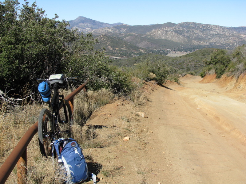
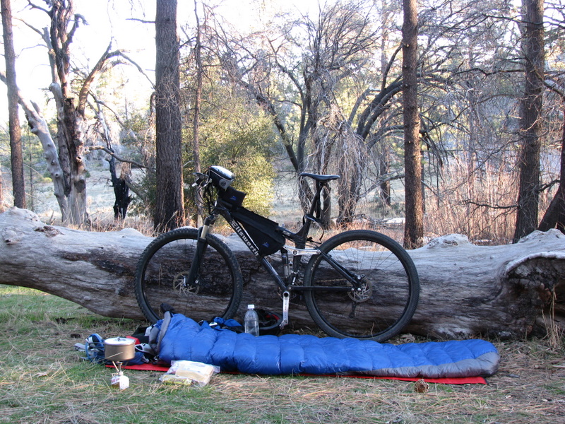
My set up: Ellsworth 29er, Jandd frame bag, REI handlebar bag, Waterproof stuff sacks lashed to seat and bars
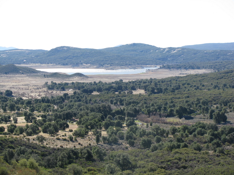
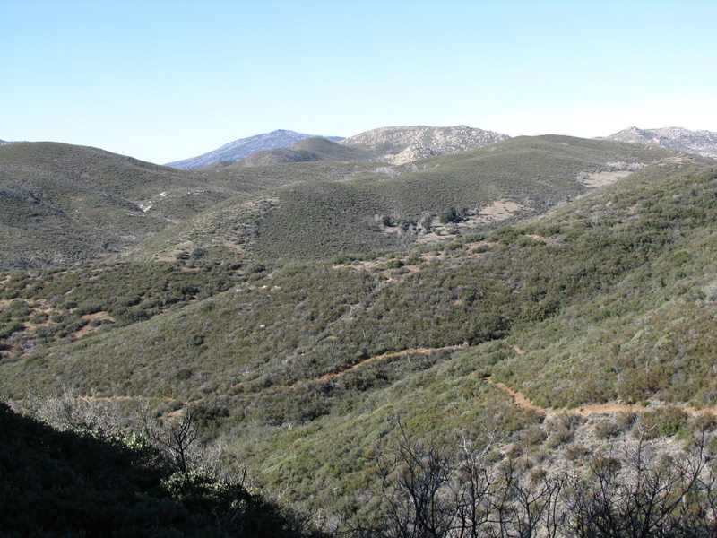
Lake Morena From near the top of the first HAB climb
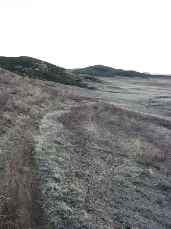
After rolling along the road for a while the road began some steeper but rideable climbs followed by a fun, rocky descent into the small town of Pine Valley. During this stretch the only people I saw were four separate border patrol vehicles.
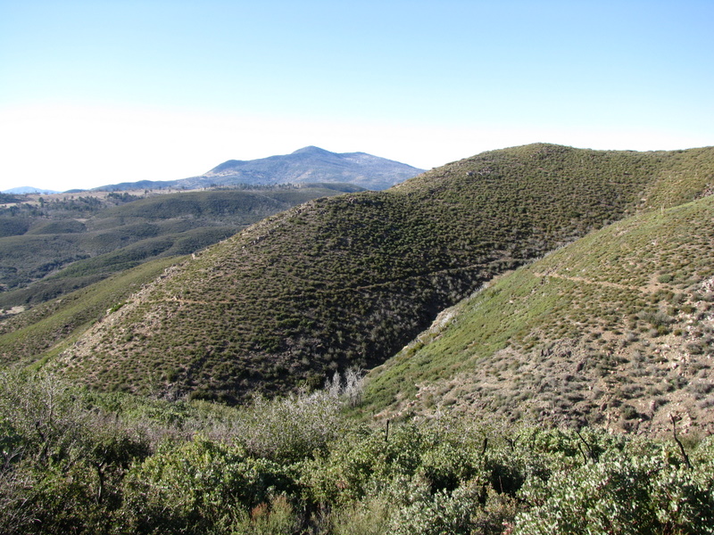
Looking towards Pine Valley beford descending for the first time
Once in Pine Valley I stopped for lunch and then followed Old Highway 80 west through the town of Guatay and over to the junction with Highway 79. A short ride down 79 and I was back on dirt following the Merrigan Fire road into Cuyamaca Rancho State Park. The road was sandy and pock marked with holes from the many horses that use this piece of trail and the wind was still blowing just as hard and getting more gusty. Soon this fire road narrowed into sheltered single track and became much more fun to ride as it paralleled highway 79, heading north up into the state park.
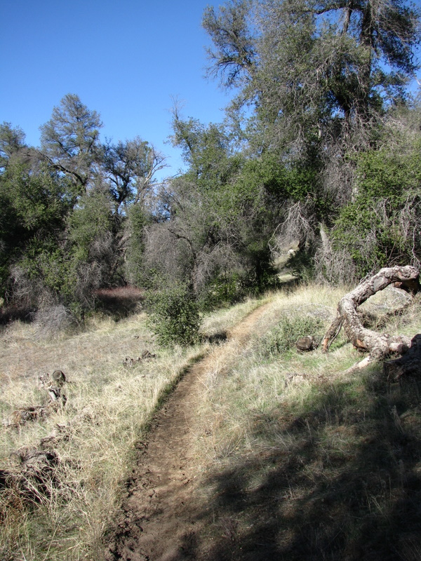
The trail through Cuyamaca Rancho State Park
I had planned to camp at Green Valley falls campground, about 35 miles into my ride because I had assumed it would have reliable water. When I reached the campground it was closed and no one was around. Fortunately the water had not been shut off and I quickly found a faucet and topped off my water. I decided not to camp here because I was not sure why it had been closed and what the legality of camping in a closed campground might be. So I continued on, aiming for Paso Picacho, another campground farther up the trail. I was still feeling strong but was a little nervous about getting to camp as this would put me near 50 miles for the day, much of which was climbing, and the wind was definitely beating me up. However, continuing on would also give me a chance to ride a very nice rolling descent into camp on a very well constructed trail, through one of my favorite parts of the park near Lake Cuyamaca.
View Of Lake Cuyamaca
Excellent singletrack near Lake Cuyamaca
About 15 minutes after total darkness fell I rolled into camp by headlamp having completed 53 miles for the day with a lot of climbing. I quickly rolled out my sleeping bag, made dinner and passed out. The winds blew steadily all night but I slept soundly unconcerned with when I would wake up, knowing that I had ridden about 15 miles further on day one then planned, thus creating the possibility of shortening day 2.
Campsite from night one
The next morning I awoke to find out I was the only one in the campground. I took my time eating breakfast, studying the maps for the days route, and packing up, in the hope that it would be a little warmer by the time I started pedaling as I knew the first part was mostly a rolling descent. I did spend some time trying to dial in my suspension for riding with a load. This is something I had not considered before yesterday, and I never really succeeded in getting it where I wanted it throughout the trip. The ride started with a short climb that was much steeper than I remembered from past day trips, but eventually it leveled off and began descending. Much of the state park is centered around a large valley that highway 79 passes through. The end of yesterdays ride climbed up the valley on the eastern side, along a west facing slope. This morning began by descending the same valley but on the west side and on an east facing slope. As a result it was quite cold in the morning shadows and I found extensive snow on the trail that was very unrideable for me. It was not deep but had a very uneven surface from people and horses walking over it and leaving deep postholes. It was also just about firm enough for me to float on top of, but would occasionally soften just enough to allow me to break through the surface crust very unexpectedly. Being from San Diego this was a bit of a novelty that soon wore off. There were also quite a few down trees as a result of fires a couple of years ago and a recent Santa Ana (strong local winds). What I had thought would be an enjoyable cruise this morning became a lot of work between getting through the snow and down trees.
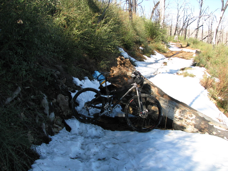
Snowy trail and downed tree

More snow along the trail on the morning of Day 2
Soon I had lost some elevation and the trail opened up, becoming snow free again. At this point I did a small amount of backtracking (1-2 miles) over trails I had ridden the day before in order to arrive at the fire road up Oakzanita Peak. I found this to be an enjoyable, well graded climb, even though I felt I should be able to push a bigger gear than I was most of the way. After reaching the saddle near the summit my trail turned east but I took the short side trip to the summit, only to discover the trail became much steeper for the final PUSH. The views from the peak and the return trip to the saddle made this a worthwhile diversion. The next part of the day was mostly rolling terrain through one of the more remote parts of the state park. At one point I found myself in a race with a herd of deer that I startled as I came swooping through a turn. They were on the inside of the turn and unfortunately chose to race off across the field towards where they would soon intersect the road at the far side of the turn. This bend in the road was just long enough, steep enough and smooth enough that if I would have stomped on the pedals a bit more I could have met the deer on the far side of the turn. As it was I decided to back off and let them dash across the trail a few yards ahead of me at full speed.
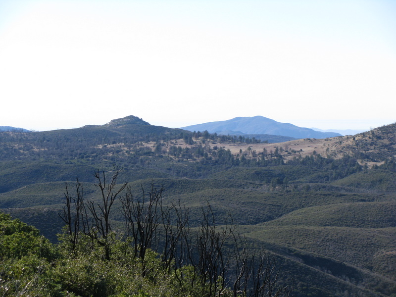
Near the park boundary looking at the back of Oakzanita Peak
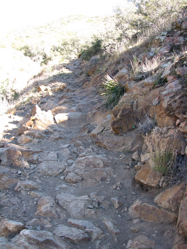
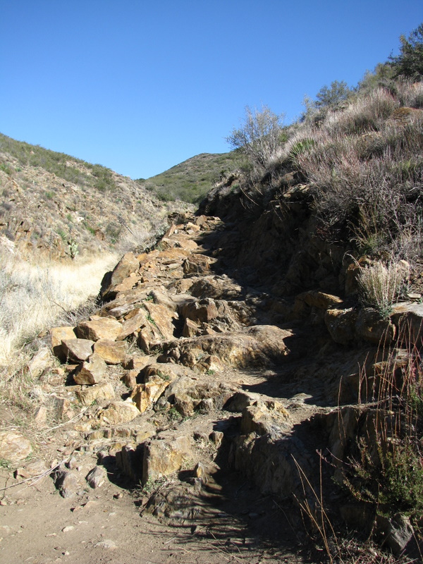
Eventually the trail exited the state park and headed into the Laguna Mountain Recreation Area. The trails through this part were definitely narrower, more overgrown and a little harder to follow but still very rideable. It just meant I had to look around a little more in order to keep from losing the trail. The transition from state park to recreation area was also confusing due to the trail signs and maps because several trails in the area change names as they cross this human created boundary. After a fun descent along a fire road that is quickly being reclaimed by the forest, I arrived at the base of the Indian Creek Climb, which is familiar territory for me as it is the way I usually climb to the top of Noble Canyon, one of the better rides in San Diego County.
Ther lower Part of the Indian Creek Trail from above
I debated riding some unknown fireroads to avoid the steep technical climb on the Indian Creek trail, but in the end decided I would suck it up and try to ride this climb. I was apprehensive because this is a tough climb even without a load and I had been struggling on many climbs so far this trip. Once on the trail, I was glad I had picked this route as I felt very strong and was cleaning most of the rockier parts despite the load. Soon I found myself not worrying about pacing, but determined to ride everything on this climb. As it turned out, I only had to walk two short stretches that I usually walk even without the extra weight. At the top of the climb I would normally descend off of Champagne Pass to join the Noble canyon trail. Today I turned left and continued out to Pioneer Mail Picnic Area along Sunrise highway.
The upper part of the Indian Creek Trail from just below Champagne Pass
The trail to Pioneer Mail was really fun, ridgeline singletrack with small rollers that allowed a little air time and it was all new trail to me. Once on Sunrise Highway I turned right and continued to the Upper Noble Canyon trailhead where I picked up the connector trail to the Big Laguna Meadow Loop. This is a smooth easy trail along a large, scenic meadow with several fun trails that drop down into the meadow on narrow single track with many turns that seem perfectly built for bikes.
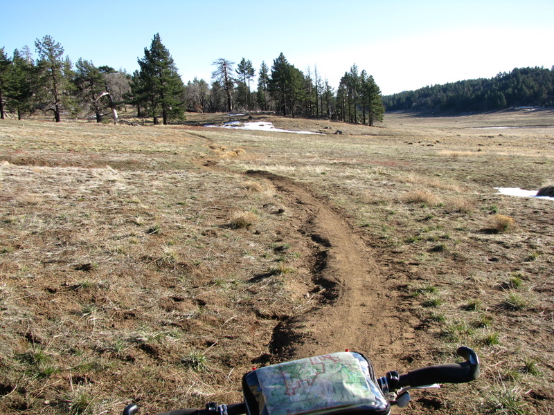
Trail through Big Laguna Meadow
The nice part of this trail for me today is that I was never very far from my intended campsite at Laguna Campground and could therefore choose to head to camp anytime I wanted or just continue riding the many trails around the meadow. After completing the main loop and two of the descents into the meadow I headed over to the campground and settled into a site for the night. Again, I was the only one in the campground. I had logged a little over 54 miles of mostly single track for the day. I was glad I had pushed on yesterday and rode that extra 15 miles so that I had the time and energy today to enjoy the trails around Big Laguna Meadow that I may have otherwise skipped.

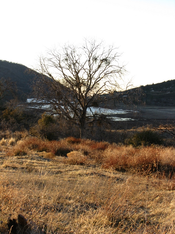
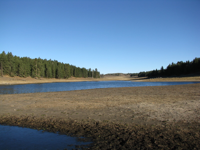
Wide view of Big Laguna Meadow and its seasonal lake
Over night the lows dropped into the 20’s and the morning was quite cold. As I was lying in my bag debating how I wanted to get myself back to the truck today, I had a strange experience. It was about 6 am when a grey passenger van, with government license plates pulls up and 10 guys in full camouflage and face masks jump out and jog off in multiple directions into the woods. As soon as the last person had disappeared from view a second van pulled up and 10 more camouflaged people jump out and follow a similar routine. Not sure what was happening, I decided to get packed up and head down the trail.
Closer view of seasonal lake while on my way back to Noble Canyon
I was really looking forward to today as it starts off on a long descent down the Noble Canyon trail that at times is rocky and technical and at others is smooth, swoopy, and very fast. After only a few moments on the trail I saw one of the camouflaged men sitting on the side of the trail near where I would soon pass by. As I approached I stopped and asked what was going on. As it turns out he was part of the Navy and trying to qualify for a SEAL team. There were a total of 60people out in the mountains for Navigation training this morning. Soon after passing him the fun really began on the descent down Noble Canyon. After the initial smooth, fast, upper portion of the trail I began to grow strangely apprehensive in some of the rockier and more technical stretches. Part of me was thinking this was a good thing, as I was truly in a remote area, alone and riding over some potentially dangerous obstacles. Another part of me was very frustrated with my lack of commitment to obstacles that I can normally ride and was afraid that this would eventually cause an accident if I did not start committing more completely to some of the tougher lines. At one point while riding through a sustained, steep rock garden with numerous small drops and squared off rocks I lost my nerve and grabbed way to much front brake while jerking the wheel to the side. Fortunately this did not send me over the bars, but it did break the seal between my tubeless tire and the rim, causing most of the air to burp out. Thankfully this small frustration helped me get my head together and the rest of the descent flowed much more fluidly.
A rocky patch along the Noble Canyon Trail
Another rock patch, but by now I had my confidence back
At the bottom of Noble Canyon I was only a short distance from returning to the town of Pine Valley and would have to choose between the efficiency of pavement and the fun of dirt but at the price of a steep opening climb. After a short food break, I chose the pavement and made great time through town, along Old Highway 80, and down Buckman Springs Road. It was during this stretch where it became apparent why the first day had been so hard. As I flew down the road at an average speed of 27 mph, I was rapidly giving away all of the elevation that I had steadily gained during that first day. In fact I was eating up the miles so quickly that I was going to be back at the car sooner than I really wanted to. So after a short map check I turned on to an unnamed dirt road and climbed back onto Bear Valley Road, the same road I had ridden early on the first day. The advantage of this was that it took me to the top of the rocky Kearnan Cylcle trail that I had hiked up to begin the trip.
This fun descent went quickly and I was back at the truck by 11 am with about 25 miles completed for the day. I ate the rest of my food and then headed off for a trip around the trails of Lake Morena in order to extend my day of riding and hit up some quality single track that I do not get out to ride often enough during the year. Unfortunately I also left the camera sitting in the truck after lunch, so no photos for the end of the trip. After climbing up to Four Corners along Stokes Valley Road, I dropped down Wrangler trail, climbed to Bronco Flats, then out Gunslinger and back onto Corral Canyon road. When I reached Corral Canyon Camp I cut through the campground and joined the Corral Trail back to Four Corners. I decided to skip the loop around and over Mt Pinos and chose to descend another piece of the Kearnan Cycle trail back to the truck. Upon reaching the truck the cycling computer was just ticking over 50 miles for the day.
All in all this was a great introduction to bikepacking and I will be back out soon. The trip measured at 157 miles on my bike computer with a lot of climbing on day one and a lot of descending on day 3. All of it was on dirt with the exception of about 12 miles of pavement. I would estimate the dirt sections were about 50% singletrack and 50% dirt roads, most of which are closed to motor vehicles. Overall the trails were very rideable and although I walked parts of several climbs and dabbed my way through parts of Noble Canyon, I would not be suprised if a strong, fit rider could ride every inch of the trail. I have yet to embrace a GPS unit so do not have exact information for this trip but have given many place names throughout this report so that any one with a set of topo maps or a forest service map (recomended for navigating private property issues) could piece it together on their own.
I especially liked the freedom to ride as late as I wanted into the evening knowing that if I didn’t reach my destination I could make camp wherever I was. If I became overwhelmingly exhausted I could stop and recover for as long as I needed. If I was enjoying the evening and wanted to keep pedaling, I could just keep on riding. It was a great sense of freedom. I also learned a lot about my set up and what worked and what didn’t. I loved most of the bags and packs I used. The only notable exception was a handlebar map bag that bounced around continuously, would dump all of its contents no matter how carefully I opened it, and which obscured my view of rocks when trying to pick my way slowly, with some finesse, through technical stretches that put a premium on following a good line. I also believe that I can get this set up somewhat lighter, with more of the weight on the bike. I hope to post up more info in the set up section soon to hear some ideas and feed back towards this end. I also know this trip would not have gone half as smoothly as it did if not for the pictures, ideas, and discussions on this site. This is a great resource and already has me planning for a trip along the Colorado Trail this summer.
Great report and first bikepack! You did it up with style. Sounds like quite a bit of singletrack, and some of it quite challenging. I’ve ridden Noble (unloaded!) before — sweet trail.
That stuff with the camo face mask guys piling out of the vans is classic. A truly “did I just see that?” moment.
I especially liked the freedom to ride as late as I wanted into the evening knowing that if I didn’t reach my destination I could make camp wherever I was.
Right on. A totally different feeling from having to get back *somewhere* by the end of the day. A remarkable freedom.
I loved the REI handlebar bag. Maybe it sat a bit different on my bike and my trails weren’t as rocky as yours. I will try it out more before I decide to take it on a rocky ride.
Scott,
Glad you liked the report. It was a fun trip and it turned out great. It is not the most remote trip and the route doubles back on itself several times as well as containing many other cut-off trails. All of this allowed me to shoot for a challenging first trip, with the knowledge that there were numerous potential bail outs to pavement or ways to shorten the route if needed.
The hardest part of Noble for me this trip was that it was the first time I had ridden it solo and it was really early on a monday morning (less other users). The “what ifs” really got in my head early on during that stretch. Once I stuffed the handle bar bag into the pack, the riding on Noble was not much harder than it would be “unloaded”
“Did I just see that” is the perfect way to describe how I felt with Camo guys, especially at six in the morning. Plus I kept seeing and hearing them in the brush from the trail during the first hour or so of the day.
The freedom of camping whenever and wherever is something I always enjoyed on long distance hikes (PCT, sierra high route, John Muir trail) It has been hard to recapture on shorter hikes which seem more itinerary driven. The ability to cover huge distances (by hiking standards) on a bike brings this feeling back even on relatively short trips.
Slim,
I think the bag is a great concept. I really liked having my map available for a quick glance and found the “window” large enough to see a large piece of map and display a small cue sheet as well. It is also a convenient place for small items.
I thought the bag was a little loud on the bike but not too bad. The real frustration was when I would open it and things would fall out even if I was very careful. It may have been the way it was packed, or more likely what I packed in it. I used it to carry bike tools, water tratment, and other small dense items and they would shift to the lower corners of the bag. When unzipped they would fold the corners down and spill out onto the ground. I also had the bag pretty stuffed which may have added to this effect. I would stuff my arm and knee warmers in as I warmed up. I think it would benefit from a plastic or foam stiffener in the bottom.
I also found it difficult to watch the line my front tire was following while riding slowly over rocky, ledgy terrain. This may just be due to the geometry of my bike and my position on it. It may not be a problem for others depending on their bike set up.
I’m glad you liked it, it seems to solve a lot of problems and it was well made. It just wasn’t working for me.
Do you have the GPX file for this? I was hoping to get out to Noble on Mon-Wed next week for this ride. If you have it available, mind if I use the GPX file?
I would love to learn about the exact route taken. Was there ever a GPX File shared? I’m looking forward to looking into this route and multi-day bikepacking adventure.
Thank you for the great report!
Maps of the Cleveland National Forest are available at the ranger station. There are many bike, hike, and hike a bike trails. I spent 10 days there last winter. I didn’t see all the trails.
Nobel Canyon and Indian Creek trails are nice. Don’t limit your self to these, explore.
Carry extra water.
Yep sweet route, I as well would love to see some type of cue sheet of the route that you took. Fire roads, trail names, etc.. It would add with my plan to come from the north and then cruise down to the east into the desert