Routes, The West Coast (CA,NV,WA,OR) » Hot Sisters Hot Springs Route
Overview
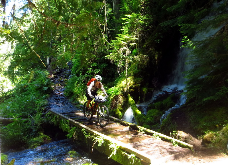
The Hot Sisters Hot Springs route highlights singletrack, hot springs and mountain climbs (on foot) all through the central Cascades in Oregon. It starts and ends in Bend, Oregon.

Core loop = red, alternates = cyan
Route overview
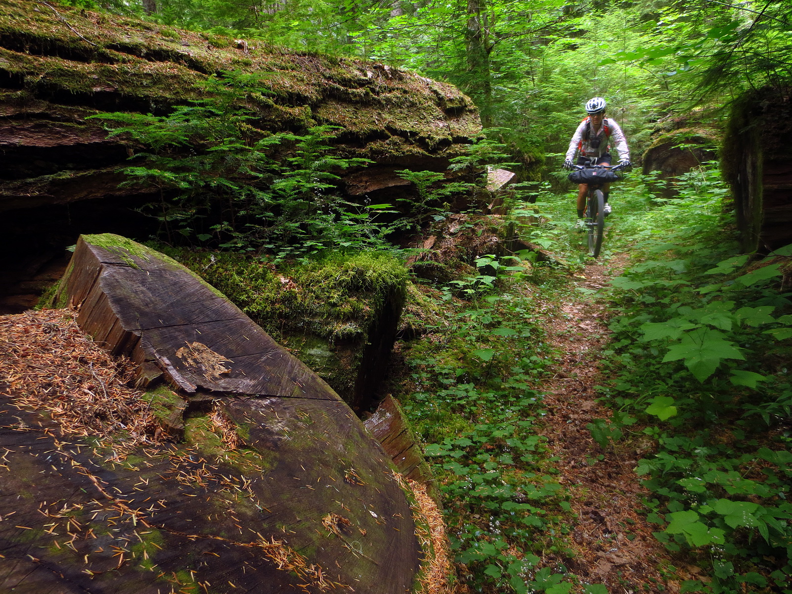
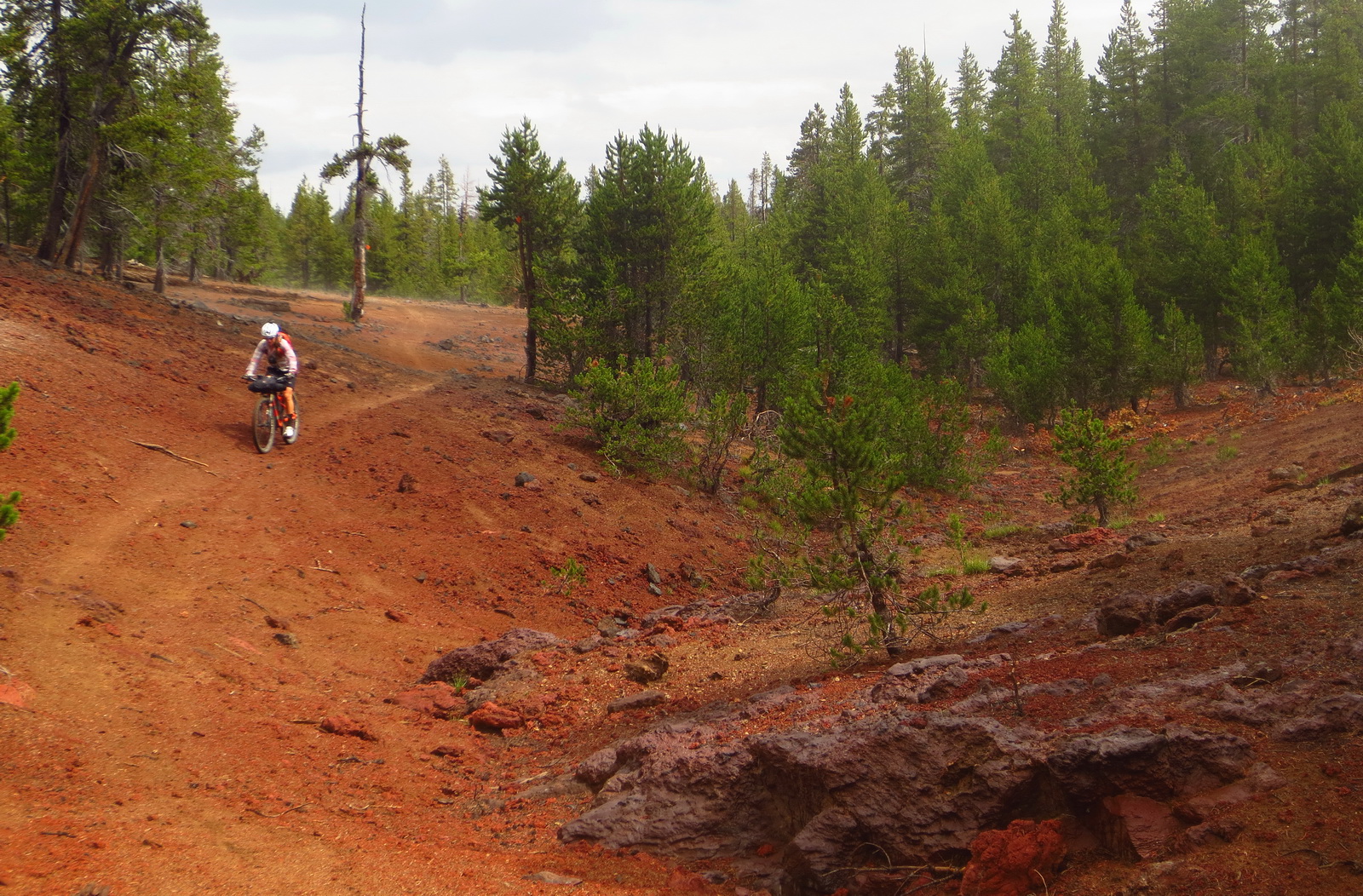
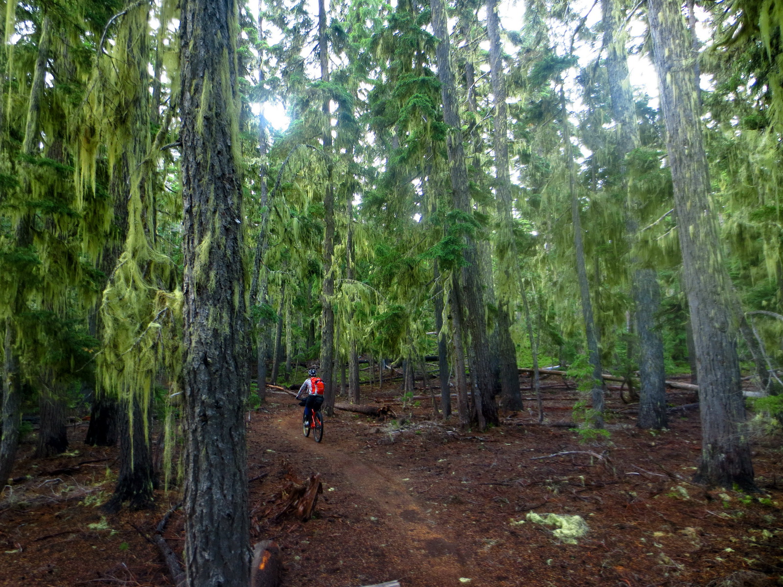
The route traces a primarly singletrack circle around the most prominent landmarks in the Oregon Cascades — the Three Sisters. The Sisters are volcanoes that sit at over 10,000 feet. Views of the Sisters can be found from all over the route. While making the circuit, the route brings bikepackers to seven natural hot springs, all exquisitely soakable. In the trail department, some of the finest and most famous singletracks in Oregon are featured. On the western side, it covers the three major river drainages (and trail systems): the North Umpqua, Middle Fork of the Willamette and the McKenzie Rivers. On the east, Newberry Crater, Metolious Windigo and Mrazek are a few of the highlights.
List of trails used (in order):
Swamp Wells, Newberry Crater Trail, Peter Skene Odgen, Metolius Windigo, Waldo Lake, Oldenburg Lake, North Umpqua, Middle Fork Willamette, Salmon Creek, King Castle, McKenzie River, Santiam Wagon Road, Dark/Scout/Suttle Lake, Lake View, Sisters Tie, Peterson Ridge, Mrazek.
Trail type
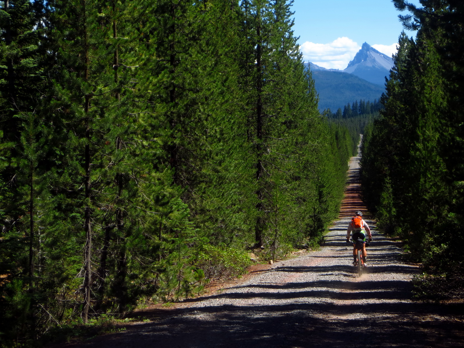
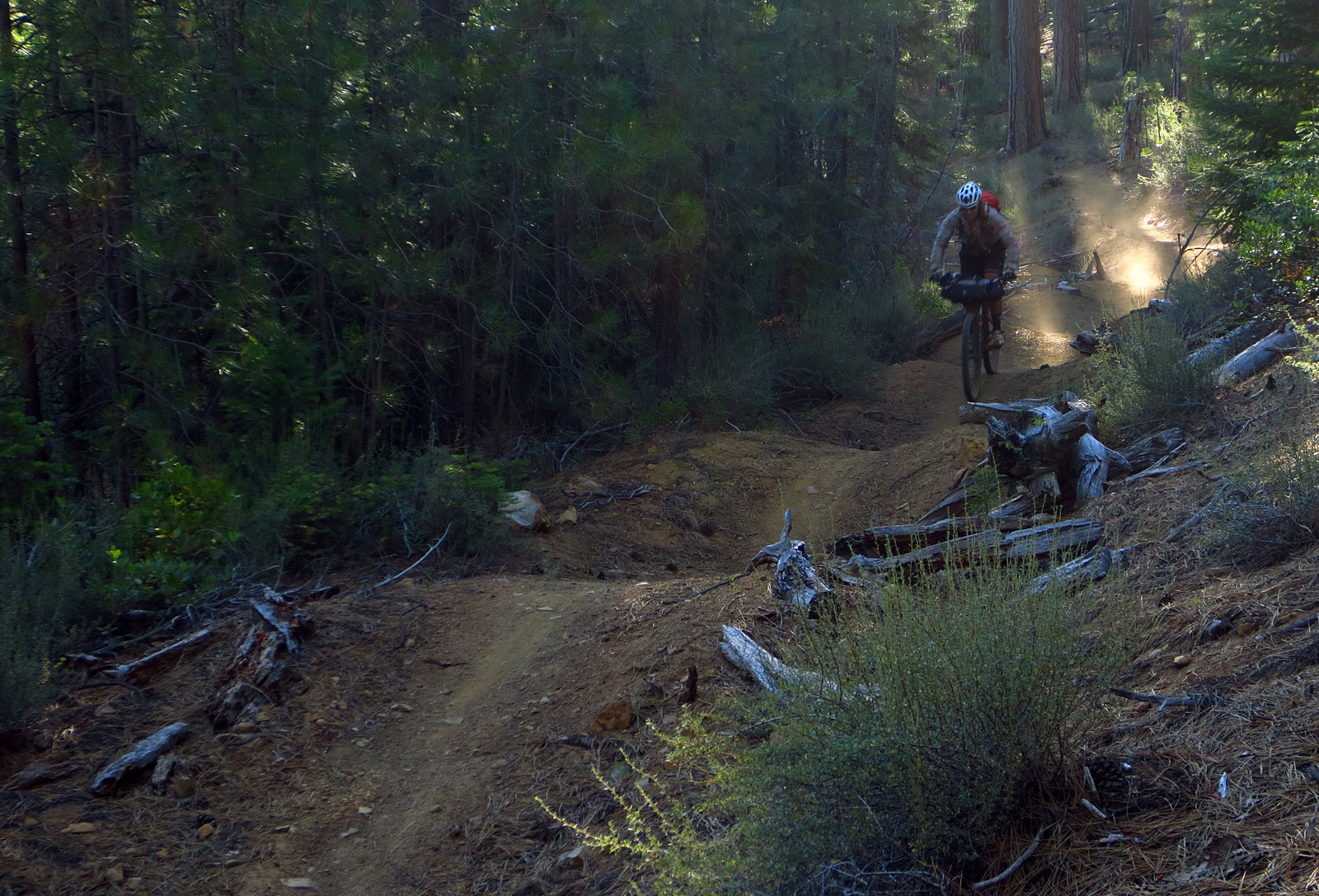
Every effort was made to maximize rideable singletrack on this route. There is still a fair amount of dirt road riding, but over half the route is on singletrack, and hike-a-bike is very minimal, especially compared to other classic bikepacking routes.
Most of the dirt (and paved!) roads are low traffic, though they can climb a lot!
Statistics
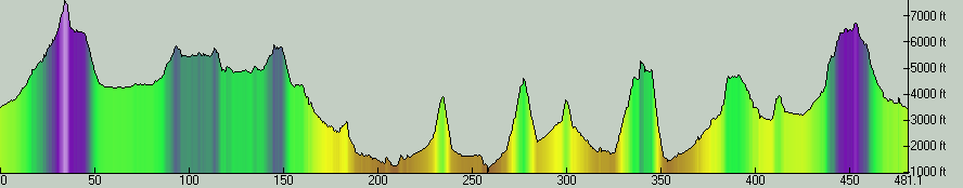
Core loop mileage: 460 miles
Singletrack mileage: ~245 miles
Elevation gain: 42,000 feet
Hot Springs: 7, on route (or requiring short hikes from the route)
Lookout/Mountain climbs: 10, including alternates
Developed campgrounds: 50+ on route
Dispersed/freecamping: available on most of the route
Longest stretch between resupply: ~70 miles, primarily on forest roads
Alternates:
McCredie/BunchGrass – An advanced option with minimal resupply that adds a hot spring, a mountain climb, a lookout and several thousand feet of climbing
Crater Lake Spur – A 30 mile primarily off-road route to the rim of Crater Lake (National Park)
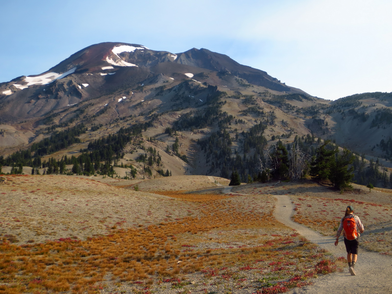
South Sister Climbers Trail – A 12 mile spur to free camping available at the South Sister trailhead (Devils Lake). From there it is a 6 mile hike, up 5000 feet, to the summit of South Sister at over 10,000 feet. This is the culminating hike of the trip, surveying all of the terrain on the route.
Olallie Lookout / Singletrack descent – A 3000 foot climb on graded roads leads to a high pass bordering the Three Sisters Wilderness. From the pass a 2.5 mile hike leads to the Olallie Lookout in the Wilderness. Going the other direction, with bikes, features some overgrown contour riding that culminates in the fast and fun Olallie descent — a classic trail.
GPS Data
GPX data is here!
![]() Hot Sisters Hot Springs – Main Loop – v4.gpx
Hot Sisters Hot Springs – Main Loop – v4.gpx
![]() Hot Sisters Hot Springs – Main Loop – v4_10k.gpx – Reduced to 10,000 points for upload
Hot Sisters Hot Springs – Main Loop – v4_10k.gpx – Reduced to 10,000 points for upload
![]() Hot Sisters Hot Springs – waypoints – v1.gpx
Hot Sisters Hot Springs – waypoints – v1.gpx
![]() Hot Sisters Hot Springs – alts – v2.gpx (includes waypoints for alternates)
Hot Sisters Hot Springs – alts – v2.gpx (includes waypoints for alternates)
Hot Springs Guide
Finding natural hot springs is often a bit of an adventure. The waypoints file has the locations of them all, but part of the fun (and reward) is seeking them out. Here are some details for the springs on the route.
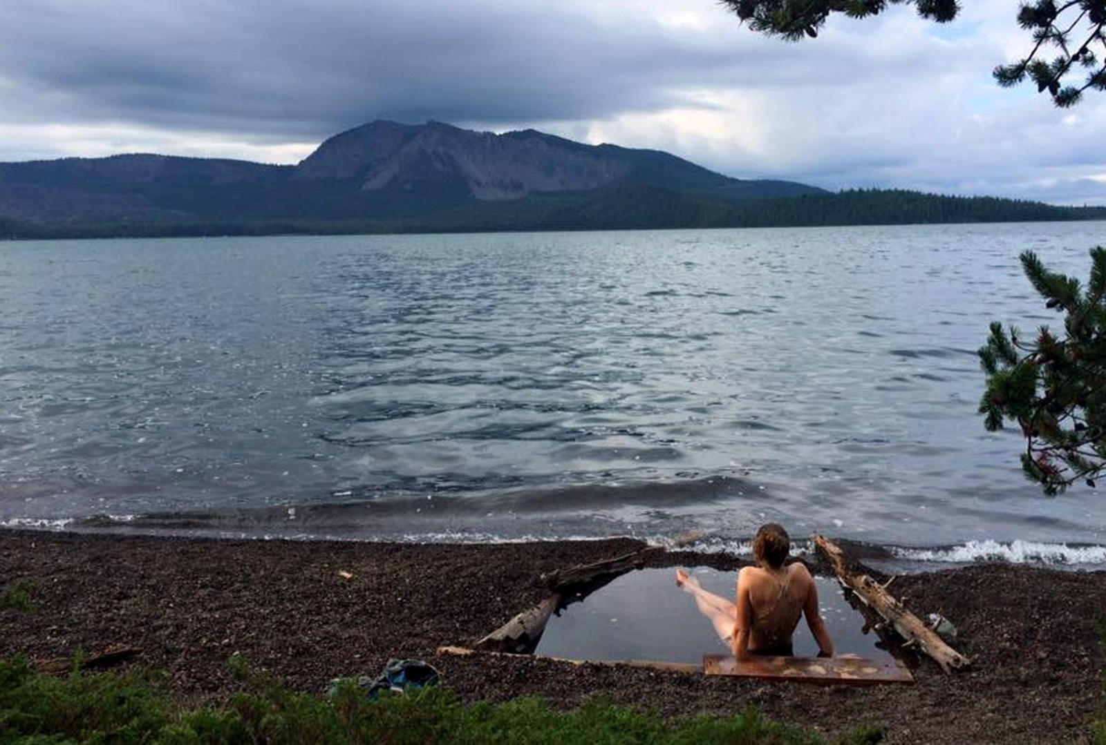
East Lake Hot Springs – East Lake is one of two natural lakes formed in the Newberry Caldera. On the southern shore, past the lodge and boat ramp, a small and sometimes steep trail of use leads to an area where rocks line a number of small pools that are in the lake.
Paulina Springs – requiring a 2 mile mostly flat hike, this hot spring is a little more secluded than East Lake. Hot water emerges from the thermals below the western lake in the Caldera. Look for signs of hot water and small trails of use dropping off the main trail, down to the lake shore. This one is a fantastic soak.
McCredie Hot Springs (on McCredie alternate): A number of nice pools are found on the south side of Salt Creek. Cross to the south side on the car bridge, then follow a semi-rideable trail west along the banks until it drops to the creek about 0.4 miles from the road.
Umpqua Hot Springs – A popular but exquisite soak perched on the rocks above the Umpqua River. It is a very short hike off the main trail. In past years it has been a zoo of folks living nearby, but in 2016 camping nearby has been prohibited, in an effort to keep better care of the area.
Wall Creek Warm Spring – Although only 98 degrees, this is a very comfortable soak in a beautiful and private forest setting. From the first switchback on FR 1934 follow the trail that leaves from a pullout/campsite about a quarter mile from the road. You’ll find a couple of warm and bubbling pools of clear water. Camping is possible off the bike right near the springs.
Terwilliger Hot Springs – One of the best hot springs in Oregon, this one is popular for a reason. There’s a $6 per person fee and a half mile hike up to the cascading pools. Clothing is optional, and there is quite a mix of soakers. Not to be missed! It is pretty easy to ditch bikes in the woods somewhere near the trailhead.
Belknap Hot Springs – part of a lodge and resort, this is the least primitive spring on the route but still a nice one. A small fee gives access to the hot springs fed pool as well as the showers. The gardens on the grounds are nicely kept, and poking around can lead to finding several sources of the hot water (but nothing soakable).
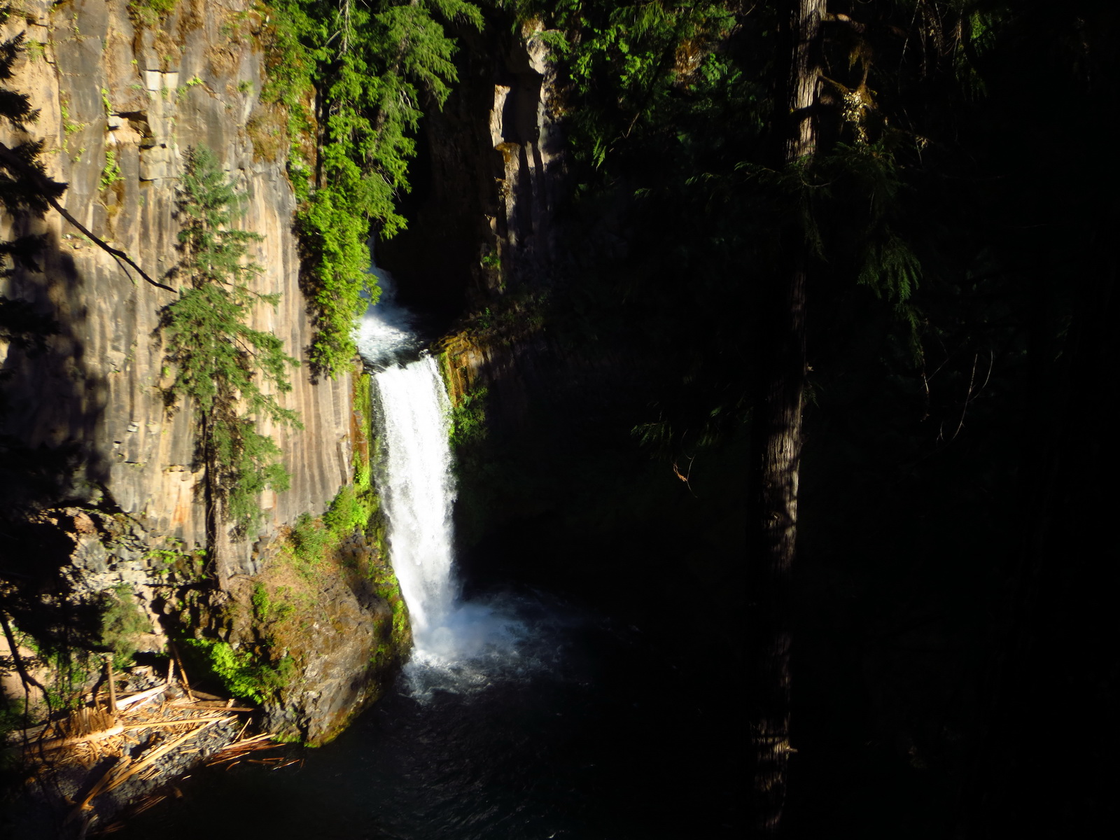
Bigelow Hot Springs – A small grotto along the McKenzie river provides a killer soak at a nice temperature. It can be a little hard to find — use the waypoint to get near and look for a trail below the McKenzie River, going south from a bridge over the river. Don’t miss this one!
Mountain Climbs
The route gives close access to a number of mountain climbs and fire lookout towers. These can be excellent breaks from pedaling and always give impressive views sometimes absent from the heavily forested trails on the route. We highly recommend carrying a pair of shoes suitable for short hikes (for the hot springs, as well).
The tops of accessible mountains are noted in the waypoints file. In most cases the route should be pretty straightforward.
Caveats
While the route doesn’t have many of the usual challenges that bikepacking routes have, like high altitude, rough terrain, extended hike-a-bikes, etc, there are a few challenge unique to the Pacific Northwest. Specifically:
Bugs – Depending on the season, mosquitoes can be pretty bad in certain areas of the route. Consider bringing a tent. On the exploratory ride we probably only had 3-4 buggy nights, but we were grateful for a tent on them.
Poison Oak – This plant is present at lower elevations on the route (particularly lower Umpqua River Trail). Consider bringing creams for either pre-exposure application, or post-ride cleansing. We used the former and had no issues or rashes. Also jump in rivers and hot springs whenever possible!
Trees – Blowdowns are a constant struggle on some of these trails. We found it to not be an issue riding even somewhat early season. Luckily there is a core of dedicated volunteers (mountain bikers!) in the area.
Trip Reports
From the exploratory ride (July 2015):
Scott’s diary starts here.
Eszter’s starts here.
Thanks
For the (brilliant) idea of a hot springs themed bikepacking route, we owe thanks to Casey Greene of Adventure Cycling.
Thanks to Gary Meyer for his help scouting the route, and for route suggestions throughout. Steve Westberg also provided valuable route beta, poison oak potions and a place to stage the exploratory ride on the route. Jolene Carpenter gave us much enthusiasm as well as route beta along the way. Thanks to GOATS/Sisters Trails/Bend Trails groups for all the trail work and clearing. And most of all, thanks to Ez for being the best riding (and hiking, soaking) partner ever.
Photos


For more photos, with captions and overview text, visit Scott’s blog:
HSHS Photo Reel 1
HSHS Photo Reel 2
Awesome route…would love to see the GPS data. I know most of those trails but have never thought to link them all together.
Scott,
When would be the best time to do this? we are off between early June and late July.
Chris — July is a good month out there, as long as it hasn’t been a high snow year. We rode it first starting mid-July.
Just posted full GPX data for the main loop, with waypoints, 10k version for upload and also an alternates file.
The time to ride this route is here! We would love to hear some feedback on the route, if anyone gives it a go (whether in full or in parts).
I also added a hot spring guide, caveats and other infos on the route. This is such a great route, we really hope some people can get out on it this season!!
Thanks for putting this together and posting!
Posted v4 main loop GPX, with several route improvements courtesy of Bend local Gary Meyer.
Scott-
This looks fantastic. Thanks for your efforts. Is this trip possible in September?
Bill – yes, definitely. Should be less buggy then from what I understand.
Great route–rode it starting out of Oakridge earlier this month. A couple of key resupply updates:
1. Lemolo Lodge burned down in June! No restaurant, and minimal resupply at the store.
2. Dry Creek Store/Restaurant is closed.
3. Suttle Lake Lodge had a sign reading “Opening Soonish.”
Albert — glad you enjoyed the route. Thanks very much for the updates.
1 – Terrible news! First they lost their awesome dog “Chomper” and now this! According to their site they are still operational, but, yes, no restaurant.
2 – Yikes — that was another stellar resupply on the route. Bummer.
3 – Not too big a loss as there are other good options nearby.
I did the Bend-Oakridge portion of this ride in late July via the south route. Amazing trip and highly suggest it! Weather was hot but cooled off most nights. Trails were in good shape. A few logistical/etc notes:
1) I rode the Crater Rim trail around Newberry instead of heading down to East Lake. Fun trail after a hard climb up.
2) The mapped route traverses some private property west of La Pine. I had to hop a fence and it was ok, but I wonder if there could be some re-routing to find a trail around this.
3) I underestimated the difficult of the North Umpqua trail. Suggest doing this portion in >1 day! Fun but demanding.
4) I also underestimated the vicious mosquitoes at Waldo Lake. Be prepared this time of year! Definitely enjoyed the Waldo Lake trail though.
Thanks again to Scott for the great route!
David,
Thanks for the feedback, glad you enjoyed the route.
1 — great option, for sure.
2 — Thanks for this, I would sure like to change it. Can you drop an (approx) waypoint for where the fence is? If so, please email me at smorris@topofusion.com
3 — Yep, very demanding, even in the ‘downhill’ direction. It’s a big reason we recommend clockwise on the loop.
4 — Mosquitos are hit and miss, but when they hit…. whoo!
Cheers!
Just wondering how long it is taking people to ride this loop — either the whole thing or Bend to Oakridge? My only similar length bikepacking experience is the Colorado Trail, which I did in 10 days, but that included a whole lot of pushing at elevation so thinking this might be a bit quicker. But I also want time to enjoy the hot springs.
Thanks for all the work putting this together.
Jon, I did Bend-Oakridge via the south route last summer in 5 days. 6 would have been more enjoyable, and of course there are lots of other trails and things along the way if you have some extra time.
Has anyone ridden this trail in the past year or two? I really like the loop from Bend option since that is much more logistically appealing. I was looking into riding this the first week in July. I know there have been a lot of fires since this last posting. Hopefully the route is still rideable.