Routes » Continental Divide Trail
Please note, this page is about the CDT, which is long distance singletrack trail, for information on the “bike version” of the divide, see the Great Divide Mountain Bike Route Page.
Overview
Generally accepted as more difficult, in many respects, than the PCT or AT, the CDT is the big daddy of all long distance trails. It is also unlike the PCT and AT in that most of the trail is open to cyclists (outside wilderness areas).
The trail is a work in progress, with many sections unfinished or routed on dirt roads.
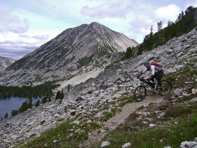
History of cycling on the CDT
There have been no known thru-rides on the CDT. Will you be the first?
Until 2014, there have been no known thru-rides on the CDT. Scott Morris and Eszter Horanyi completed the trail, from Crazy Cook to Waterton Lake, in the summer of 2014. There is still much to explore on the CDT, especially as it develops and changes over the years.
Besides a full thru-ride, sections of the CDT, are also frequently bikepacked. A prime example is where the CT and CDT overlap in Colorado. Other sections in New Mexico and Montana are also frequently ridden.
Many areas of the CDT are currently being considered for wilderness designation, despite historical mountain bike usage. There have also been indications that land agencies would like to discourage or not allow bikes on the CDT summarily. Since cyclists are already shut out of the other two major long distance trails, it would be a shame to lose access to the CDT!
GPS Data
Drop-n-Roll has current GPX files for the entire trail here: CDT GPS Data. They are based on Bear Creek Survey’s official CDT data as well as Jonathan Ley’s maps
CDTBike GPX data to come!
The following are two GPX files from different CDT loops along the MT/ID border:
Trip Reports
Zen on Dirt – CDTBike 2014
CDTBike 2014 – Diary of Scott Morris, including GPS data
CDT bikepacking in New Mexico – by Tony Mason and his daughter, Cassi
CDT bikepacking from Lima, MT
CDT bikepacking from Jackson, MT
Alma to Magdalena Chapter 2 – Wahoo on the CDT
Links
CDTC: CDT Coalition Unfortunately no mention of cycling is made on their entire website, let alone bikepacking, despite the majority of the trail being open to bikes. They do not seem to view human powered and silent travel of the CDT as an acceptable use.
Jonathan Ley’s site – his maps are the best source of current information on the CDT. Most thru-hikers use his maps.
I just want to say, as someone that thru-hiked the CDT in ’07, Jonathan Ley’s maps are sufficient for navigating the CDT and they are put together with that usage in mind in terms of scale and notes. Those maps were the only maps most thru-hikers carried.
Updated this page to include mention of the first thru-ride of the CDT! Also updated links to GPX data and the CDTC. Much more info to come!
Has anyone done the tour divide who can tell me if I have a DWAI that is 15 years old if I will have any trouble getting into Canada?