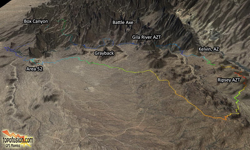
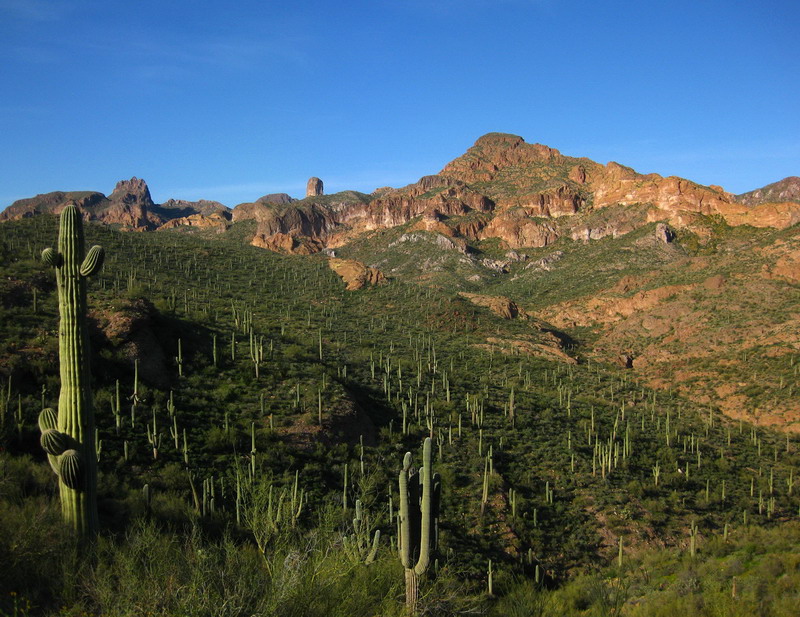
The Gila river runs between Kelvin and Florence, cutting through some of the most amazing country I have ever laid tire on -- from rhyolite cliffs to deep saguaro studded canyons, singletrack to freeride rock mesas and brutal roads. I dreamed up a loop that would comprise all of the 'goods' the area has to offer, and it seemed like the perfect weekend for it. Abundant winter rains and a March warming trend made me think the desert might -- just might -- be in its prime. Only one way to find out.
I finished my last revision to the dissertation at 9pm on Friday night. Exhausted with the computer, I quickly wrapped up the GPX track, studied a bit, then went to start packing. Things came together very well -- there's really not much you
can bring on a 2 day bikepacking trip.
I met Lee for breakfast at Bobo's, where we proceeded to fill our guts with the greasy but oh-so-good food. That breakfast would power us well past lunch.
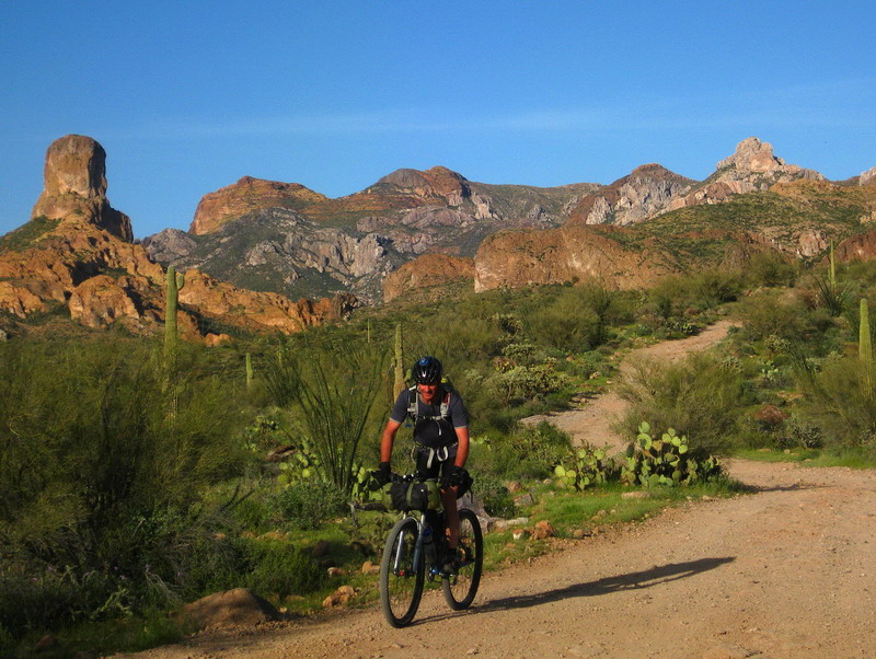
A quick drive to Kelvin and we were on our way, crossing the Gila and making a B-line for new Arizona Trail.
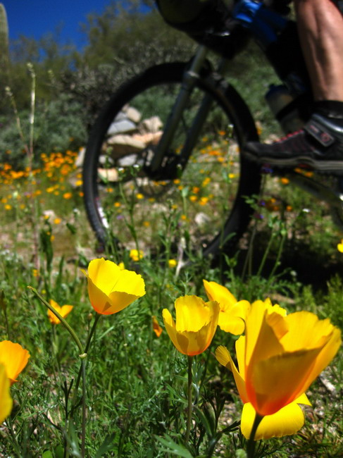
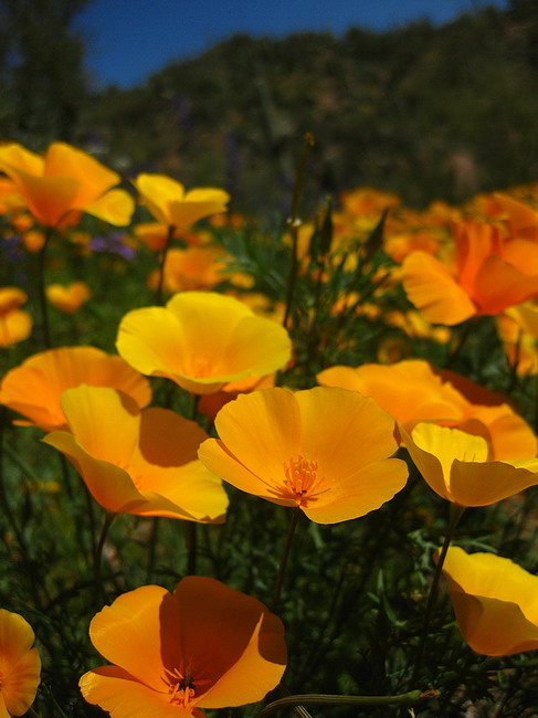
It wasn't long before we were surrounded by all sorts of colorful things.
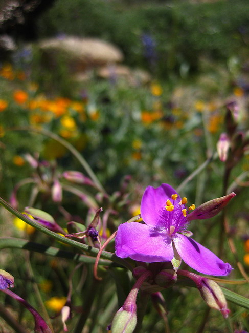
The rain's effect was impressive, with knee high grasses/flowers and obscured tread in places.
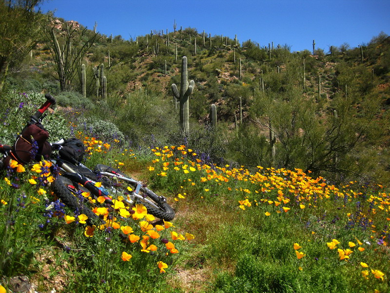
I was giggling as the bright colors whisked by on the sides of the trail. "My eyes are starting to hurt..." says Lee.
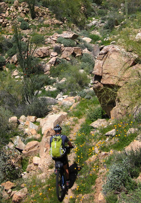
So well constructed, it's almost effortless to ride. And I think about five people have ever ridden it.
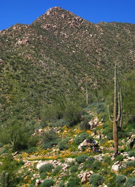
There was a veritable berm of grass and flowers on the outside edge of the trail. It might not do much to actually keep your tire on the trail, but visually it made riding fast that much more tempting.
And so I did.
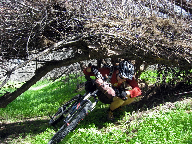
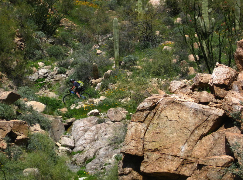
photo by Lee Blackwell
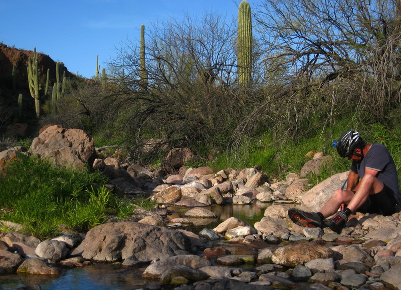
Some of the side drains were running, even though the last storm was 1.5 weeks ago. So we decided to skip the trip up Walnut Canyon to the artesian well (aka bubbly spring), instead exploring the future AZT corridor closer to the river.
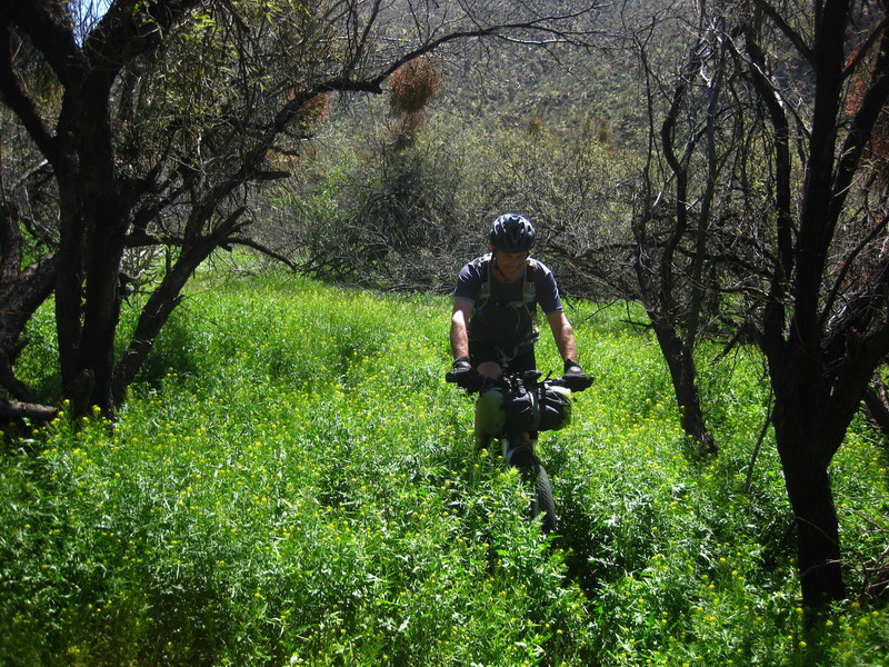
It went well at times, and other times we hunched to get under trees, fought through sharp brush and hopped fences. Lee and Scott, back to their usual tom foolery. I think there is a viable route through most of it, but the 3 foot high grasses were obscuring everything, making trail sniffing that much more difficult. It was fun to roll for miles through the grass, leaving a trampled little 'trail' with our tires. Though it was a little unnerving as sometimes there were branches or pits hidden in the grass.

Eventually we hit a pinch point on the river and were forced to gain elevation, bushwhack style. We happened upon very fresh AZT flagging and stakes, taking us to a tiny pass in the cliff above the river. I don't think they will be able to build rideable trail here, but I look forward to seeing how it goes. We fought the worst brush of the trip to get out of there, and sighed in relief as we reached a legit road.
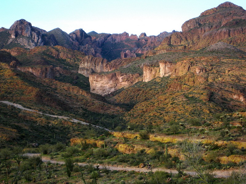
We had saved ourselves several thousand feet of climbing, but our route was no faster. It was more about exploring something new than saving time or energy, so we were all smiles as we turned away from the river to finally pay the climbing piper.
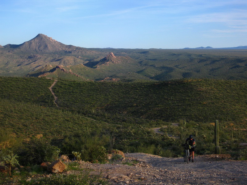
Epic roads, leading to epic scenery.
A number of the climbs are solid rock, meaning that as long as you've got the power, you've got the traction. Normally I'd be spinning up in 20x36, but I kept it in 20x30. And it felt good.
"Man, it's taken me about 2 hours just to catch up to you!" says the driver of a jeep, beer hanging out the window in his hand.
I short circuited another driver's brain when I answered where we had come from. After twitching his head he answered, "but... whaaa... Kelvin? On a jeep trail!? How?"
We got passed by a few more, and were pitied by several, but bikepackers get to see so much more and have so few limitations. I didn't envy a single one of them as they "sped" up the hill, leaving us in the dust.
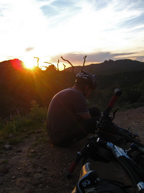
I felt so spoiled by the availability of water, the pleasant temps, the electric green, the wild flowers, my new bike, and just the general feeling of being a bikepacker, rolling through the landscape as the sun lowers, without a care and with the freedom to sneak off and camp just about anywhere we please... ready to continue the ride come morning.
Put differently, evenings like this make me happy just to be alive.
We descended out of Martinez, over to Box Canyon and were amazed by the steady flow of water rushing down between the cliff walls. I thought about Jonesy, wrapping up the AZT 300 over a week ago. The water might have been hub deep for him!
After splashing around and craning our heads to catch glimpses of sky and cliff, we spied a small side grotto that looked perfect for a rest. We threw out the sleeping bags, got a little fire going and boiled some water for our freeze dried meals. Once properly rehydrated, we toasted the meals in honor of our good friend Mike Curiak. Mike would be eating, that night, his last of over twenty freeze dried dinners, camping for a final night before making the push to Nome and
the completion of his epic Iditarod trip. And here we were, not even wearing jackets, and with warm hands, two hours after sunset. It was the best camping I've done in a long time.
I laid down and popped my headphones in my ears. I love listening to music, at night, while camping in a quiet place. You can crank the volume down and still hear all the nuances in the music. As the beats and textures ran through my skull I played over the events of the day and tried to process all the visuals and feelings. It was a good day, and I drifted off to sleep after a few tunes and a few shooting stars.
Day 2 to come.


