Eastern USA, Trip Reports » USA-NY-Adirondaks
Introduction
In the March 2003 issue of Bike magazine, an article about mountain biking in the Adirondack Park in New York was published. That article highlighted the available mountain biking, the huge potential, and the unique challenges of mountain biking in the Adirondacks.
That article set the hook.
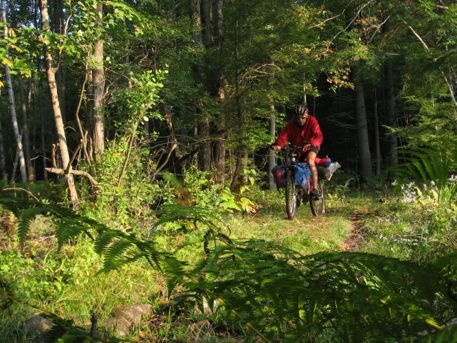
This trip report is a consolidation of information and highlights from 4 trips to the Adirondack Park to do multi-day, hybrid (road/dirt/trail) tours, day trip rides and general sight seeing.
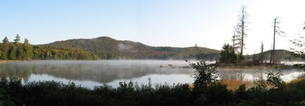
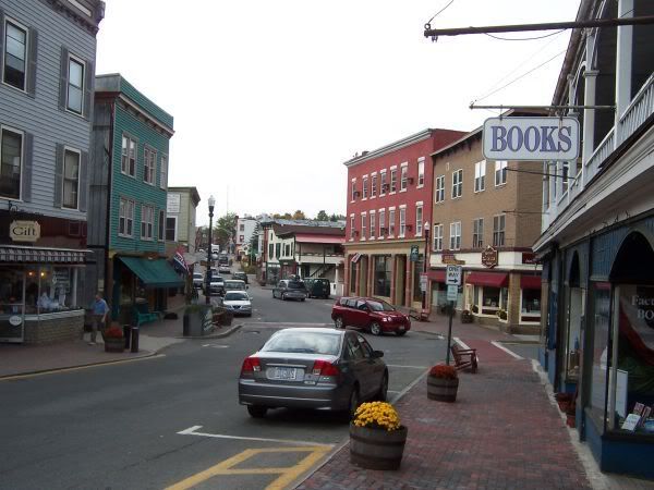
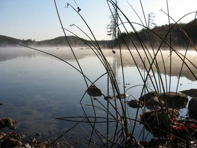
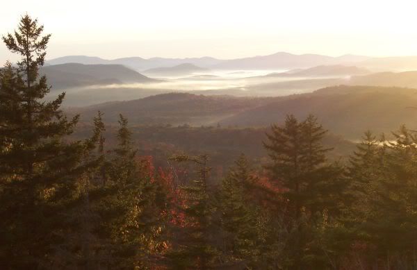
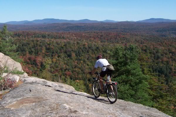
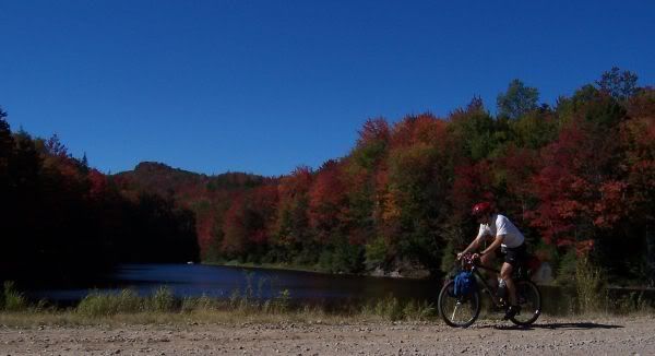
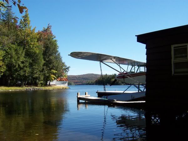
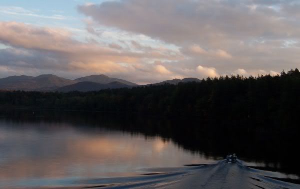
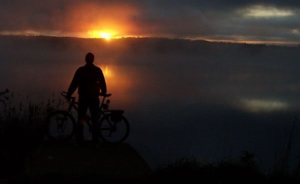
The Adirondack Park is diverse. From remote, loon inhabited ponds to the high peaks around Mount Marcy to the Olympic venues of Lake Placid and the charm of the town of Saranac Lake.
Although about one half to the land is in private ownership, the legislation the created the park in 1892 stipulated the park was to be managed as ‘Forever Wild’ (more history).
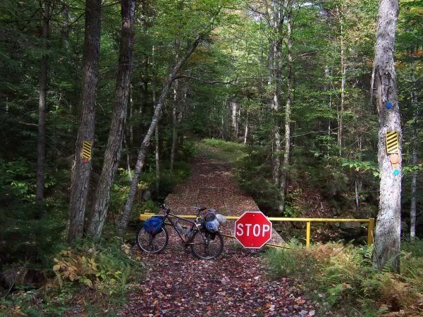
The Adirondack Park Agency, administrative authority of the park, regulates land use (including zoning and recreational use) contained within a designated boundary, the so-called ‘Blue Line’. Of the 6 million acres within the Blue Line, about 1.3 million acres are classified as ‘Wild Forest’, where off road mountain biking is permitted.
About ¼ of the US population is within 1 day d
rive of the park. (source: Adirondack Park Agency Website).
These attributes make the ADK a prime destination for hybrid bike touring.
Highlights
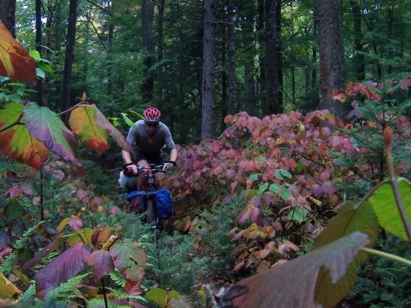
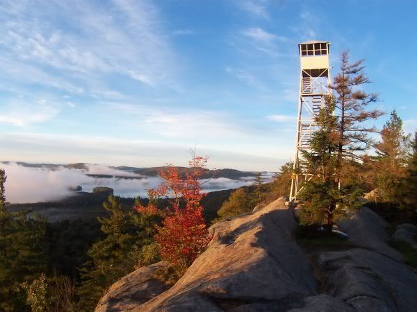
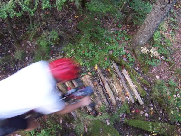
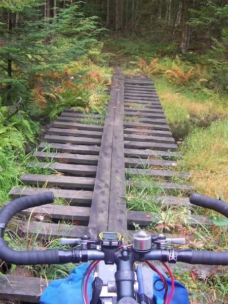
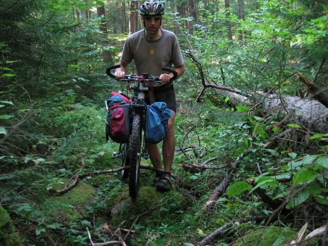
There is something for just about every riding style. Technical single track, rail trails, dirt roads, ‘truck’ roads, snowmobile trails and scenic paved roads all offer riding opportunities. Points of interest include fire towers, state parks, remote lakes and ponds and deep, dense forests as well as tourist attractions and quaint, tourist towns.
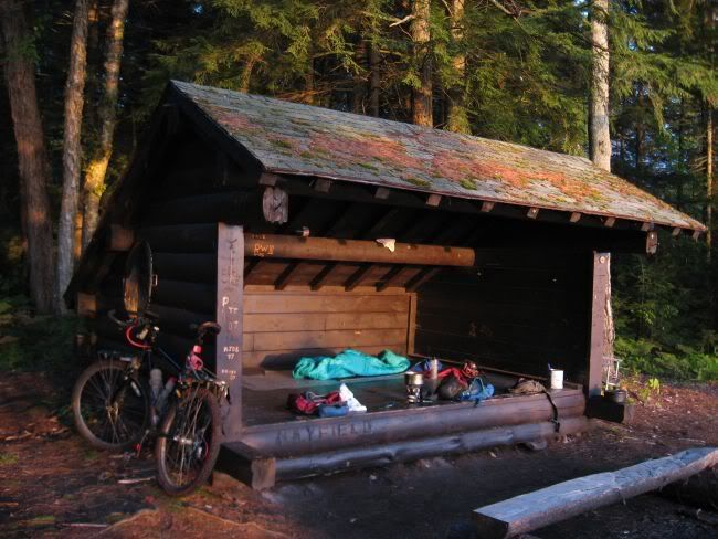
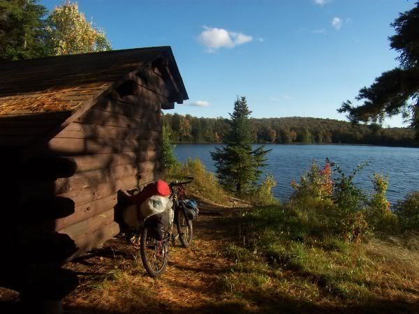
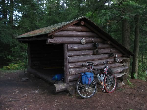
It is easy to plan trips that include overnight stays at Adirondack shelters (there are around 200 shelters throughout the park).
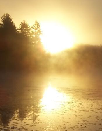
Compared to Appalachians, the mountains and hills in the ADK are more ‘peaky’ while the Appalachians tend to be ridge and valley topography. My theory is that the peaks, combined with the larger areas that are relatively flat, and the large amount of water improves the sunrise and sunsets with more opportunities for low angle sunlight.
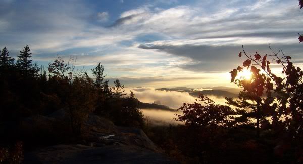
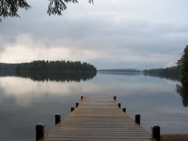
Imagine riding and in the late afternoon arriving a remote, uninhabited pond. Maybe take a swim in your private pond before having dinner. While cleaning up dinner, the sinking sun creates a spectacular sunset. As dusk draws nearer, the lonely call of the loon pierces through the evening coolness. What more can you ask for?
Bike Trip planning
It is kind of odd, given the proximity of the park to ¼ of the US population, the beauty and diversity of area that the mountain bikers do not flock to the ADKs.
There are a couple of published mountain biking books published for the ADK. These books outline day trip or shorter types of rides. (The books also duplicate some of the same rides!). Linking the rides listed in these books is an easy method of building a longer route.
Since land use categories limit where bikes and be ridden on trails. Planning a longer trip that includes riding trails requires a little research. The previously mentioned guidebooks just scratch the surface. Given decent computer skills, or access to a GIS system, the GIS info available from the APA is invaluable for trip planning.
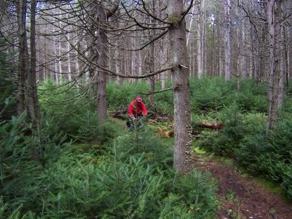
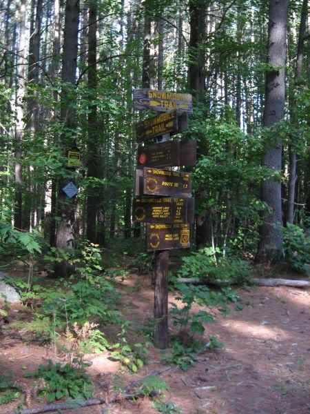
Snowmobile trails in the Wild Forest areas can be prime for mountain biking, but the riding results can be hit or miss. My experience is that snowmobile trails in the ADK can easily be populated with basketball size rocks (technical riding), or be well overgrown (frustrating riding) or even totally blow down choked (desperation scrambling).
 One finds that many snowmobile trails end at waters edge in the spring/summer/fall but would logically continue across ice in the winter.
When to Go
All of my trips have been in late September. I like this time of year for a couple of reasons:
- The family vacation season is over.
- The bugs are gone. (if planning a trip in the summer, be sure to research black fly season)
- The leaves are changing. The weather is crisp. Still shorts weather during the day. It is still warm enough to take brisk swims in the lakes and ponds.
- Most commercial attractions are open, although many of the State Park campgrounds are closed for the season.
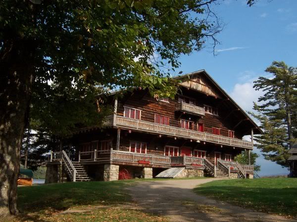
Unique Cultural Attractions
Lake Placid—you can get Olympic Overload in that town
Adirondack Museum, Blue Mountain Lake. A great place to absorb the history and traditions of the Adirondaks.
The Wild Center, Tupper Lake. A natural history museum of the Adirondaks.
Camp Sagamore, a ‘summer camp’ of the Vanderbilt Clan.
Resources:
The Adirondack Park Agency: http://www.apa.state.ny.us/gis/index.html
Adventure Cycling Publishes a road-touring route through the park.
JHL99 Feb 2011
wow man! these pics are amazing. I’ve only ever been backpacking in the region, but being able to cover more ground and explore by bike never crossed my mind.
Incedible looking country side. I wish we had hut options in my area. I love that type of shelter.
You make the East Coast look interesting! Well done.
Great photos. I never thought about going there before. Thanks
“You make the East Coast look interesting!” Because it is interesting! For whatever reason, the east coast doesn’t get much media coverage.
I think most regions have something special or unique to offer. Generally, it is a matter of having realistic expectations.
WOW! Very well done.
I’ve taken many multi-day paddling trips to the Adirondacks and you’ve ignited my interest in bikepacking the area. Gotta love September!
WOW, you got a paradise out there, you have to thanks god for putting you in the rigth spot !!!
Great Photos, congratulations
Beautiful! I’d love to see some hints at where to find the “hits” and how to miss the “misses.” Know of any mapped out any bikepacking routes? I live just across the lake – but rarely explore the ADKs.
I think the reason the East Coast gets such little exposure is that it is much harder to photograph than Out West. You’ve put a dent in that theory though… nice job!
I agree, Davey. Although there are a few other reasons-
much greater population density means there are fewer wild places and the wild places are more crowded;
less public land: of what recreational use is a forest if you’re not allowed to visit?
I’m a Tennesseean moved to Oregon. I got back to visit family and I’m usually disappointed. It seems to be getting more and more developed and crowded. There’s still lots of space in Oregon (though not in the north Willamette Valley!).
Have you thought about posting your route?
This link:
http://i111.photobucket.com/albums/n160/jhl99/2011/02Feb_ADK/ADK_RouteMap.gif
shows the routes I have done. All routes where loops, so if the segments don’t close up, it is because I just marked up paper maps for the connection. The “Blue Line” is the park boundary.
It’s been a few years, so these trips kind of blur together in my memory,. I can’t offer much additional detail. I will reiterate though that the guidebooks mentioned, and the GIS CD from the Park Agency should give anyone enough info to plan a route.
jeff-this is a great summary of that area!!! on my bucket list now:-)
Here’s some great geodata information from the NY DEC.
http://www.dec.ny.gov/geodata/ptk
I’ve brought in the DEC roads, DEC mountain bike, and DEC hiking trails to GoogleEarth, and then over to TopoFusion to plan a long ride this August. Road + Trail + Dirt Road. There will be some single track / snow mobile trail / etc. Awaiting some word on trail conditions for a nice 33m connector…