Australia / New Zealand, Trip Reports » Tasmanian Trail Report
The Tasmanian trail is a long distance walking/cycling/horse-riding trail linking Devonport and Dover. The total distance is about 480 km, however track deviations have since altered that figure.
Typically, the trail is completed from North to South, since this is the way in which all directions are given in the guidebook, however since my only chance for transport to the trail was to be from the South, then it was decided that this was the better option. Additionally, heading North allowed the more remote areas to be covered first, and the (hopefully) easier riding to be left towards the end.
The guidebook suggests covering one stage per day, or around 30km, however at that rate it would take more than two weeks to complete the whole trail; time which I did not have. As such, the Australia Day long weekend was the longest window of opportunity I had to attempt the Tassie trail. Obviously 3 days is not long enough to cover the whole trail, however I did want to see how much ground could be covered in the time I had. It didn’t matter if I rode 30km or three hundred, as long as I could finish near to a town where transport could be arranged.
As such, Friday night I was fortunate enough to grab a lift with my parents, since they were camping ‘down South’ for a few nights, and with a little persuasion I managed to coerce them into camping near to the start of the trail.
And so it began.
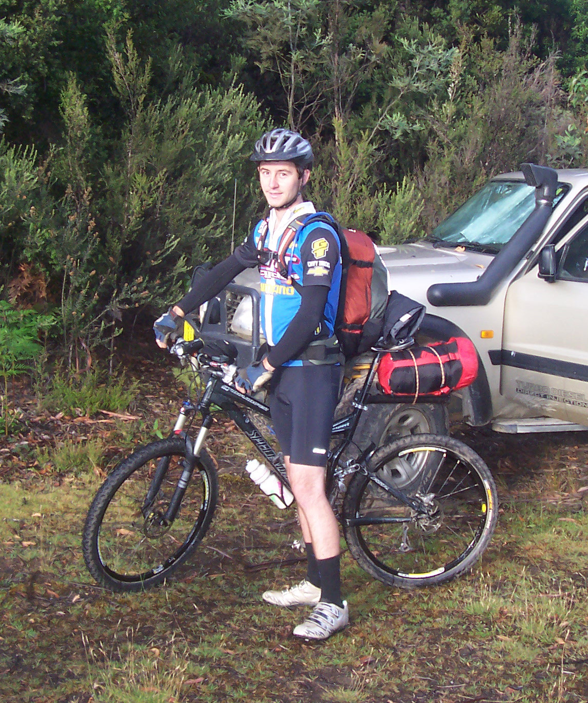
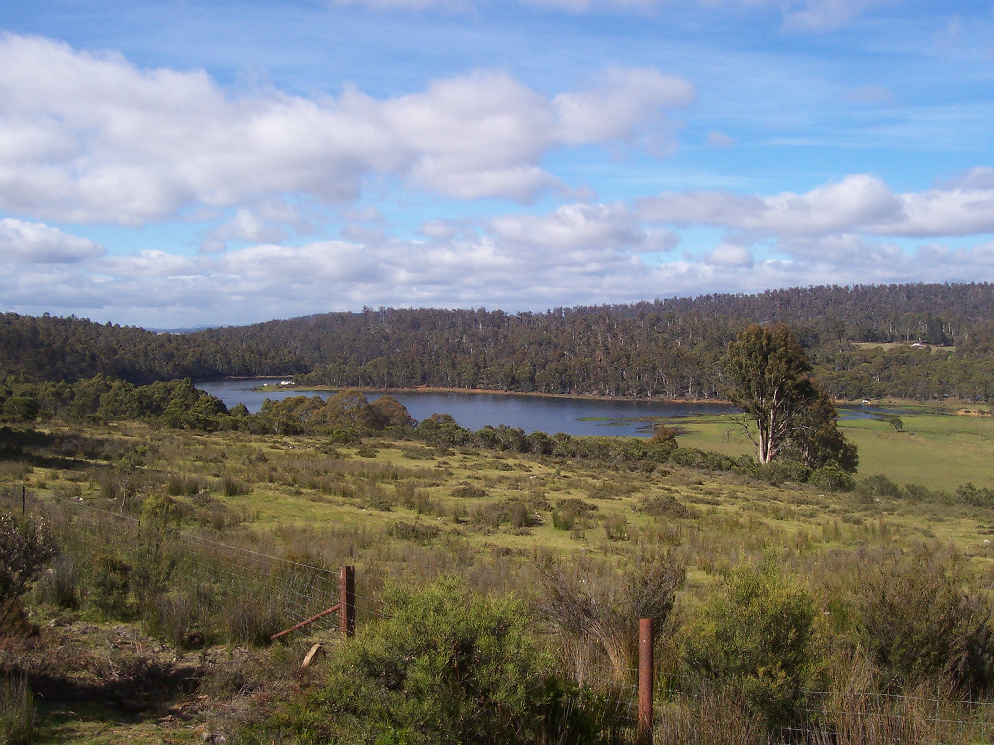
The beginning: Esperance River Campsite.
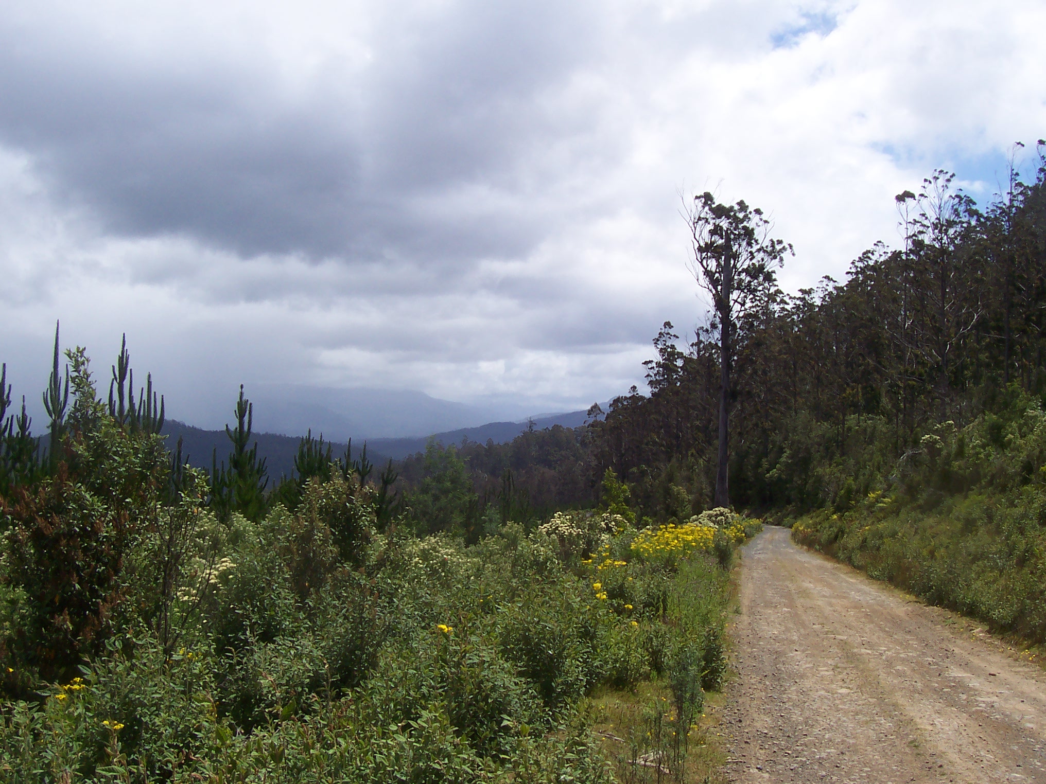
Saturday morning involved a reasonable start of 7:20am, before which I’d had a few obligatory photos taken, and ensured I had each and every item that I was likely to need on the journey. Before long I was on the trail, leaving Esperance river campsite and heading along well-made fire-roads through the ‘Southern Forests’, as named in the guidebook. Easy navigation and gentle climbs lasted an hour or so, while I continued through the forests, until a little later on I arrived at an intersection at which the nearby trees (and signs) had been logged. Referring to the maps offered little assistance, and I turned off on the gut instinct that this was the right way to go. 15 minutes of constant climbing confirmed my decision, as a Tasmanian Trail marker showed the way. However, soon after I arrived at another intersection without signage; it too had suffered from the recent logging, and again the maps proved useless. I continued on the main trail, rolling downhill for 5 minutes or so, before finding that this road had only recently been made, and was a dead-end used for logging (A quick check on Google Earth post-ride proved that the trail had existed for only a few months, much later than the maps in the guidebooks, which had been created 15-20 years earlier). After less than 2 hours I’d been unsure of my direction twice, and I was beginning to wonder how much time I’d spend riding up and down hills that weren’t part of the trail. And so I began the 10 minute climb up to the last turnoff, and had little choice but to ride and hope there was a trail marker not far away.
Thankfully, there was. And so I continued further, coming across more intersections with both trail names and Tassie trail markers, before travelling through Swearing Bob’s plain over rough stone ledges and around large puddles, all the while the clouds above appeared to be gathering and a storm brewing as a result. Soon after the rain pelted down, while I donned my jacket and continued to pedal. However, shortly after the rain started, a loud clunking noise emanated from the bike every time I’d hit a bump. It became loud enough that I soon had to pay it some attention, and so I had a quick look, hoping not to find anything that was going to force a premature end to the ride. Nothing was visibly wrong, although I had a sneaking suspicion that it was one of the rear shock mounts coming loose, the tightening of which required the only Allen key that I hadn’t packed (Murphy’s Law anyone?).
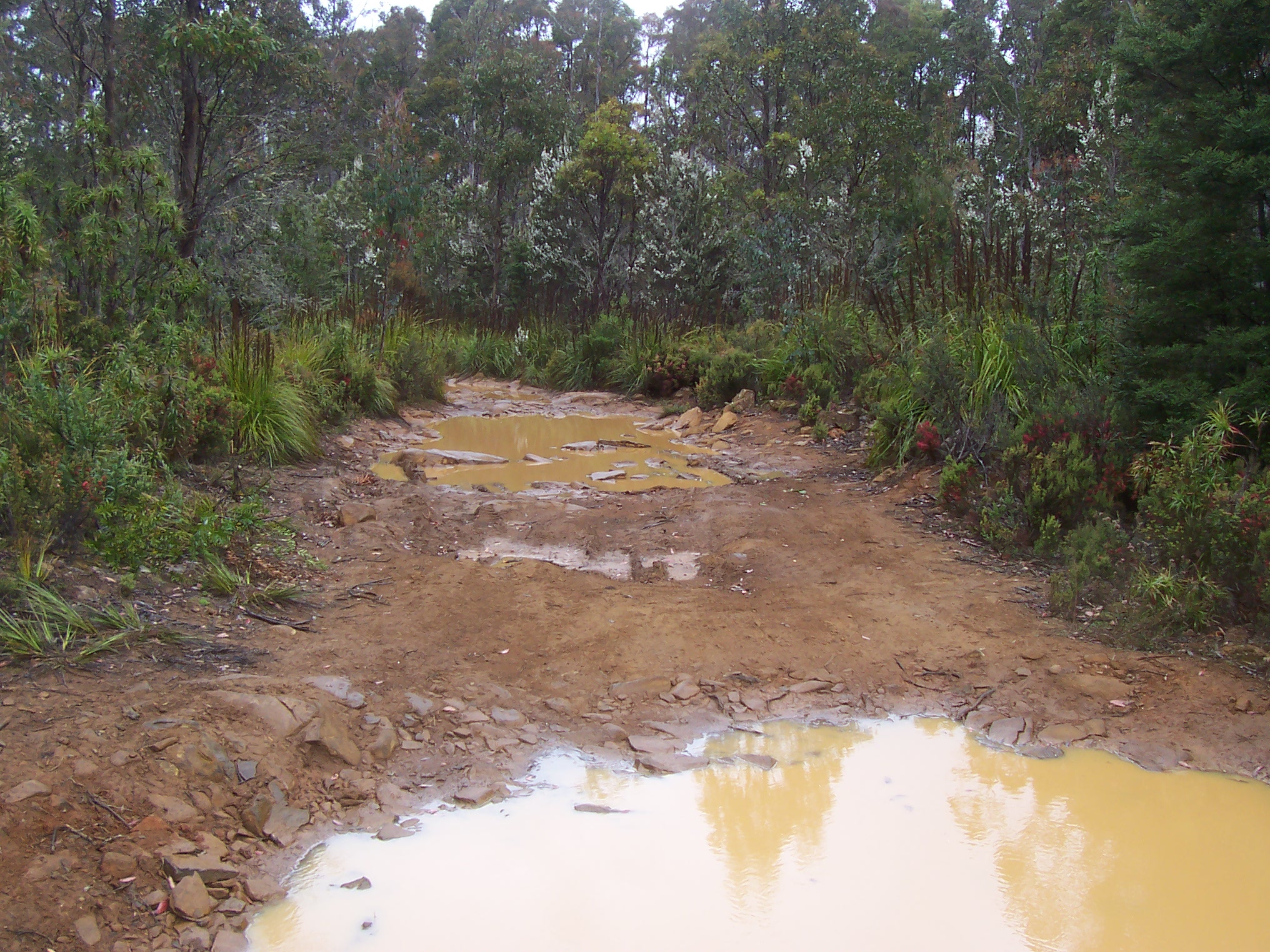
And so I continued on, unable to stop the noise, and all the while being annoyed at myself for not bringing the crucial Allen key ( I have a rule that if I think about a specific item while packing for the ride, but don’t pack it when I think of it, then I’m guaranteed to forget to pack it and then require it on the ride, and the more often I think about it without packing it, the more seriously I’ll need it; for this particular Allen key I’d thought about it half a dozen times without packing it, and as a result I REALLY needed it). The rain soon turned the 4WD trail into a slippery mudslide, and finding traction on the steep descents and ascents from the creek crossings occasionally proved difficult.
At about this time I was finding out that my jacket wasn’t as waterproof as expected, and so it clung to my arms like a $2 poncho – I was hoping that the bag wrapping my sleeping bag and sleeping clothes was somewhat more resistant. The rain continued on and off, while I continued on wet 4WD trails through more forests, before coming to a clearing and thence an intersection at which I proceeded to turn right, since it seemed the right way to go. Fortuitously I forced myself to stop and check the guidebook, which promptly told me to turn left.
More climbing then ensued, up through farmland and forests, before following more Tassie trail signs, which soon had me in Geeveston (about 2.5 hrs from the start) and then to the highway. Wrong! I knew I should never reach the highway, but had considered the trail markers to be heading in the right direction; however there are many deviations from the actual trail route to allow for easier passage through various sections (the deviations from the actual trail are marked with the same markers as the trail proper, and hence the confusion). A quick turnaround at the highway and a retrace of my steps to the last turnoff followed, at which I chose the only other option, left. I was now sure I was heading in the right direction, and a quick look at the map confirmed my assumption. However the trail soon became rough, and the trail markers noticeably absent, however the map said that the trail followed this path, and there were no other roads to take. Not before long, the trail turned into a rough firebreak, recently bulldozed along a fence-line, all the while I was telling myself that the trail has just been cleared due to lack of use. Steep climbs followed, forcing pushing of the bike, and lifting up and over logs.
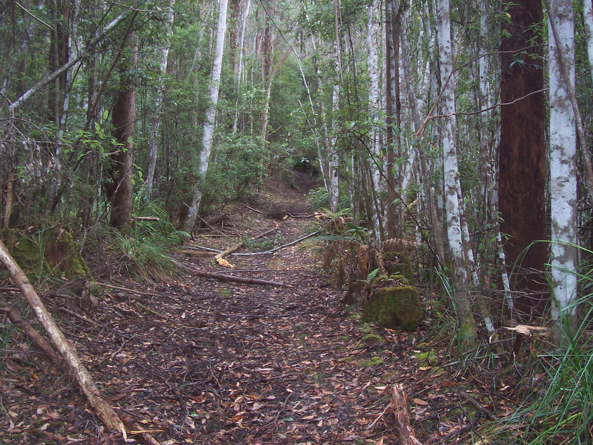
Completely lost on a steep and rugged trail near Geeveston. Fallen trees and steep hills meant pushing the bike was the order of the day.
This continued for around 30 minutes, at which point I came across an intersection with an unformed road (again no trail markers), and so I remained on my firebreak ‘trail’. The firebreak soon turned skyward (even more so than before), and I was forced to really dig in to push the bike up the hills. Another 20 minutes of uphill forced me to reconsider my situation, and resign to the fact that I was nowhere near the Tassie trail, so as soon as the firebreak turned left, I turned the bike around and retraced my hard-earned steps, back to the intersection with the unformed road, where I turned and ended up at the edge of a huge cleared paddock on the top of a hill. At this stage I knew I was far from the Tassie trail, but didn’t want to retrace my steps all the way back to Geeveston, so I made a rough estimate of where I was on the map and cut directly across the paddock for a kilometre or two, attempting to find an exit to a road. Unfortunately, there was no road adjacent to the paddock, and I soon jumped the fence into the forests on the other side of the paddock. The forests were clear enough to ride through, albeit slowly, and I soon found myself in the back of a vineyard, at which point I crept through the avenues of vines, trying to find an exit to a nearby road.
A little while later, after quietly riding through the vineyards and then ever-so-quietly riding past the house of the yards, I was on a tar road; at last! A quick look at the map showed I’d deviated from the Tasmanian trail by some distance, but it didn’t matter, I was happy to know where I was again.
From this point it was relatively easy to meet up with the Tassie trail again, so I continued along the road until the next section of Tassie trail, noting on the way the point at which I was meant to have joined the road – I was now back on the Tassie trail proper! However it wasn’t for long, as another wrong turn forced an extended hill climb along another rough firebreak, which turned out to be a return trip back to the first intersection! After spending 30 minutes or so being lost and riding a trail which looped around on itself, I was beginning to get a little frustrated, which is probably a mild understatement. Nevertheless, perseverance paid off and I soon found another trail marker, which had me out of the forests and onto a rocky road through button-grass plains.
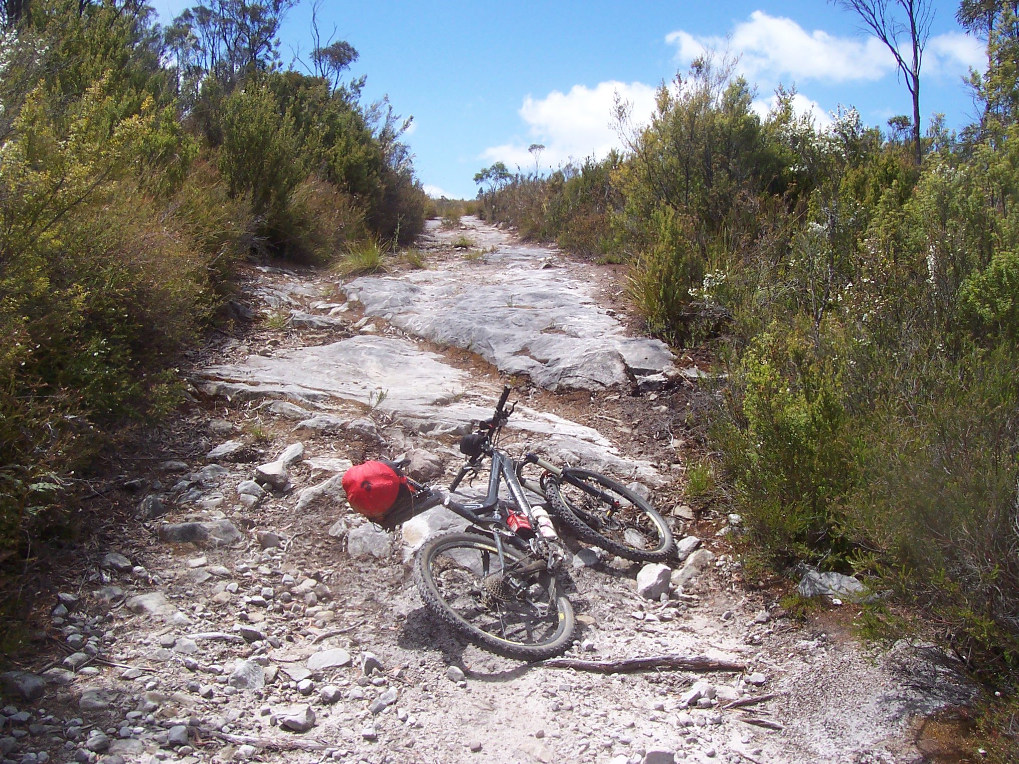
A rocky 4WD trail towards Judbury; progress was slow, but trail markers were common and navigation was simple as a result.
An hour or more was spent slowly crawling up the rough trail, all the while the bike groaning with the untraceable noise. This section was relatively uneventful, although the huge vistas over the ranges to the north south and west offered great views, and the dark clouds were a reminder to keep pedalling to more sheltered areas.
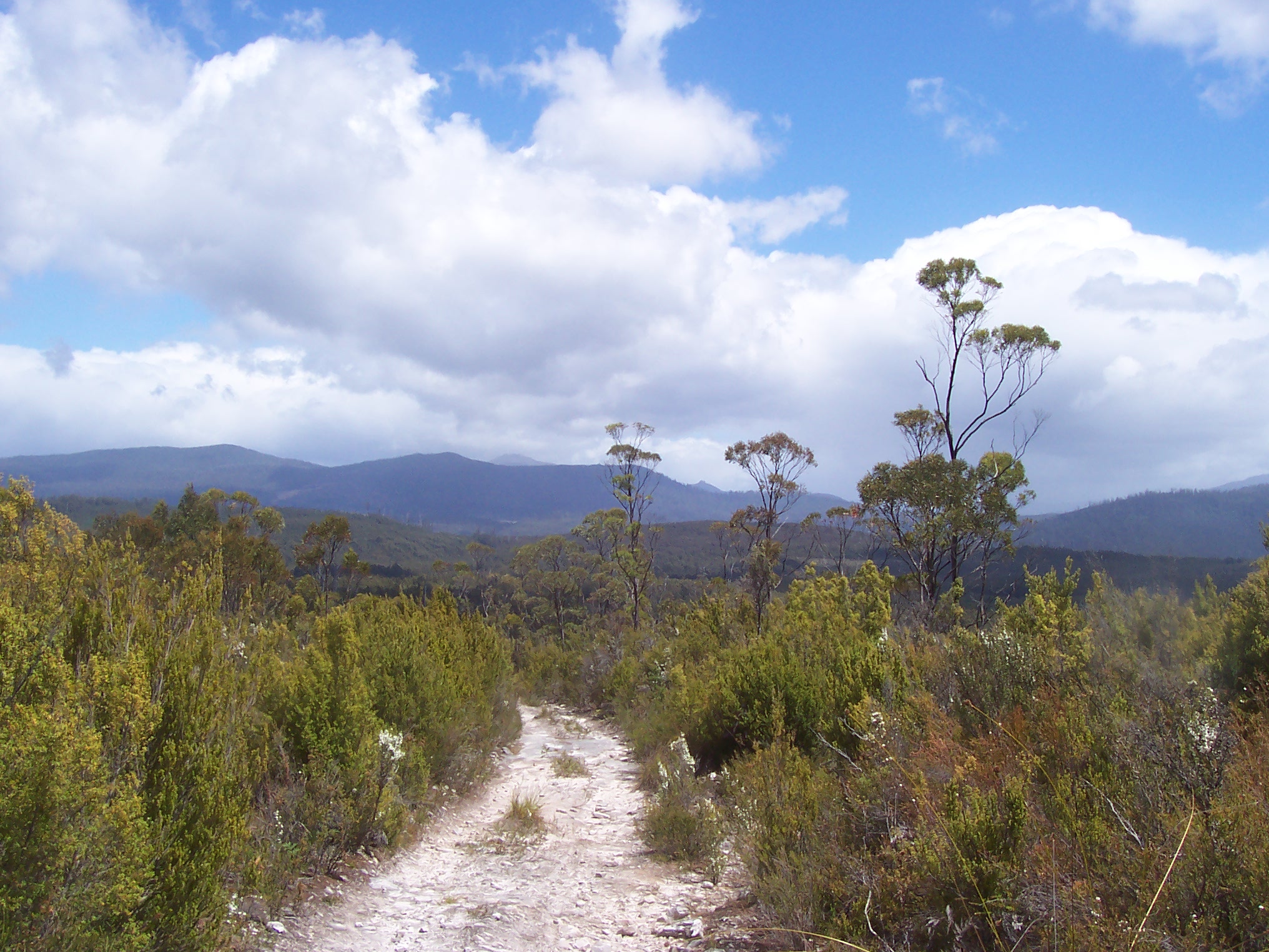
Nice vistas abound - this one looking West on the way to Judbury.
Serious rain clouds on the horizon, but flower-lined trails; who could ask for more?
By 2:30pm I had arrived in Judbury, a tiny town on the banks of a wide river, where I refuelled and filled up with water. This was the first real break for the day, and was immediately before the climb up and over the Wellington range; a climb and descent that was likely to take the better part of 3 or 4 hours. Soon after leaving Judbury, the gravel road began its ascent up to 900m; gradually at first, and then becoming far steeper as the road became a trail, and the trail became a 4WD track. Soon the rain did its thing again, and the ride became a walk, as I waded through several knee-deep mud bogs and many more of lesser depth. The rocky, wet climb continued well into the late afternoon; some sections rideable, while others were obligatory ‘pushes’. Nevertheless, eventually, the hill flattened and the trail became rideable, despite large rock sections interspersed with bog-holes and the occasional fallen tree, and even further on, the trail turned downhill, and the half-hour long descent into Lachlan began. This descent followed another rough 4WD trail almost all the way into town, before becoming a tar road for the short cruise to the local park.

Trail? More like river! The climb up and over the Wellington range didn't disappoint in terms of challenges.
The top of the Mt Wellington range proved a haven for 4WD trails – a visit in the car next time?
I’d packed precooked sausages for dinner for Saturday and Sunday nights, and a free gas barbecue at the park afforded a good chance to make them a little more enticing. It was here that one of the local kids and I had a long chat about the Tassie trail and the 4wd track I’d just descended. He also had great stories of previous Tassie trail walkers and riders, and was interested in how long it had taken me to get to Lachlan from Dover. He ogled over my bike and gear for ages, which reminded me of my need for an Allen key, which he happened to have nearby. A quick check of the bolt surprised me, as it wasn’t loose – even if I had brought the right Allen key it wouldn’t have helped earlier! After a quick-ish meal, we raced to the local bridge, where I thanked him for his help and continued on my way into New Norfolk, however this wasn’t before I noticed a flat front tyre, which had a slow leak, so I reinflated it and told myself I’d repair it in the morning.
By this time it was well after 7pm, and the sun was getting low; a quick stop for water at a park in New Norfolk and I continued on my way up into the Black Hills, where I found a quiet spot overlooking the valley and promptly laid out my bivy bag, after a hard day of 111kms and 14hrs.

Campsite one - minimal gear proved quick in terms of unpacking and unpacking each night, as well as maximising the distance covered each day.
A long, albeit intermittent, sleep saw me to 8am the next morning, when I awoke looking over the valley towards New Norfolk. A less-than-speedy packup and breakfast took almost an hour, before I began walking up the Black Hills road. A few minutes later I was back on the bike, slowly grinding up to the top of the hills, before a lengthy dirt-road descent towards Bushy Park, where a Chicko + sausage roll really hit the spot.
I didn’t hang around long, before heading to Glenora and thence followed the trail through a long paddock; the route depicted by “turn left at the large tree” and “descend until you see a fence on your left”, proved no hassle and I was soon on Meadowbank road, where I filled up at a local creek, and continued on as the day heated up. A few kilometres down Meadowbank road brought me to the next (well-defined) turnoff which was to take me on an extended journey though local paddocks and forests.
Farm trails near Glenora.
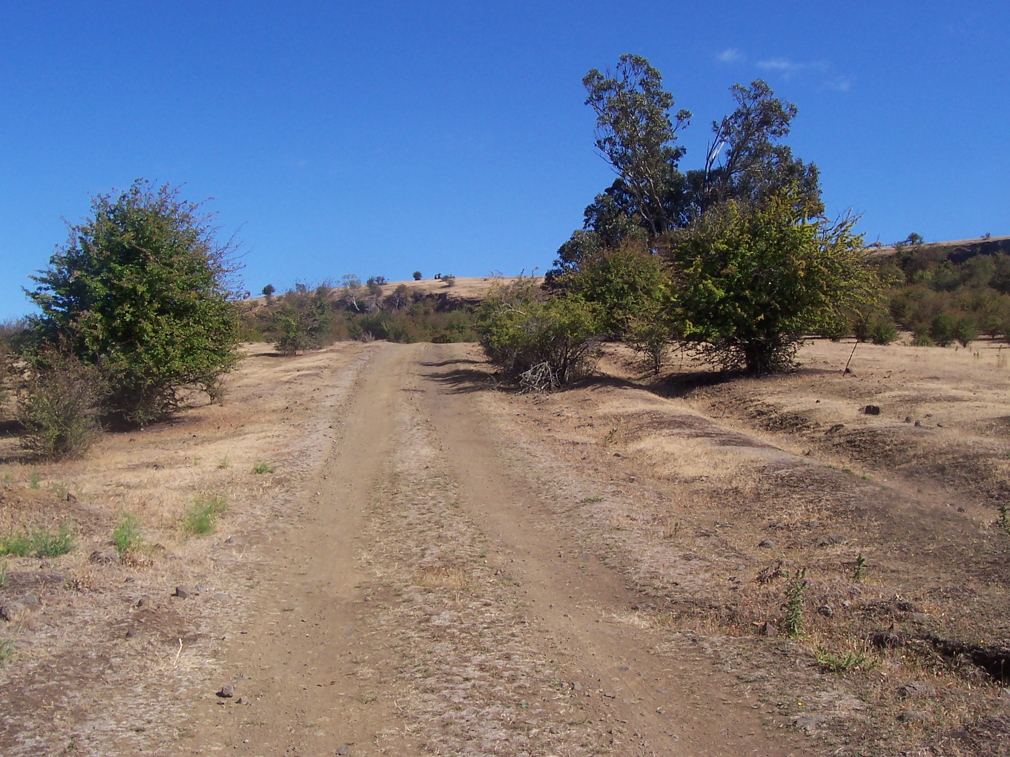
A climb for approximately 20 minutes along a rough bush trail ended with a huge cleared paddock overlooking the local surrounds, and continued with great vistas and well signposted turnoffs through forests and paddocks for an hour or so.
Climbing through paddocks and hopping fences was common.
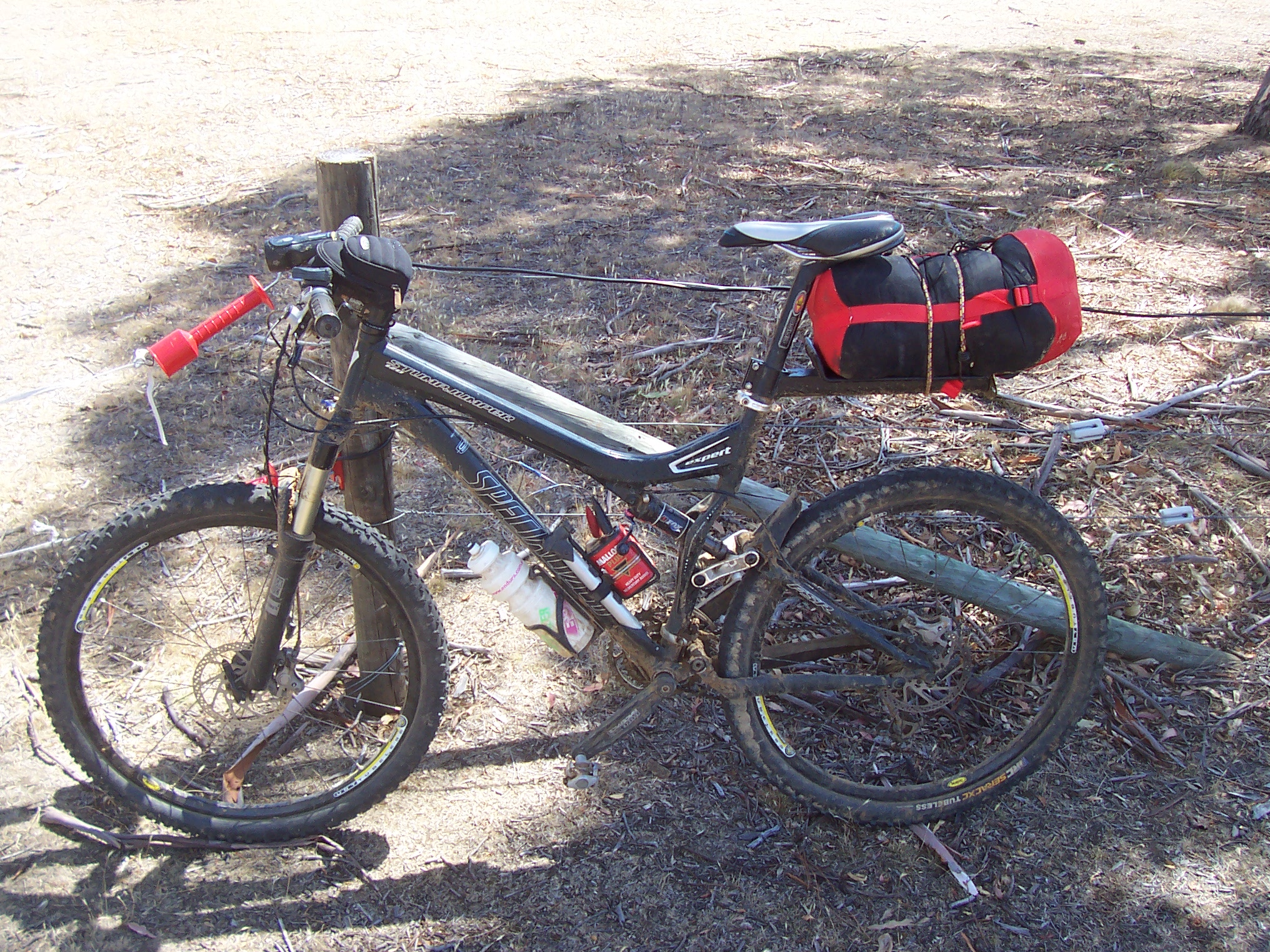
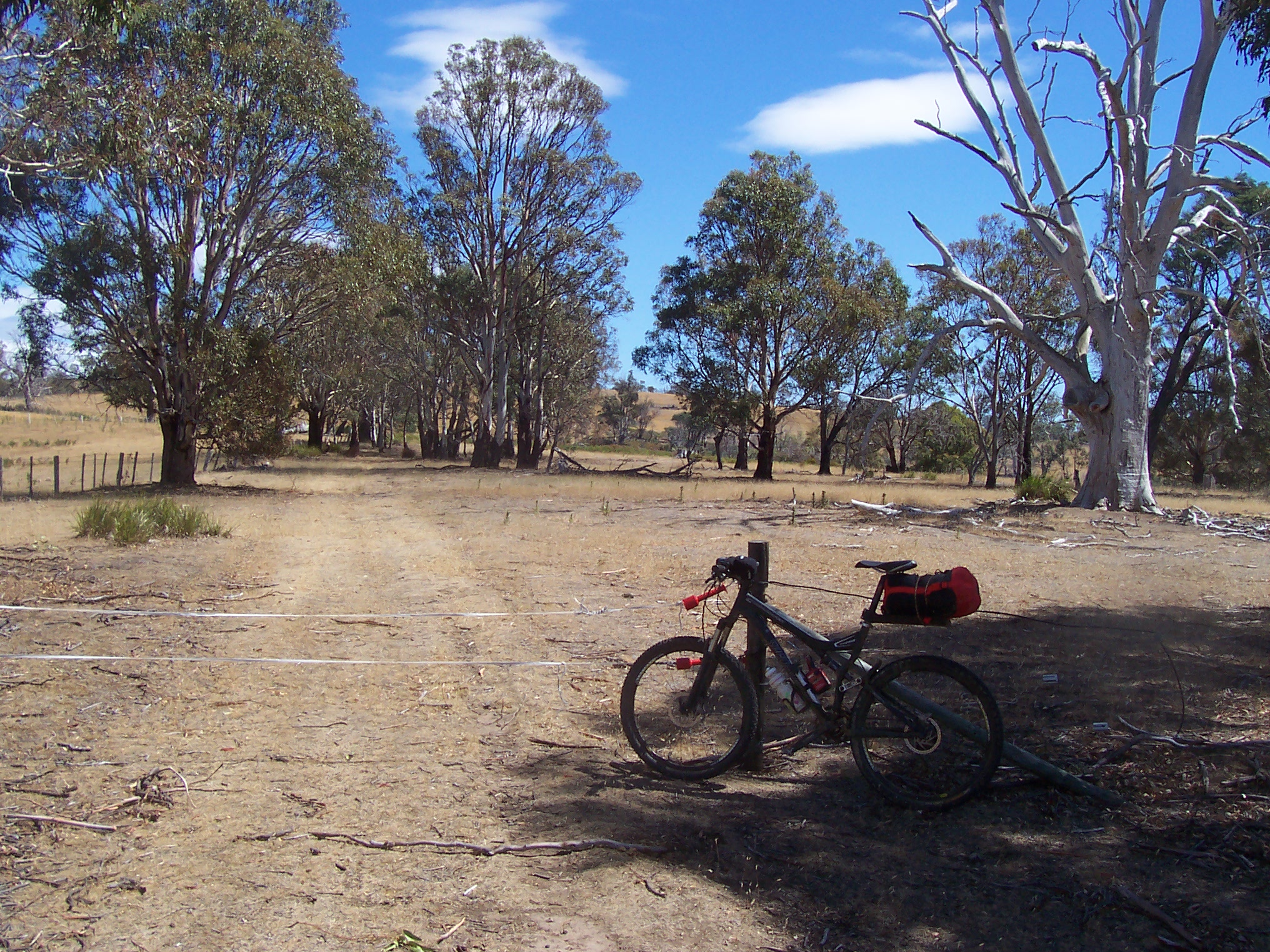
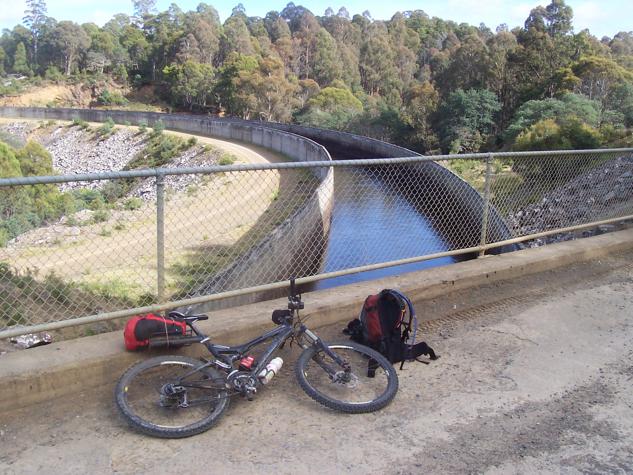
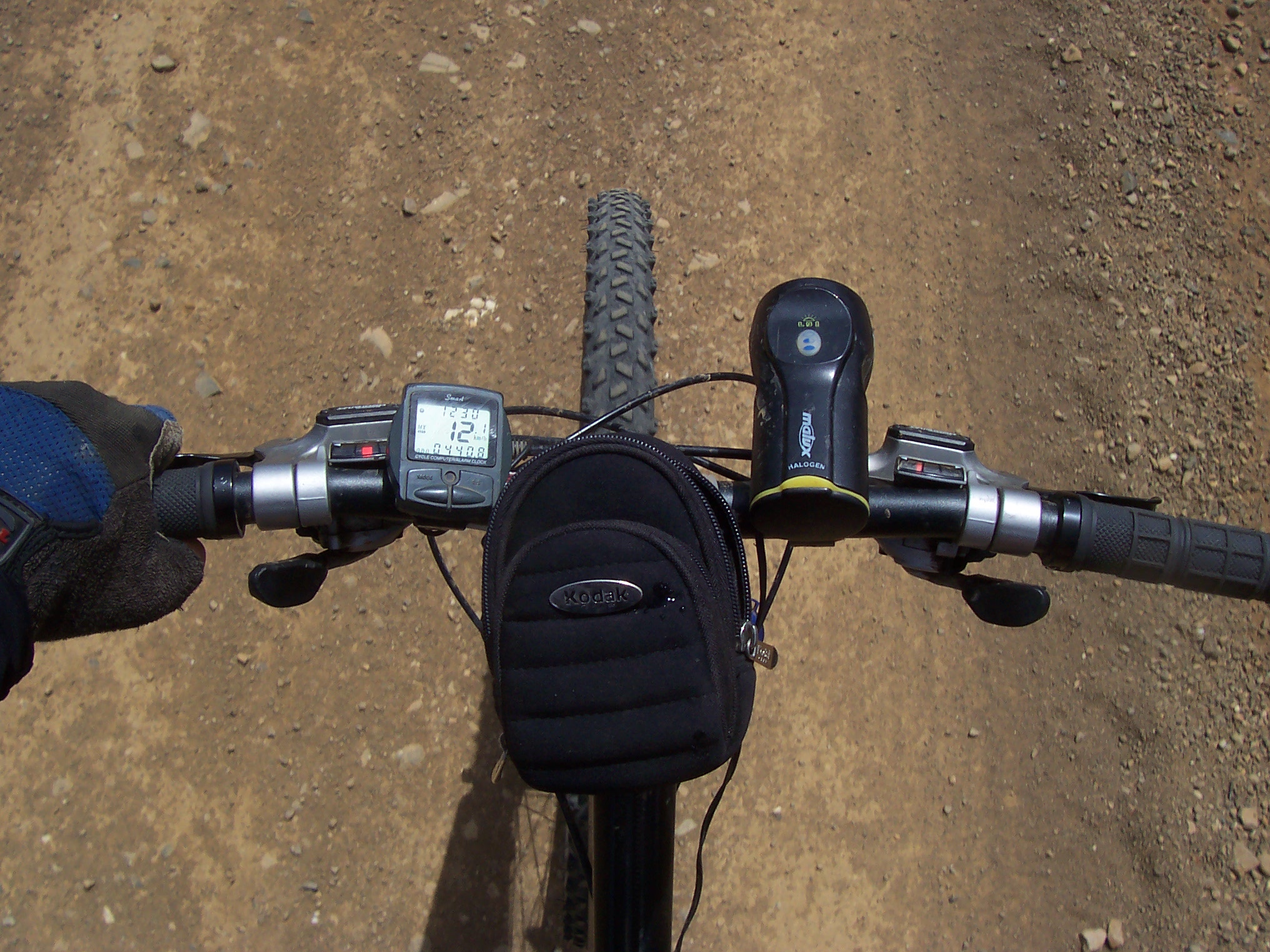
Bike setup

A nice vista looking back towards Glenora

Bicyclist and Bicycle - atop a rise after Glenora.
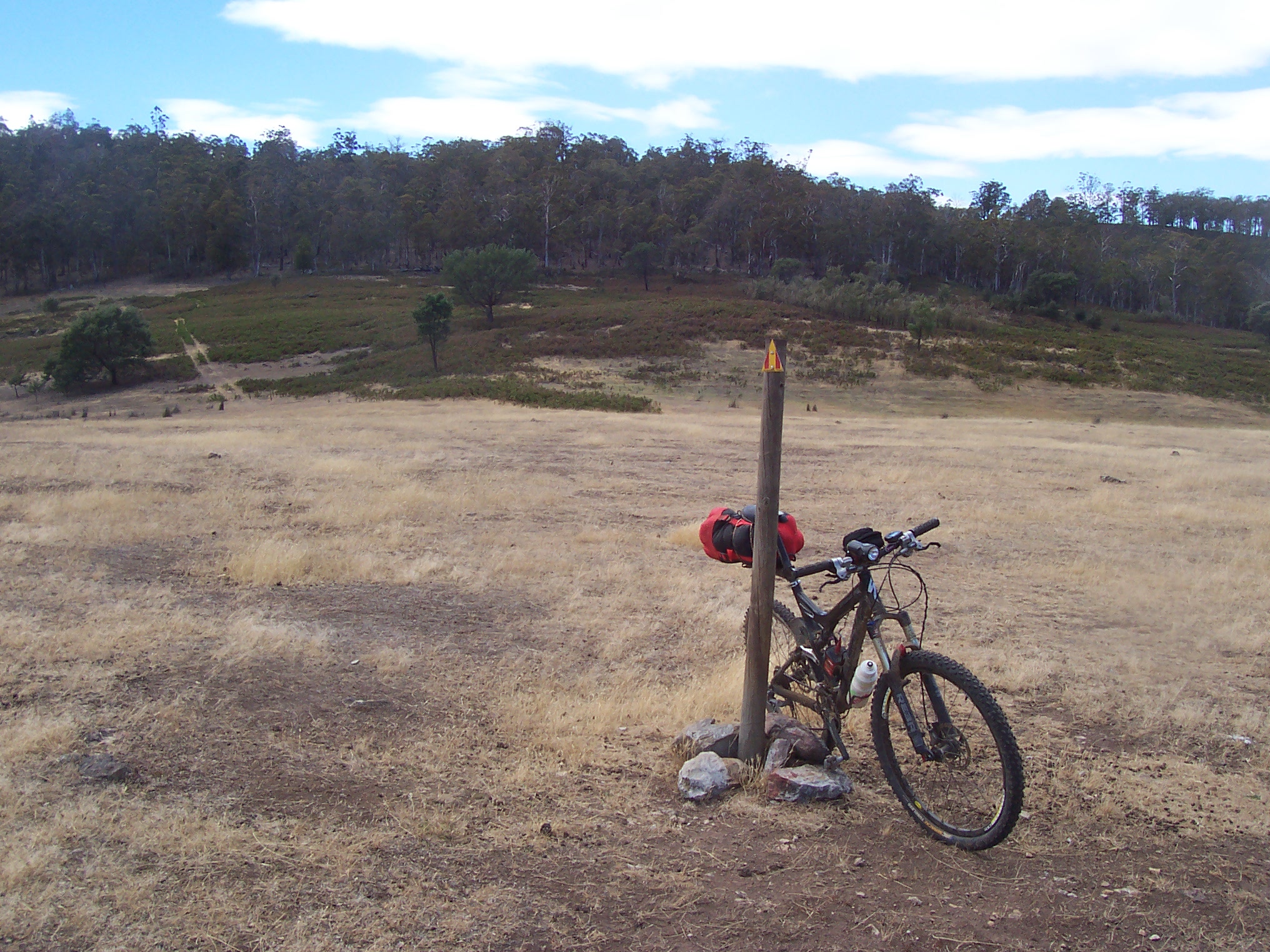
Open fields with isolated trail markers offer the authentic epic feel.
At this point the trail intersected with Ellendale road, where a lengthy tar road section was a welcome change to the rougher bush tracks of earlier in the day. This tar road took me through Ellendale, and further on towards Ouse, where a turn into one of the local forests along bush trails soon had me pushing up sandy 4WD trails between huge pines.
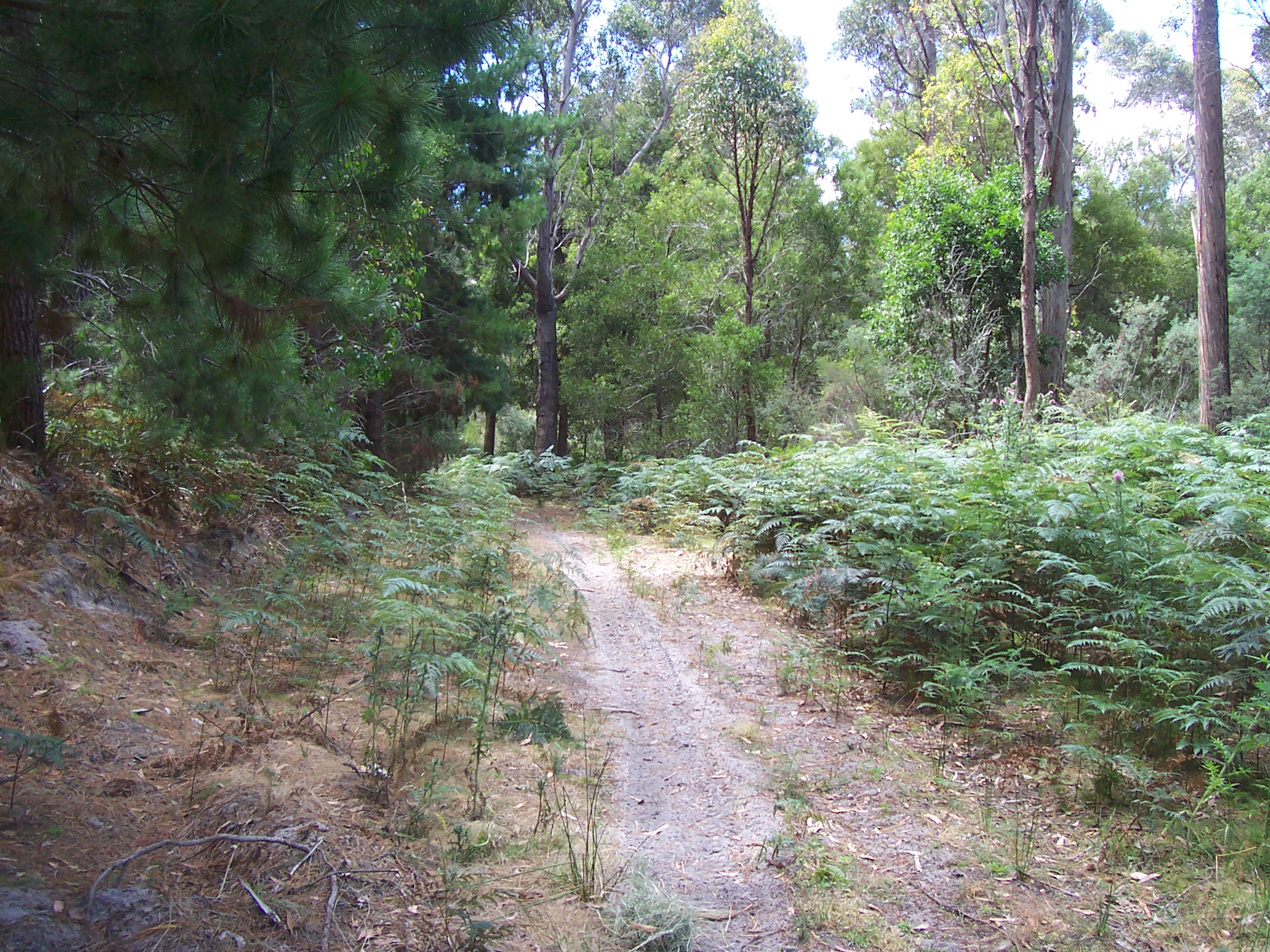
Sandy singletrack on the way to Ouse.
Thankfully I was still on the Tassie trail, as confirmed by the markers on trail-side trees; however it wasn’t long before I was soon lost again. This time I’d seemingly deviated from the trail somewhere in the forest and had now arrived at an intersection. Again, the map proved of little use when I couldn’t determine where I was on the map – local landmarks didn’t help. So I turned right, thinking that was the right direction, but after a kilometre or so I realised it wasn’t and turned back to the intersection. I then tried left, which I followed for half a kilometre, before realising that this direction didn’t seem right either, so I then returned to the intersection and took the original turn to the right, which I followed for kilometres over rough corrugations, before arriving at Meadowbank Lake. What!??! A quick check of the map confirmed my suspicions that I was now a long way off track, and had headed south-east approximately 10km more than I should have. Nevertheless, I now knew where I was, and made good time along the tar road into Ouse, where a Chicko roll and drink again worked wonders.
By this time it was about 4:30pm, and so I continued on up the Victoria Valley road heading towards Victoria Falls. A tar road, which turned into a dirt road, followed by a dirt trail, and finally a 4WD track, climbed several hundred metres through forests over about 25km, and ended at the Falls, which are well worth checking out. A quick dinner at the local picnic area of sausage rolls and sausages recharged the legs and encouraged me to complete one last section before nightfall.
This section was all on well-made dirt roads, allowing reasonable speed and some rest from the bumps; as a result, it took little time to reach Dee Lagoon, which offered great camping, but wasn’t quite as far as I wanted to make it for the night. Further along I passed though Dee township – a tiny road-side town in the middle of a huge forest – and then on towards Bronte Park.
Dee Lagoon - a welcome sight high in the mountains.
A few kilometres before Bronte Park, I found a great little dell not far off the road, offering soft grass and being well covered by trees. I quickly laid out my gear and started a small fire to dry my wet shoes. Soon after a car came past but didn’t slow, so I must have been invisible to the road users, or so I thought. Not long after, when it was almost pitch black, another car came up the road, and then slowed not far from where I was camped, before turning around and slowly coming back to the roadside nearest the camp, where it promptly stopped. Voices were then heard as two people got out of the car and started pushing through the brush near the camp. When they came closer I could begin to hear what they were saying, “Oh geez, there’s someone camped in here!” at which point they burst into the tiny clearing where I was camped, in almost pitch blackness, and I told them what I was up to. The fire had been reported by the first car that had passed, and the second car, with farmer and son, had driven to see what was going on. I said that I’d put it out as soon as I’d dried the clothes, at which they commented that I should just make sure it’s out before I left in the morning. I quickly dispersed the fire and headed to bed, which was far more comfortable than the previous night.
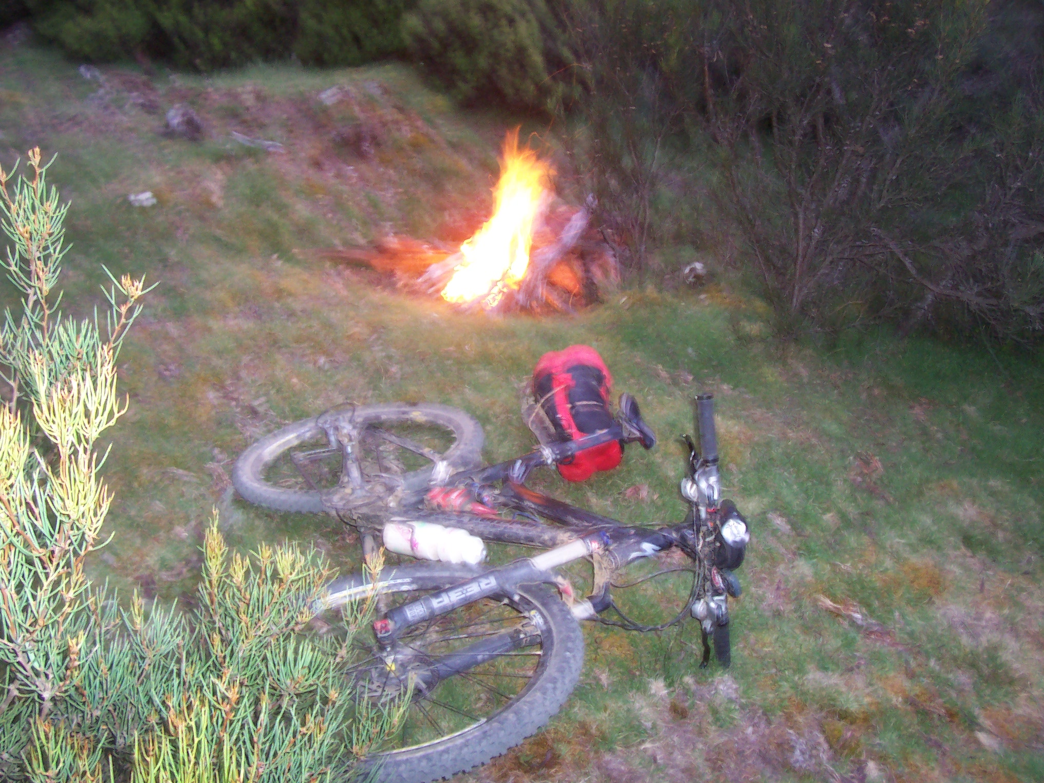
Campsite two and the noteworthy fire.
Another relaxed start on Monday morning was the result of another long sleep, and it was about 8:30 by the time I got away. A 20 minute ride into Bronte Park was enough to get the legs working again, before heading west towards Pine Tier along various tracks and across green paddocks.
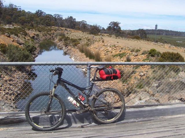
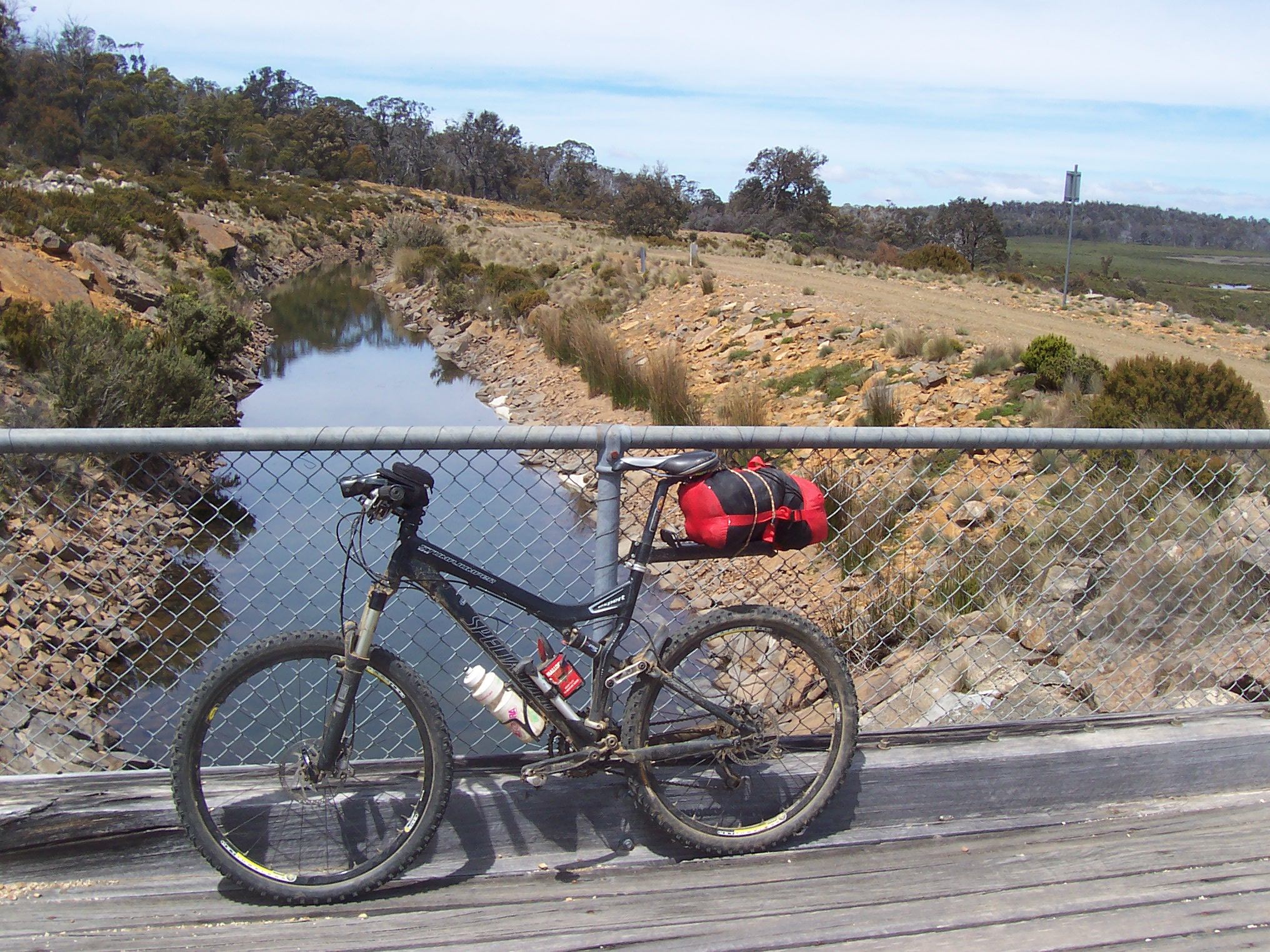
Flume #1 just after Bronte Park.
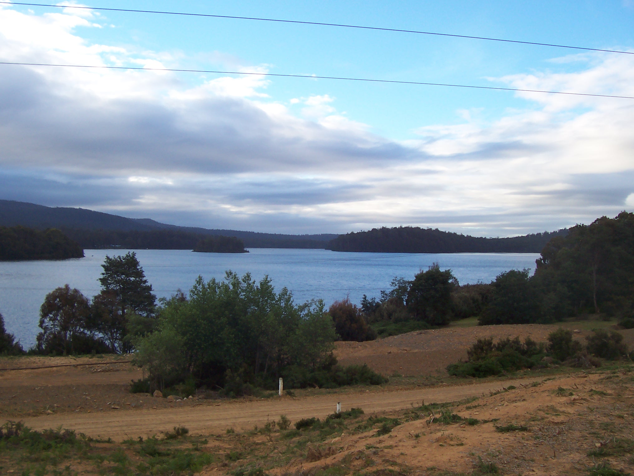
A lake near Pine Tier - campers were aplenty due to the long weekend.
Great vistas of the local lakes and nearby hills were a nice reward for the efforts. However, significant climbing on fireroads followed, before seemingly becoming lost again for 20 minutes or so. The trail then descended onto the dirt Marlborough highway, for the long trip to Miena, with many long hills and plenty of traffic, amongst the always impressive amount of roadkill – not so nice when breathing heavily. An hour and a half to cover only 20 kms on the highway hinted that I was really beginning to tire, or that the road was steep, I’m not sure which.
However, just before midday I reached Miena for another Chicko roll and pie, before heading through town and on towards Tod’s corner. From Tod’s corner my exposure to the sun really increased, and my sunburn was beginning to show, and now that I was following a flume, the shade was minimal. The flume trail continued for some time, all the while staying relatively flat and smooth – some good speed was made through this section.
Flume trail towards Arthur's Lake
The flume road then ended at Arthur’s lake, a popular fishing location offering one of the most rugged tracks of the Tassie trail. Along this section, the trail follows a powerlines road, made from large stones, and requires some effort to traverse, despite being relatively flat. A short rest for a tasty pack of 2-min noodles was enough before the 25 km road section to Poatina, however the extreme sunburn which I was now suffering from was so painful that I required frequent rests in the shade in order to keep going (4 days later my left leg is still swollen from sunburn!). Nevertheless, the highway section was uneventful, and the descent into Poatina enjoyable, as I dropped close to 1000m in one long tar-road descent. I made it to Poatina just before 4pm, where I rested in the shade for a couple of hours before meeting Mum and Dad for the trip home. All in all, 332kms were covered in the three days; still 145km short of the entire Tasmanian trail, however I was never really expecting to be able to ride the entire trail in 3 days, and was happy that I had seen as many new sights, and visited as many new places, as I had. All in all, a fantastic adventure.
Here’s to the next one,
Nice work mate! 🙂
Sounds like routefinding is a major challenge on the Tassie trail. Would you consider trying a GPS on the next trip? Even if you don’t have preloaded tracks, you can see where you’ve been and figure out where you are on the map.
Good report, thanks.
What’s a Chiko roll?
I was wondering that too…
Wikipedia is awesome!
“The Chiko Roll is an Australian savoury snack developed by Frank McEncroe, a boilermaker from Bendigo, and first appeared at the Wagga Wagga Agriculture Show in 1951[1][2]. It was inspired by the Chinese egg roll and spring rolls and was designed to be able to be eaten with one hand whilst drinking a beer with the other. The Chiko roll consists of boned mutton, celery, cabbage, barley, rice, carrot and spices in a tube of egg, flour and dough which is then deep-fried. The wrap was designed to be unusually thick so it would survive handling at Football matches. It was originally called a “Chicken roll” despite not containing any chicken then later renamed “Chiko Roll”.”
So, mutton, celery, cabbage, barley, rice, carrot, egg and deep fried, huh? Wonder how that recipe came about. Sounds pretty dense, calorie wise.
Did you take any Vegemite along with ya? 8^)
Cool to read & and see pictures of a ‘far away’ land. Read about ‘tar’ roads and ‘paddocks, big ol mud puddles, Chiko rolls and mystery bike noises (what was that noise anyway?) etc etc
And every time I read about you missing a turn, re-tracing up the wrong hill, cutting cross country in hopes of finding the right trail, missing trail markers and minimal help from the map etc I kept saying to my self, yp – ‘been there done that’, but now———with my (I love it) GPS, well……..!! Not that GPS it solves every questionable turn on the trail but it sure does reduce lost time and lowers my anxiety.
Anyway I really enjoyed the read!!!!!!!!
(and next time I am on a long all day ride and get hungry I will be wishing for a Chiko roll)
Thanks for the feedback guys – yeah, those Chiko rolls sure give you a boost when you’ve been eating cold, dried food for days on end. I spose you don’t have them in the States 🙂
As for navigation, I did consider using a complete set of topographic maps, however the trails that have been put-through in the past decade or so would still be unmarked. As for a GPS, well that would have helped only if I had the full topographic map set. The photocopied topographic maps in the guidebook were very good for the most part, however in a few spots the copy was too light, therefore omitting some detail.
If i did the trail again I think it would be fairly straightforward – most of the errors were obvious with the aid of Google maps once i was home.
I am almost considering doing a the same trip with a little bit of speed thrown in – I found navigation too difficult to really push the pace, and despite having lights, wasn’t keen to push on after the 9pm sunset.
Scott is the true GPS ‘expert’ but here is a laymans rational for GPS……You can use lots of online and off line maps/sat pic etc etc to lay out a ‘ artificial track’ (a set of marks/way points that show up as a ‘path/trail’ over the GPS units background topo map) to create a electronic path to follow.
Then as you ride the real trail/track you watch your “artifical track” , of course the artificial track you created at home will vary some from the real track but it’s pretty amazing how ‘close’ you can get your ‘home made track’ to lay right on top of the real trail you are riding.
Then when the real trail tosses you a curve you just zoom in/out your GPS screen, compare your ‘artificial-home made track’ to your ‘current-real time track’ and also what you ‘see’ around you and make a call/choice.
Sense you can lay down a ‘real time track’ as you ride along you will know within a few yards (meters for you?) if you made a correct turn/choice. Repeat—in most cases, with in yards, you will know if you turned the right way. Saves so..ooooo much time and you can almost always leave your maps packed away.
So YOU could make an artificial track, follow it while making a ‘real track’, save & post the real track on line here and then if any of us make it to Australia we would have a real track to load into our GPS units and follow, hint hint………
opps-hijack–sorry
Marshal is right on here. I think it would have been pretty easy to draw an artificial route to keep you on track out there.
In fact, someone has already done that. Check the page on the Tassie trail here at bikepacking.net:
http://www.bikepacking.net/routes/tasmanian-trail/
only $1520 for a flight to Devonport, Tasmania, Australia, guess I need to buy a lotto ticket tonight