The West Coast (CA,NV,WA,OR), Trip Reports » Oregon 3 Rivers Variation – The Desch-Mc-Ump-Mette
7/4/2013 – 7/11/2013 Aaron Gardner and Mike Barklow
“That does sound like a lot more fun……” Mike said while sipping his Coke. It was February earlier in the year and we were discussing plans for a summer bike-packing trip. We had originally planned on the Colorado Trail, but once I started looking at the trail stats and nightmare logistics my confidence was waning. I had only done one long ride before and that had taken a toll on me with overuse injuries lingering for months. The Colorado trail seemed like it would be biting off too much, so I proposed the Oregon 3-rivers trip I had read about on bikepacking.net.
The primary inspiration for this ride came from 2 trip reports: The Oregon 3-Rivers trip by Scott Morris and Paul Lacava’s epic one day ride from Bend. By combining the 2 routes we had what seemed like a natural tour. Just the right length, and containing more single track than I would have imagined possible. With only one missing piece (how to get back to Bend from the McKenzie) we set the dates and started researching.
We arrived in Bend in the afternoon on the 4th of July. Of course there was lots going on and we were relieved that Pine Mountain Sports was still open. We were rummaging through the maps when an employee (Paco) came over and offered help. We told him our plans and he immediately stoked our fires with his enthusiasm. I had stitched together a path of fire roads back to Bend from the McKenzie and Paco very politely showed us a better route. His advice ended up being dead on just like his knowledge of all of the trails on our trip.
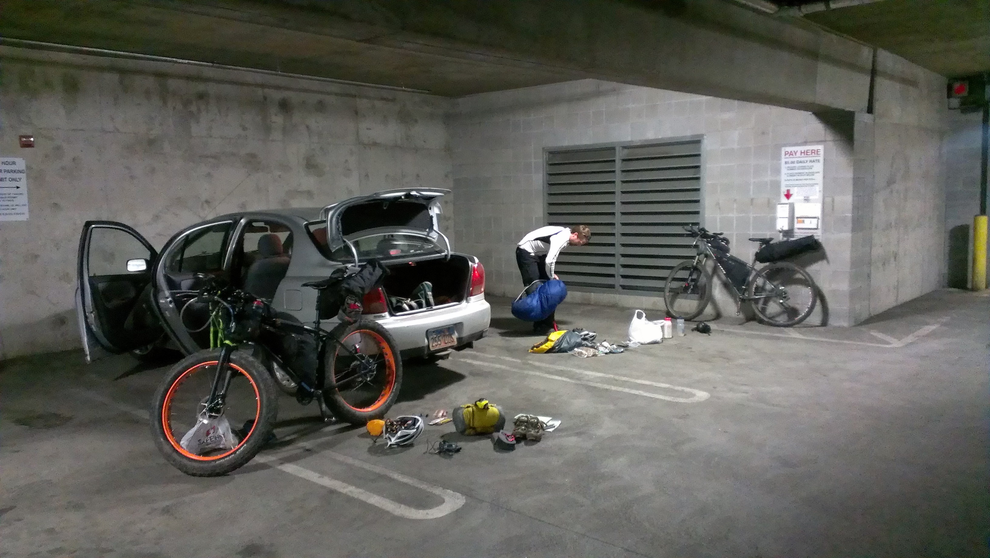
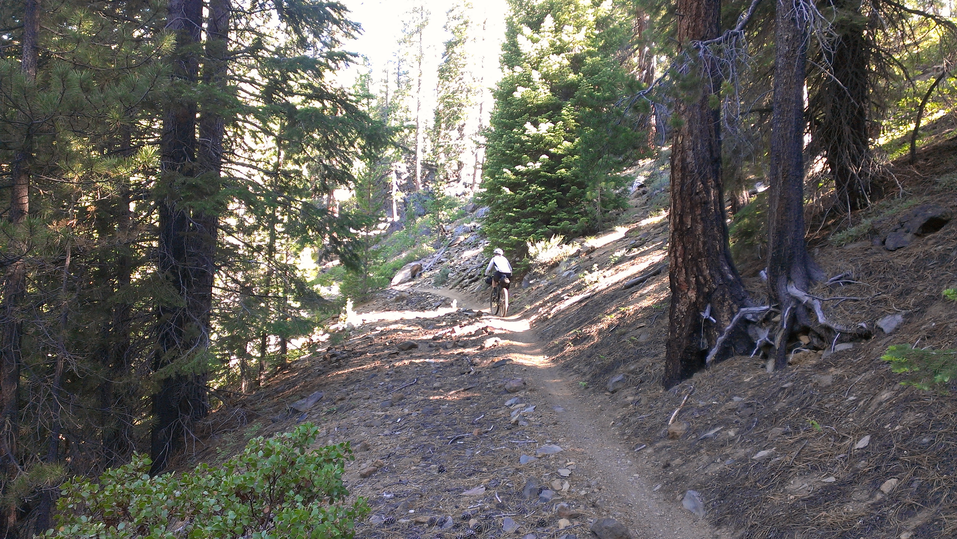
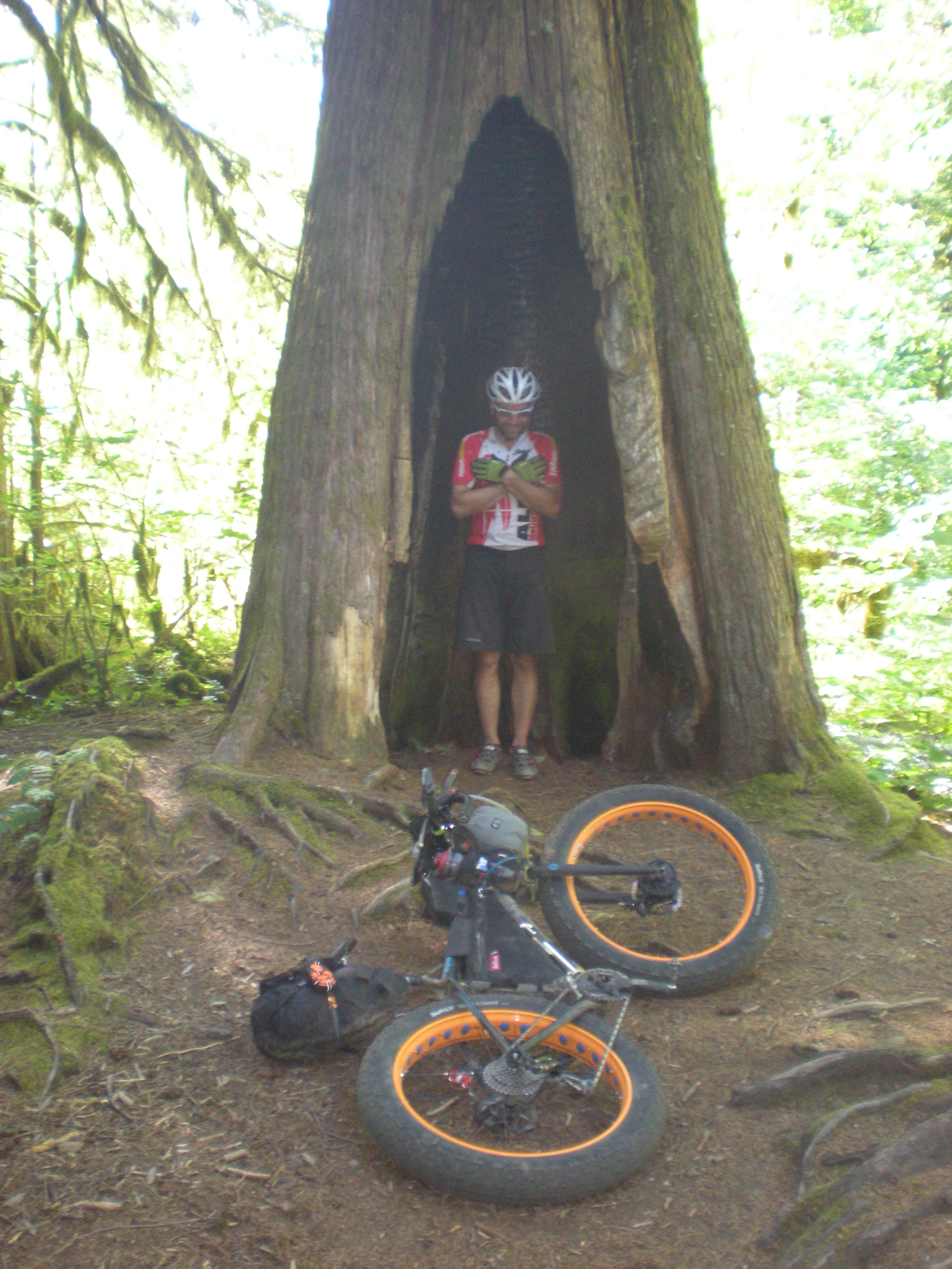
We left our car in a parking garage and were on our bikes by 7. Starting on the Mrazek trail, we gradually flowed upwards rolling around corners and through tight trees. We both commented on how quickly we had transitioned from urban concrete jungle to forest solitude.
Around 8am we passed our first person who said she cleared all of the spider webs on trail above us. About 20 minutes later Mike proclaimed she hadn’t come this far….
Before we knew it we were at the junction with the Metolius-Windigo trail. Just past the trailhead we met a nice lady who saw our bags and asked what we were doing. We told her and she mentioned her husband had recently done a similar tour with only a bivy-sack and it had rained the whole time. “When he got back he said he felt like a used condom!” she said. Quote of the trip so far!
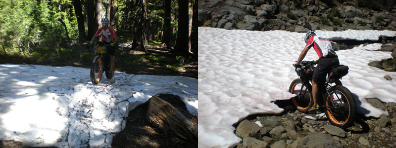
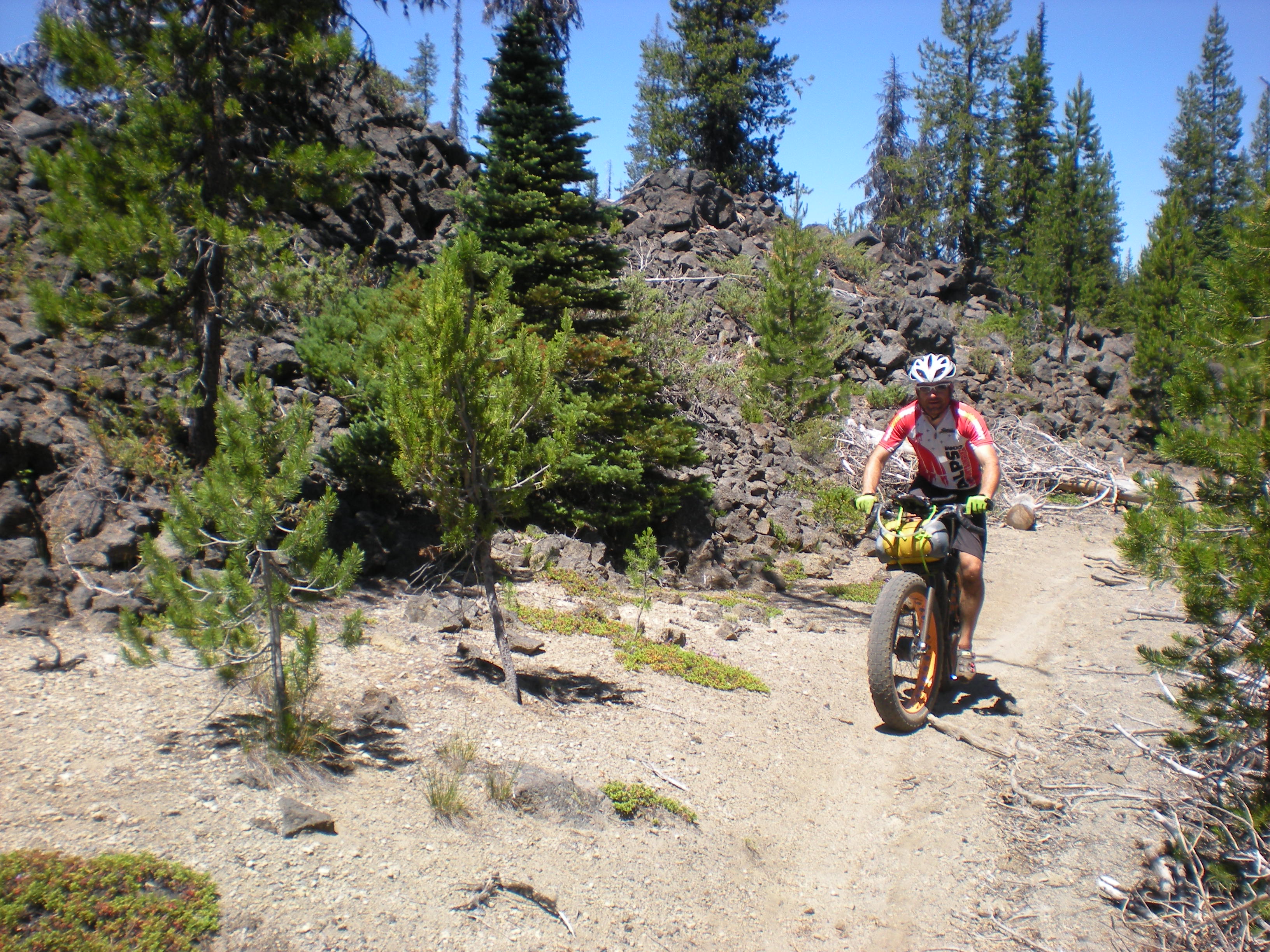
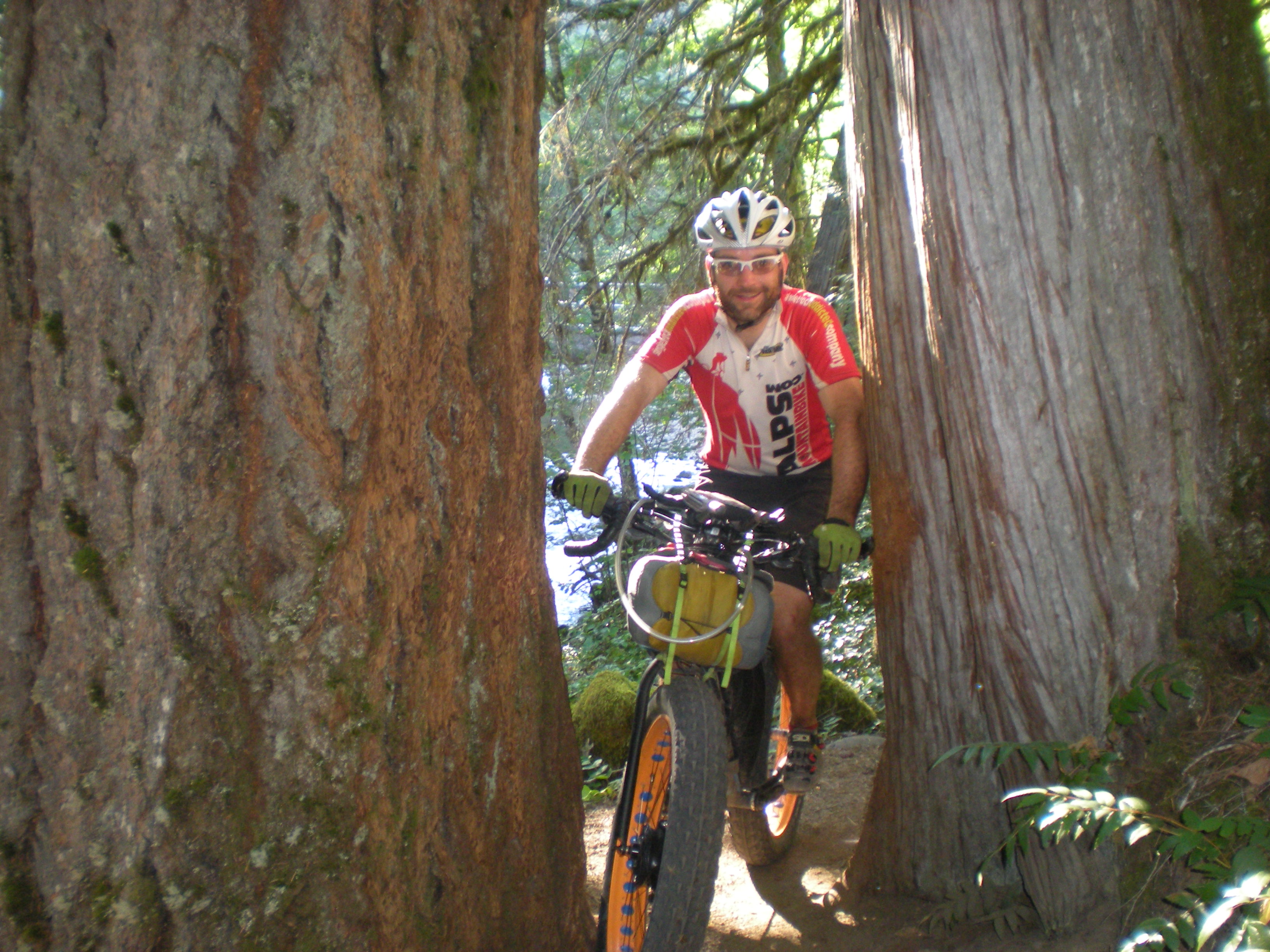
The Metolius-Windigo kept climbing and it was not surprising when we hit snow. Luckily for Mike he was on his Fat bike..
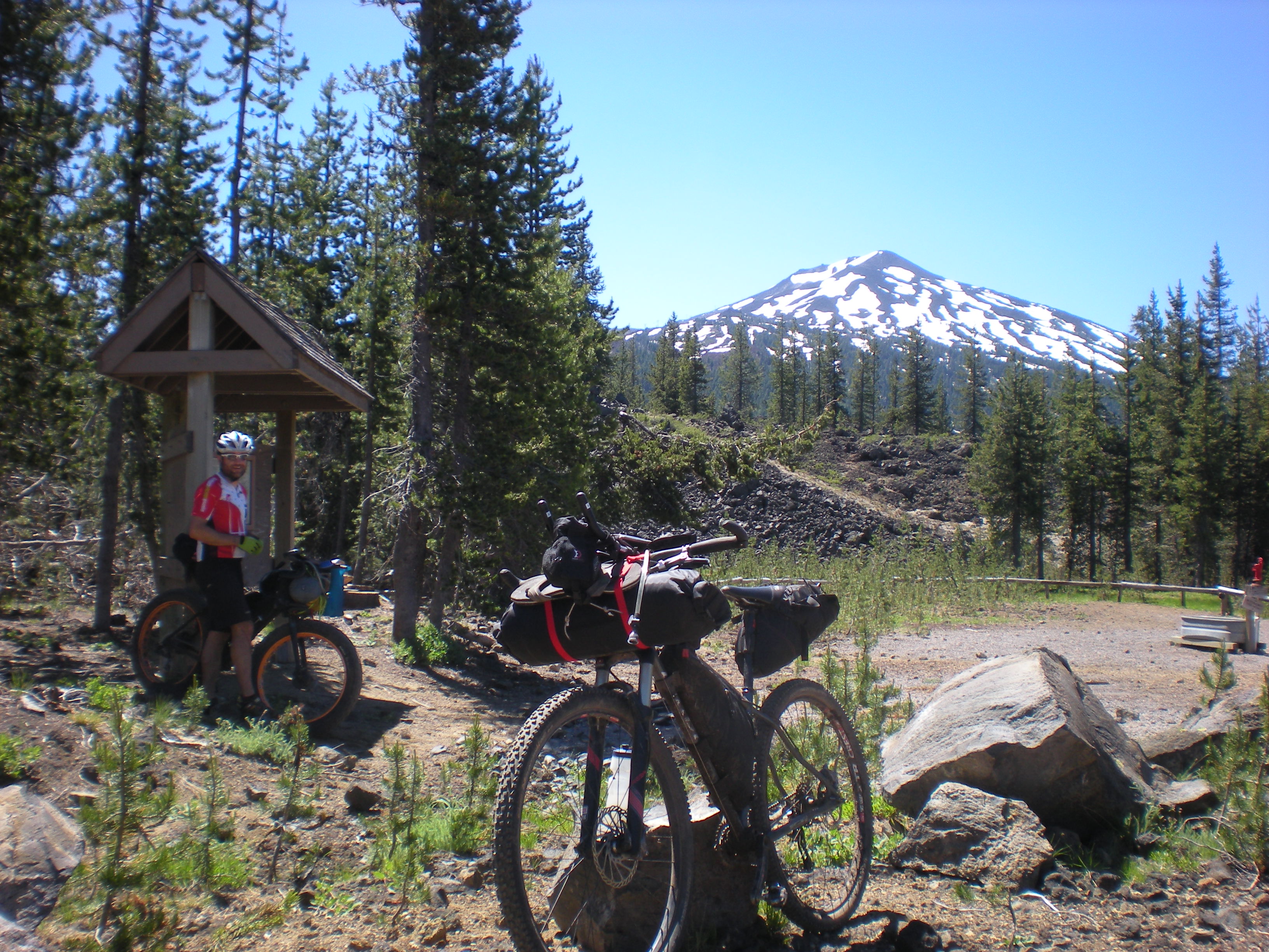
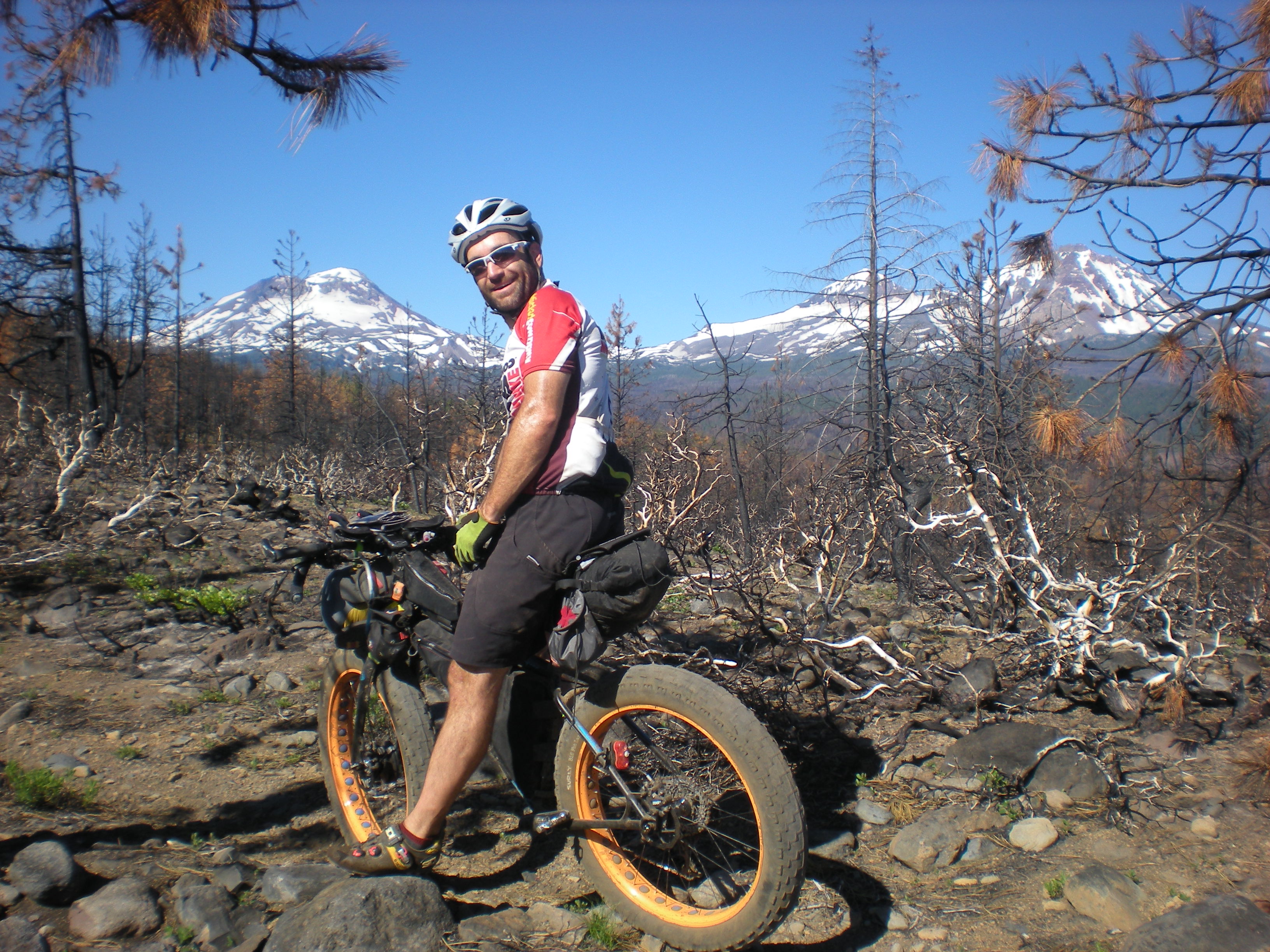
Eventually we made it to our high point of 6700 feet and started wrapping around Mount Bachelor through lava fields and old burn areas. The trail was a little sandy but not bad.
At this point I had the maps on my bike and was navigating. Maybe it was because it was the first day and we were so excited, maybe it was because the trails were so fast and flowy despite climbing, but I had severely underestimated our progress. When we arrived on the shores of a lake, I told Mike I thought we were at Hosmer Lake. We ran into some hikers who asked if we came in on the Edison-Lava trail. I said “you are way off” we are clear up here pointing at the map. One hiker looked at me funny “Umm, this is Lava Lake”. Mike got some good milage out of this one (as he should), repeatedly telling me he thought we were at Hosmer Lake.
We cruised down a few miles on the Cascade Highway and jumped on a double track at Cultus Lake. After a few miles we jumped on the Charlton Lake trail which seemed more challenging with a few downed trees and steep, yet short, climbs. It was close to Charlton Lake we met our biggest nemesis for the duration of the trip….. Mosquitoes.
We cruised down to Waldo Lake and jumped on the east Waldo trail. Fun swooping descents and moderate climbs had our energy levels back up after a long day. Mike ran over a stick and I watched from behind what can only be equated to seeing a car crash in slow motion. The stick rolled up and into his derailleur which then rotated off of his frame…. “buzz kill” Mike said. Mike quickly rigged his drivetrain as a single speed while we slapped muzzy’s.
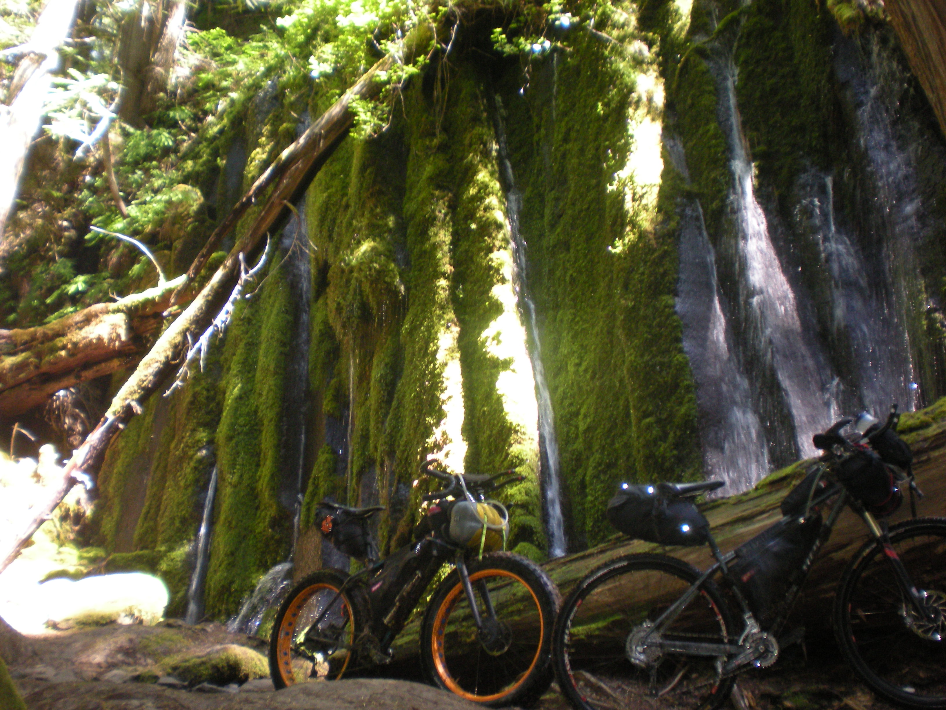
An ill fated attempt to get water at Waldo Lake (the mosquitoes made it almost impossible – even with a steri-pen) and we were on our way down to Gold Lake. The Gold Lake trail was a fast buff downhill. We decided to camp at Gold Lake despite the cloud of mosquitoes following us everywhere. I sure was glad I had a tent to hang out in….
Leading up to the trip I had gone in circles trying to decide on a shelter. A bivy sack in Oregon didn’t sound fun (I’ve had too many rainy nights in them). I have an old mountaineering tent that is on the heavy side and not very compact. Researching other tents became frustrating, plenty were light but they all packed down to about the same size which was not very small. At last I found the perfect compromise, the NEMO GOGO Elite (The photo of it packed in a nalgene bottle hooked me) Problem was, it was out of stock…. everywhere. A special thanks to Scott at Fitzgeralds Bicycles for digging through his suppliers to come up with one and for the sound advice on all of the awesome Revelate bags.
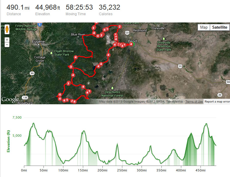
Day 1 – 75 miles
The next morning I awoke to that old familiar feeling. Kinda like one of Tony Sopranos henchmen had beat me mercilessly with a bag of oranges… We coasted 26 miles downhill to Oakridge on the Willamette highway. When we passed a runaway truck ramp, Mike couldn’t resist testing his fat bike again….
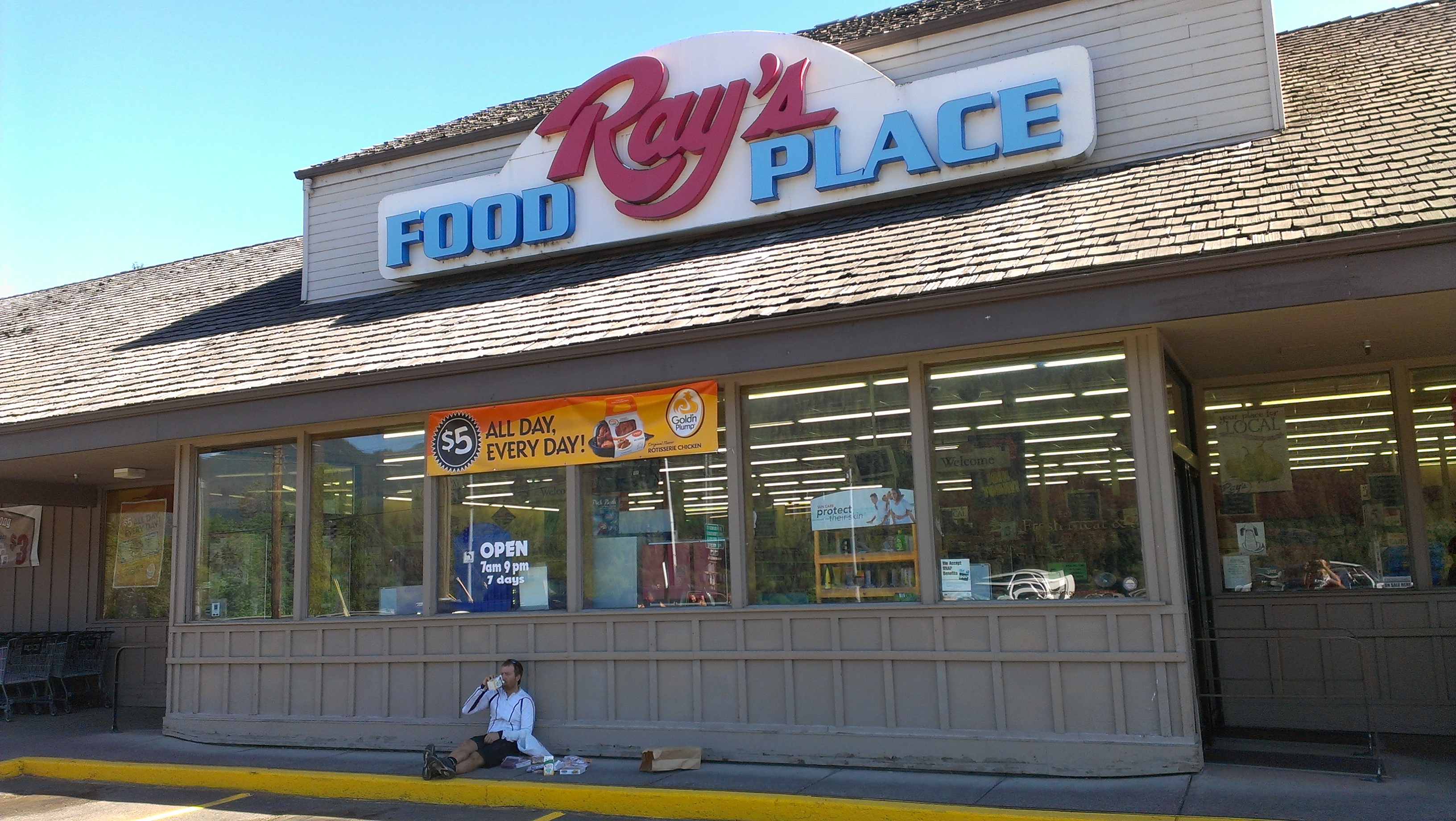
Once in Oakridge we went straight to Mountain Mercantile (great shop) where they quickly fixed up Mikes bike with a very clever Problem Solvers Derailleur Hanger. A quick refueling stop at Ray’s and we were on our way.
A few miles of highway along Hills Creek Reservoir and we were on the Middle Fork of the Willamette. The Middle Fork trail started fun with twisty low angle single track. It ended like a bad dream you can’t wake up from. About 20 miles in, with 15 to go, the angle starts to get steep, the trail deteriorates, and the skeeters get downright diabolical. Towards the top it was a full on panic driven flight for life with switchbacks too steep to ride. My jersey was covered with dime size splats of my own blood. Mike was a little more prepared….
Finally at the top we hopped on some double track and found out that Oregon mosquitoes really can fly at 10 mph. I’d like to say it was that we were so strong that kept us going that night. But really as Mike put it “mosquitoes are the best cowbell ever”. Eventually with the lights on we made it to Lemolo Lake for the night.
Day 2 – 85 miles
In the morning we rode over to the Lemolo Lake Lodge for breakfast. The kid behind the counter told us the buffet was “all we could stand”. I don’t think they saw us coming, we were ravenous. I felt a little bad cutting into their bottom line, but Mike and I each downed 3 full plates of bacon, eggs, pancakes, french toast, and biscuits and gravy. We stocked up with a few things from the lodge store and headed out towards the most anticipated (at least for me) trail of the trip.
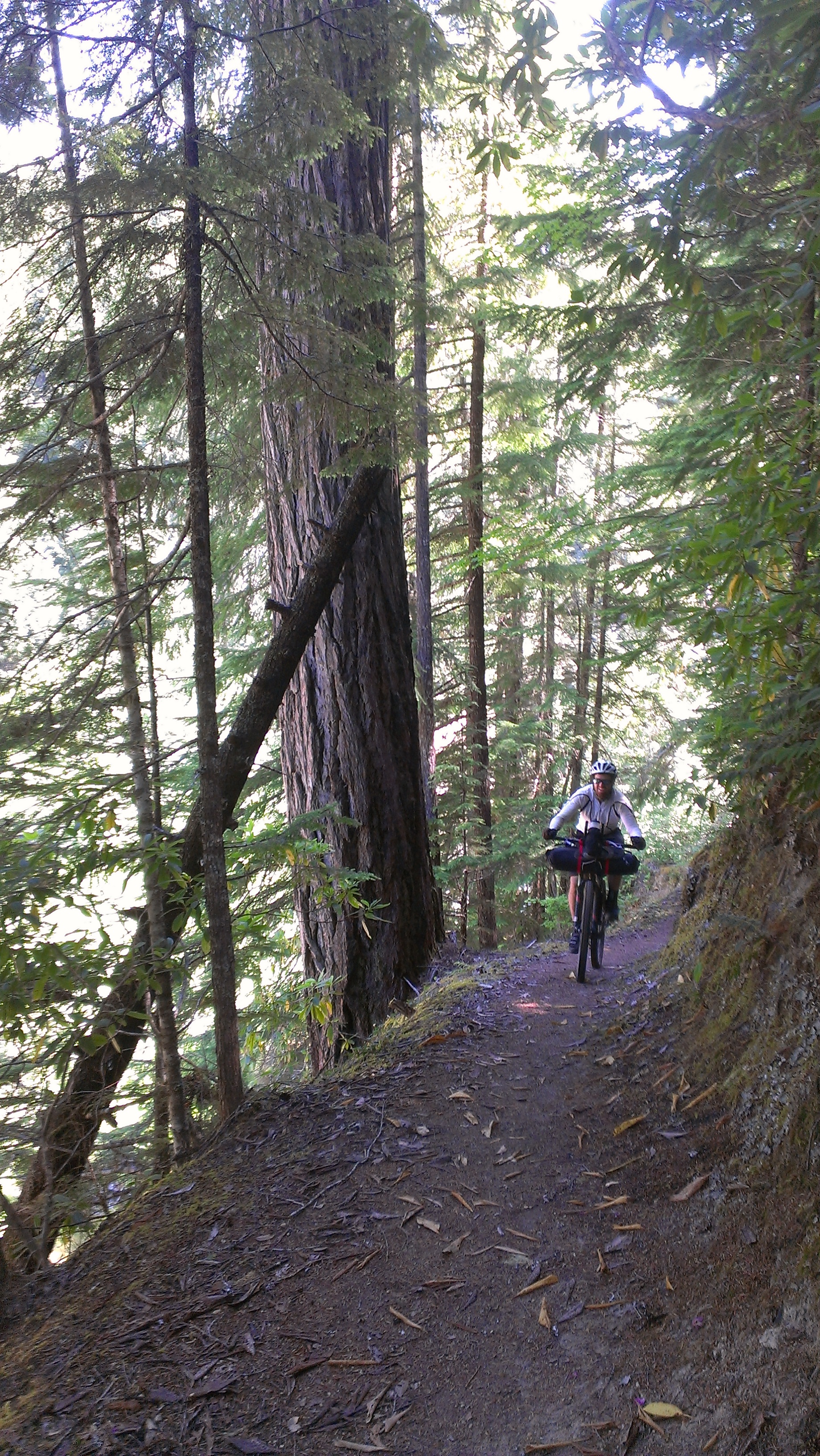
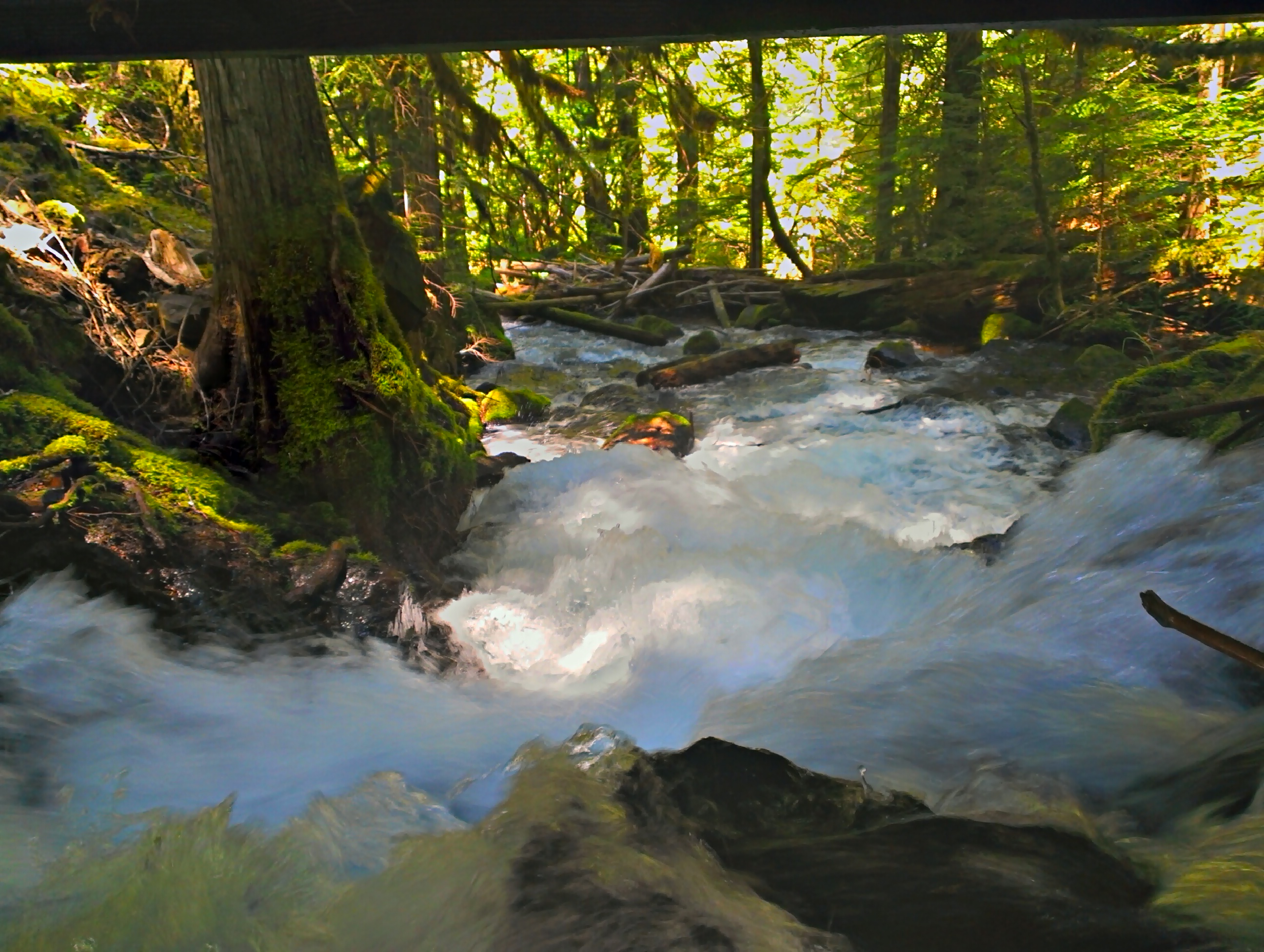
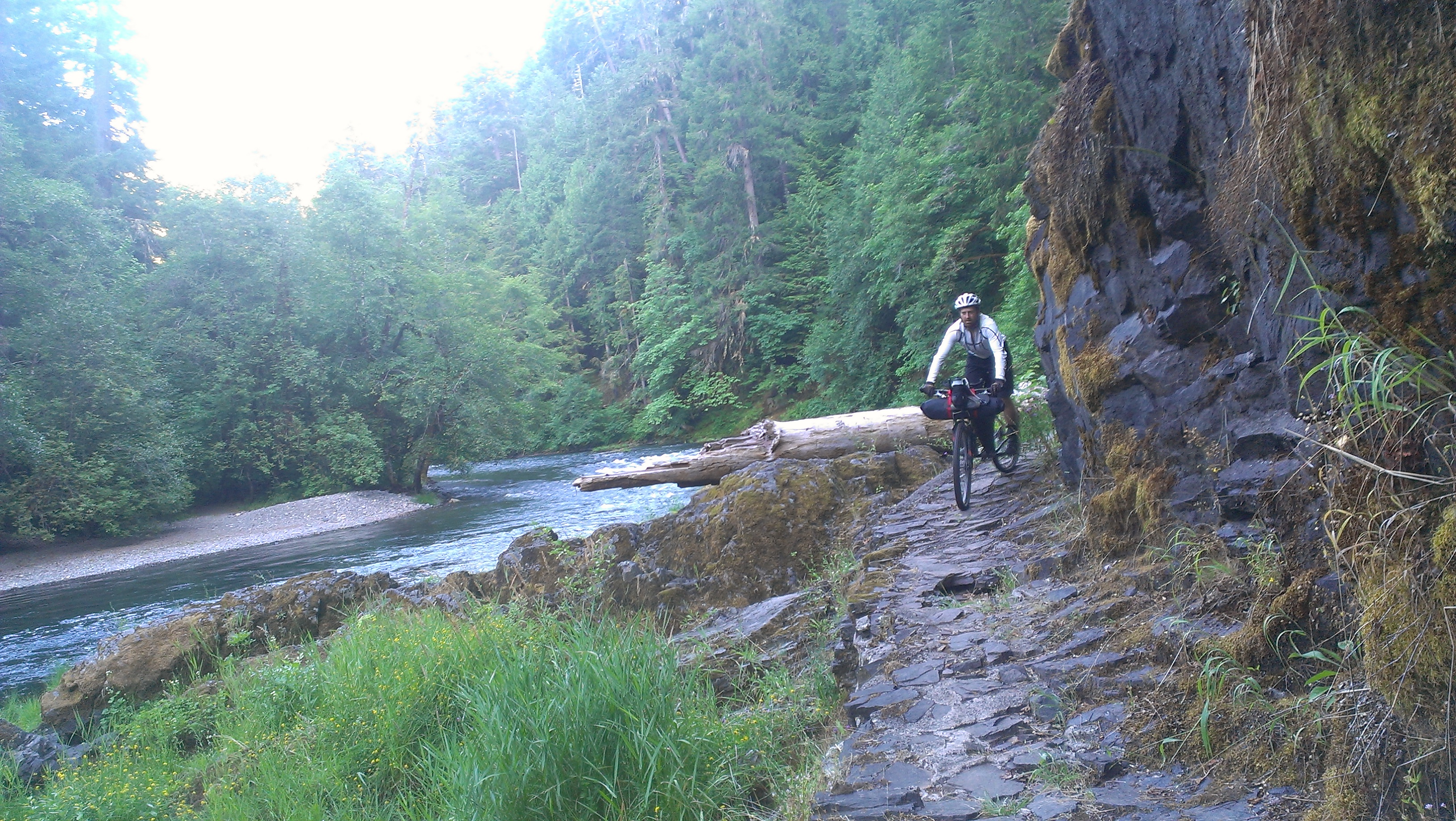
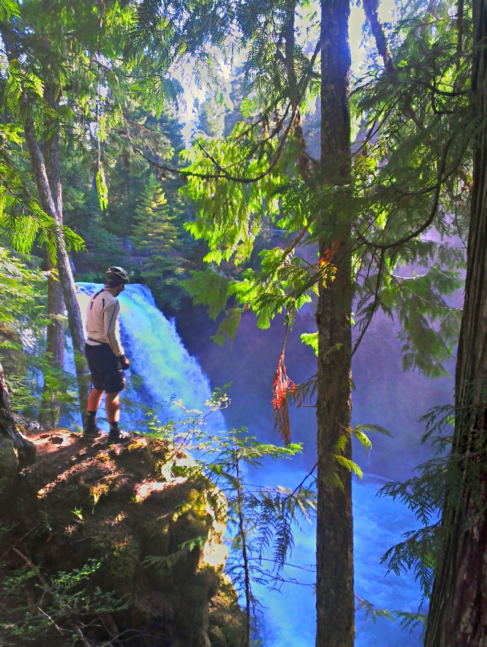
It’s hard to imagine a better trail than the North Umpqua. Fast flowing descents, jaw dropping exposure, buff loamy soil, old growth trees, pristine river water…… the entire day was pure bliss. 50 miles of heaven. If you consider yourself even a remotely serious mountain biker you have to ride this trail before you die.
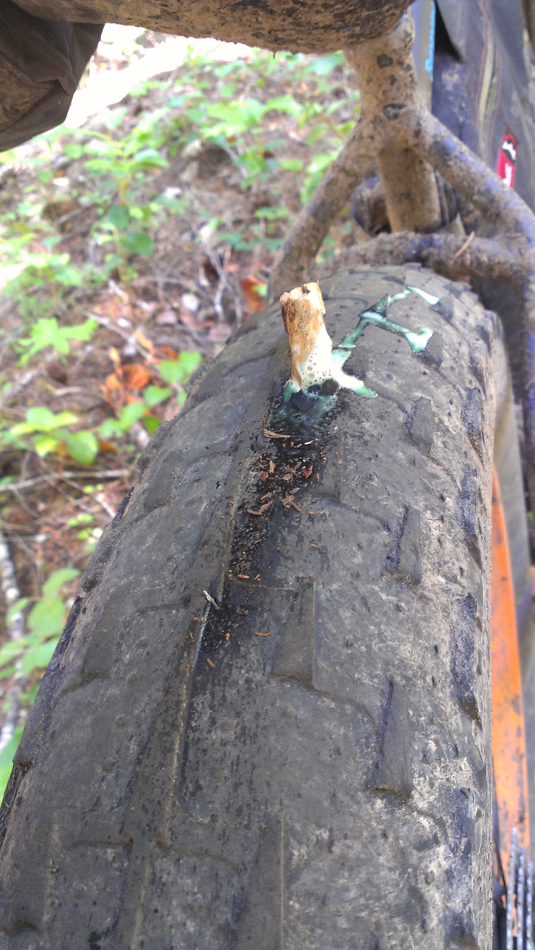
Mike driving a 6 inch stick into his tire didn’t dampen our spirits in the least.
We had planned on dinner at the Steamboat lodge but it was closed by the time we arrived. Instead we dined on day old used-to-be-frozen hot pockets and cleaned up in Steamboat creek. Steamboat creek must have some hot springs feed it because it was bath water temps.
Day 3 – 50 miles.
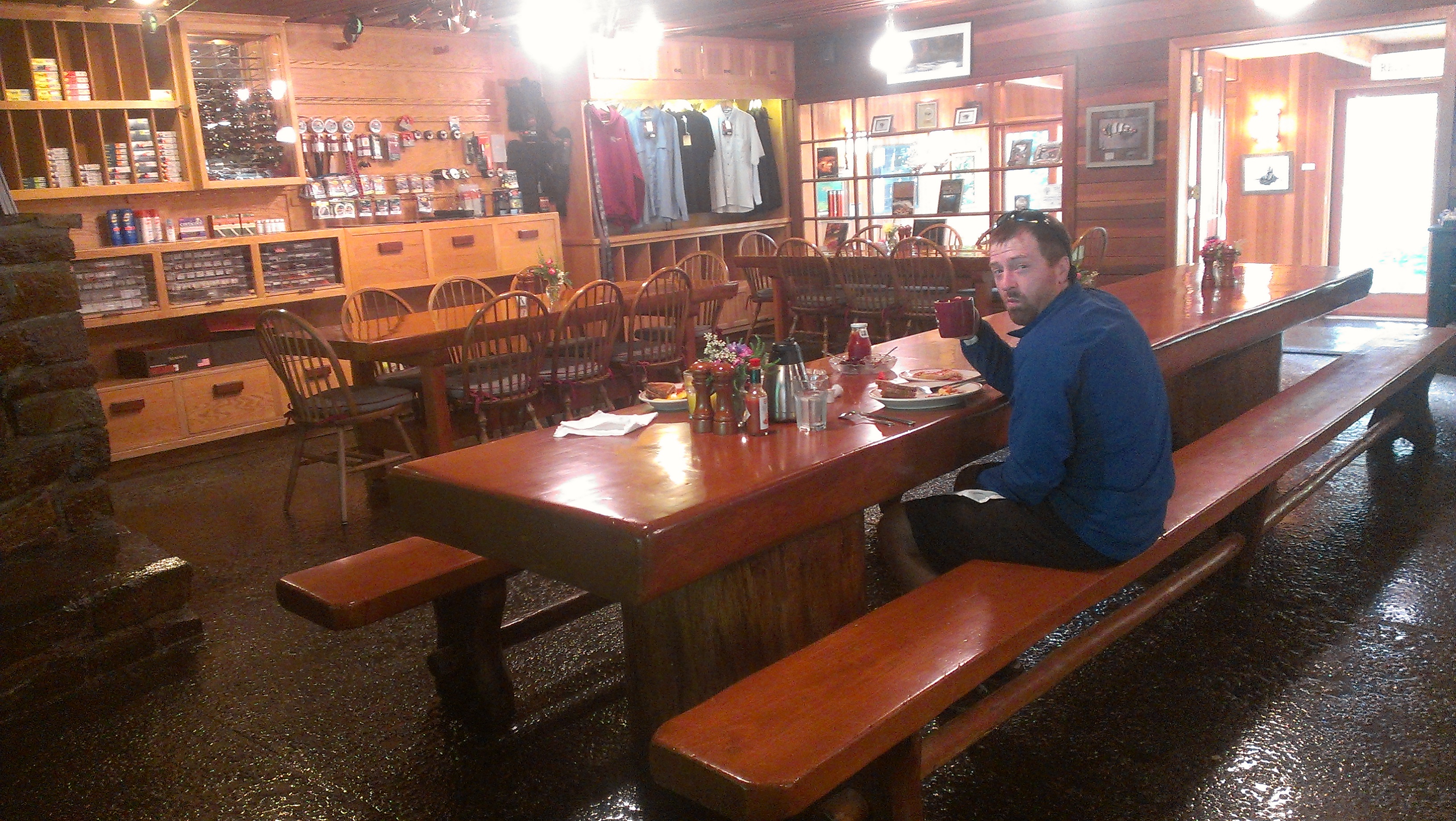
In the morning we rolled down the street to the Steamboat Lodge for breakfast. Really classy place, a high end fishing destination. The food was top notch -everything was fresh and delicious.
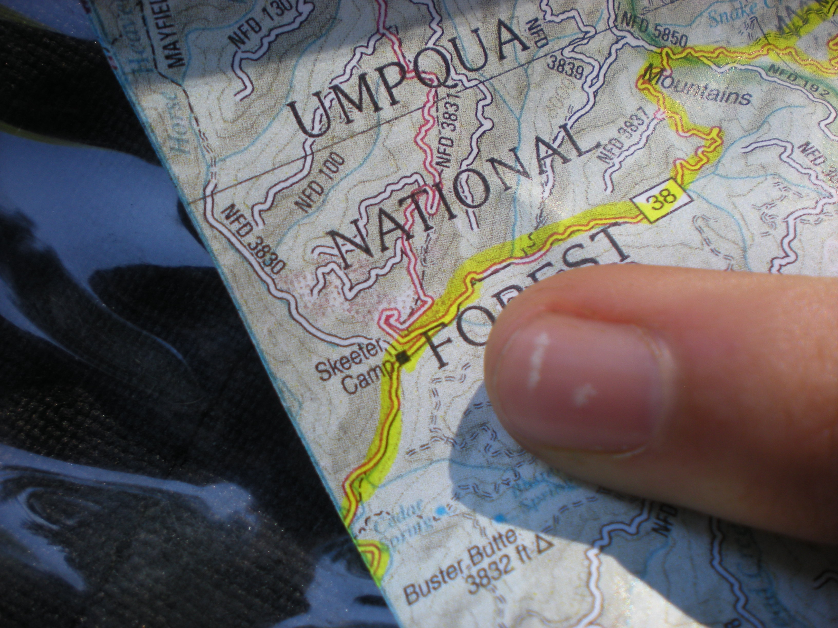
With good food in our bellies we headed towards Oakridge on the steamboat highway. With only an occasional logging truck, we had the road almost to ourselves. Beautiful scenery made the ride go fast but there was something in the back of our minds since we were going up to high altitude again…..
With an ominous spot on the map we were shaking in our pedals… but they never materialized.
We did however ride through an active logging operation. With chainsaws buzzing in every direction, log skidders and cranes on the road, we didn’t pause for pictures. It was interesting to see the operation though since they were not clear cutting. From below the area would look forested still because of the selective way they were thinning the trees out.
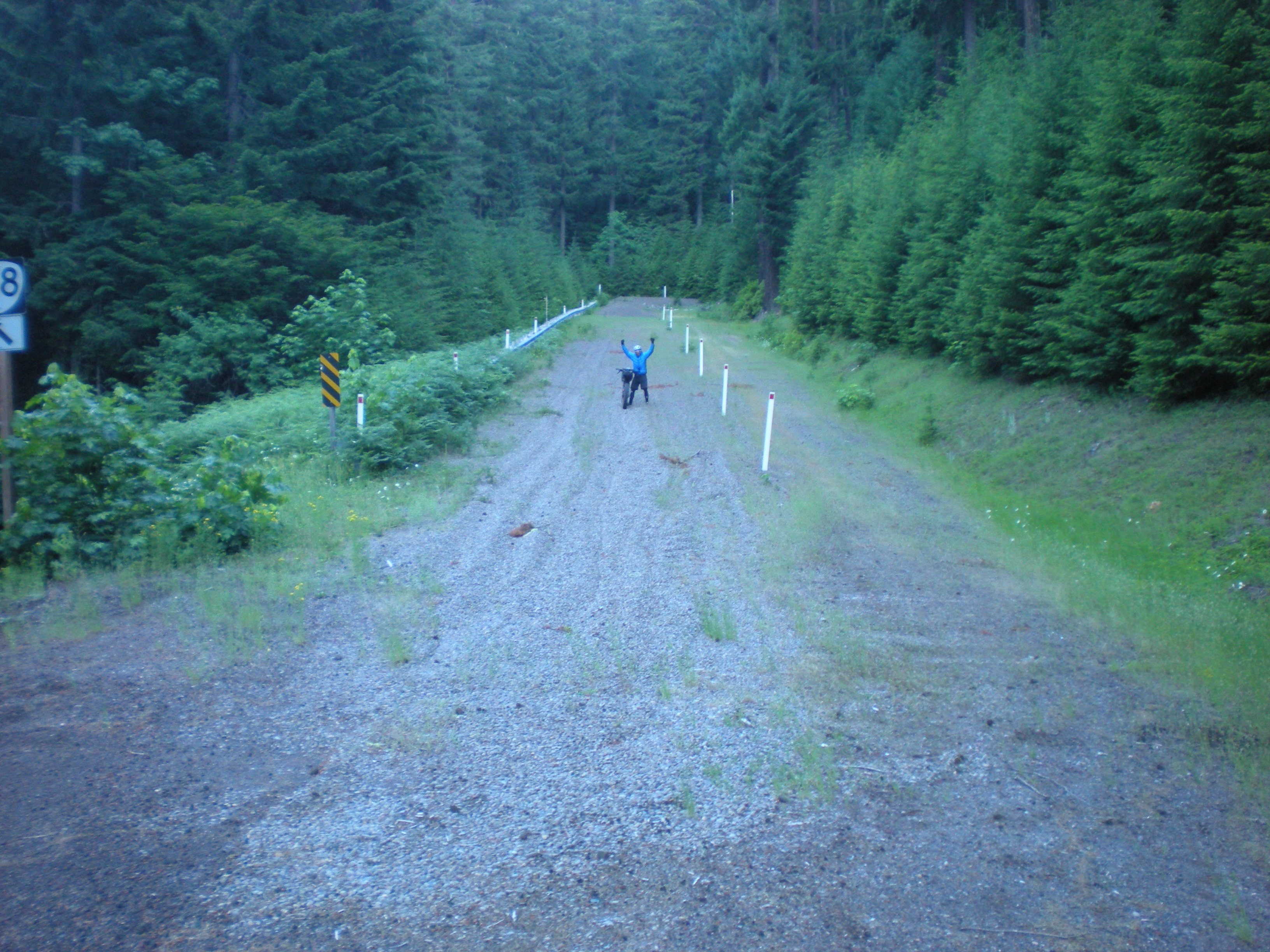
Shortly, we were at the high point of the road and dropped quickly down towards the last 10 miles or so of the Willamette Middle Fork trail. On highway 21 we discussed how unmotivated we were to leave Oakridge once we got there… Motel time!
Oakridge is a great town for bikers on a budget with plenty of room options for around $45 a night. Once checked in we headed to the Brewers Local for dinner. I knew this brewery was legit when I saw 6 beers on cask. It really wasn’t even a fair fight. With my metabolism in high gear I quaffed down some delicious Best Bitter which hit my blood stream in a hurry. The beer really complemented the cheeseburger, sweet potato fries, and quesadilla too. Great place if you ever find yourself in Oakridge.
Day 4 – 52 miles
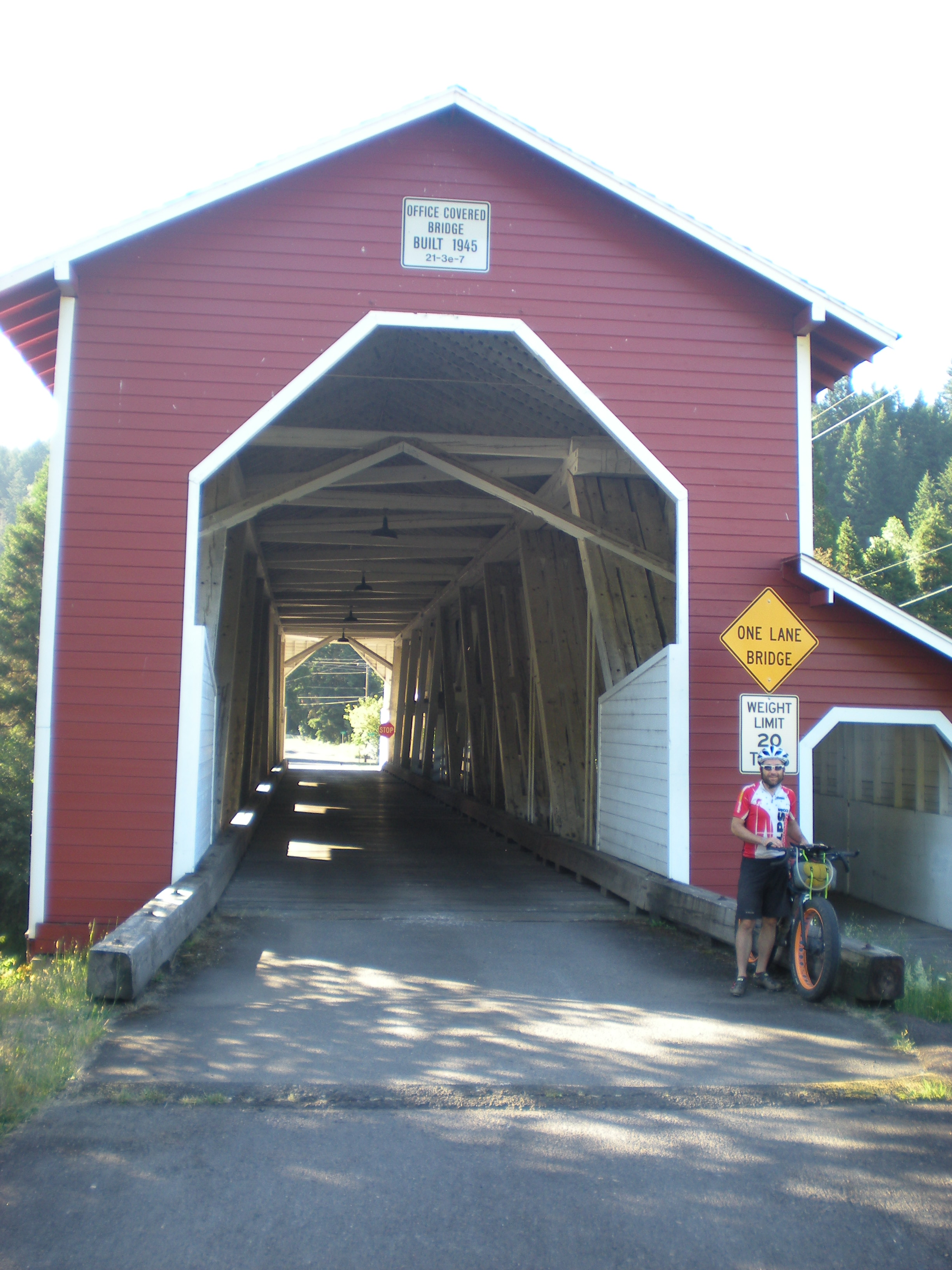
We rolled out of Oakridge and through the old mill town of Westfir. Then across a cool old covered bridge still in use.
Here we hopped on the Willamette North Fork trail. This trail was ok, but didn’t really excite so close after the North Umpqua (I’m ruined). We came across some nice folks doing trail work who were bike tourers. Their enthusiasm in seeing us was off the charts. After swapping story after story we finally kicked ourselves into gear again before we got stuck in Oakridge another night with this nice couple.
Just before we hit the Auferheide highway again Mike got another flat. He instantly regretted not buying the oversized fat bike tube Mountain Mercantile had in stock. Rather than risking a tire disaster, Mike decided to ride the 10 miles back to Oakridge. I went on my merry way up the Auferheide with the agreement that Mike would catch up to me eventually (Mike is one of the strongest riders I know). It only took him 30 miles. I thought I was going fast. Mike rode 50 miles on a fat-bike to my 30 on a 29er and wasn’t even that fatigued when I saw him again…..
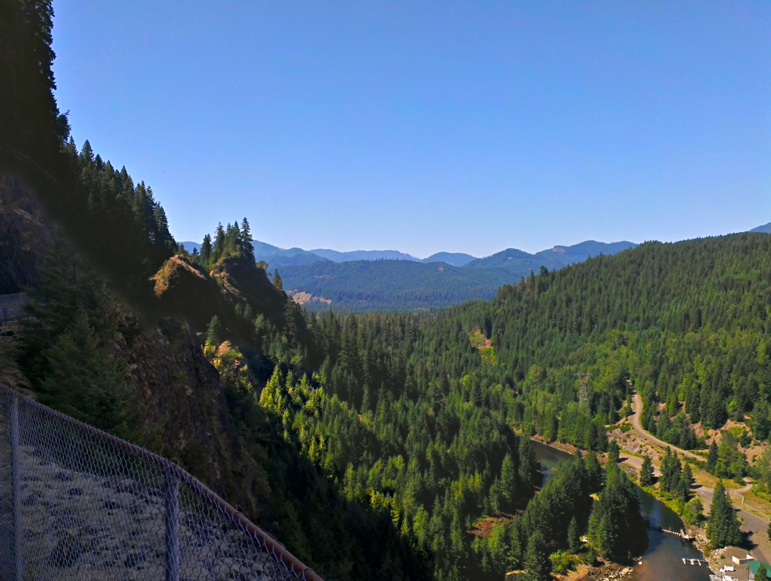
From the top of the Auferheide we dropped down to the north along the South Fork of the McKenzie eventually riding around Cougar Reservoir.
A quick downhill took us to the highway 126 which had more cars on it than we had seen in 4 days. It was also hot. Very hot. We needed the perfect pick me up. Ice cream and meat-on-a-stick!
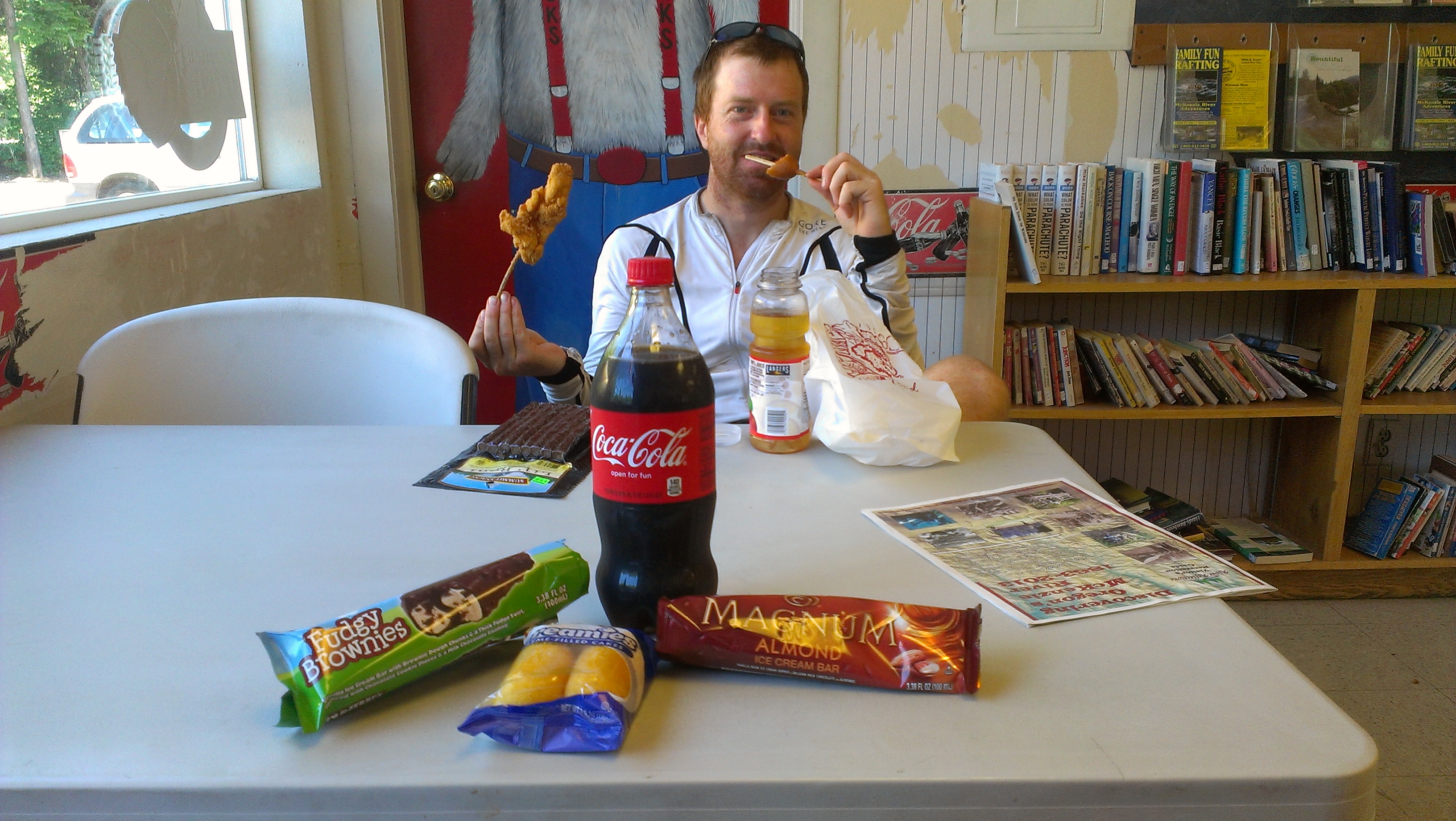
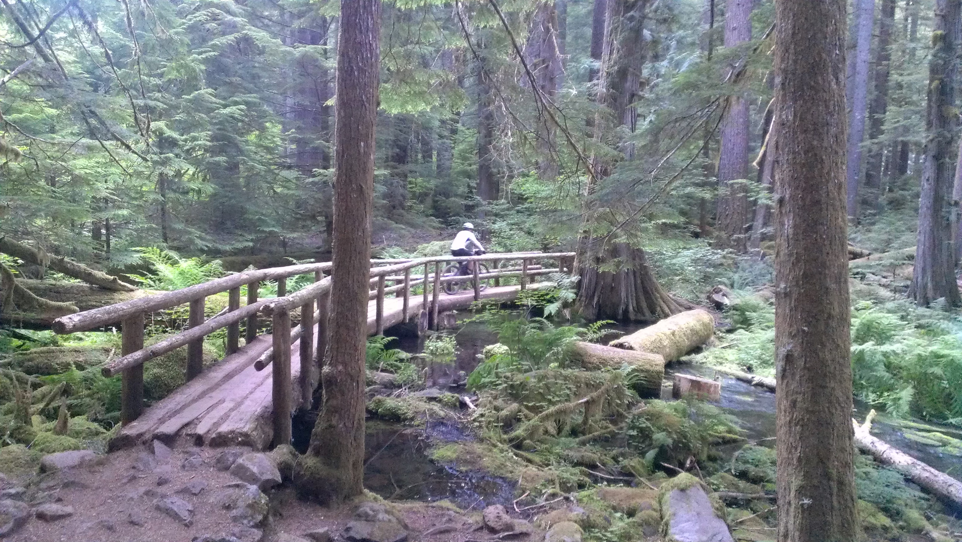
After eating 1500 calories each, we braved the road with the McKenzie in our sights. At the trailhead we gladly hopped onto SWEET singletrack. The transformation was almost instant. Just seconds prior it was 95 degrees with high humidity and trucks blasting past us. On the trail with the old growth trees shading us it was 10 degrees cooler and all we heard was the river.
The lower part of the McKenzie is really fun, even uphill. We both started to get the giggles again on the fast arching curves. Perfectly groomed, buff singletrack – thoughts of being tired or bored were gone.
We stopped at Trail Bridge Reservoir for the night since the trail gets steeper upriver. We laughed about how good the trail is and dined on our frozen burritos.
Day 5 – 105 miles
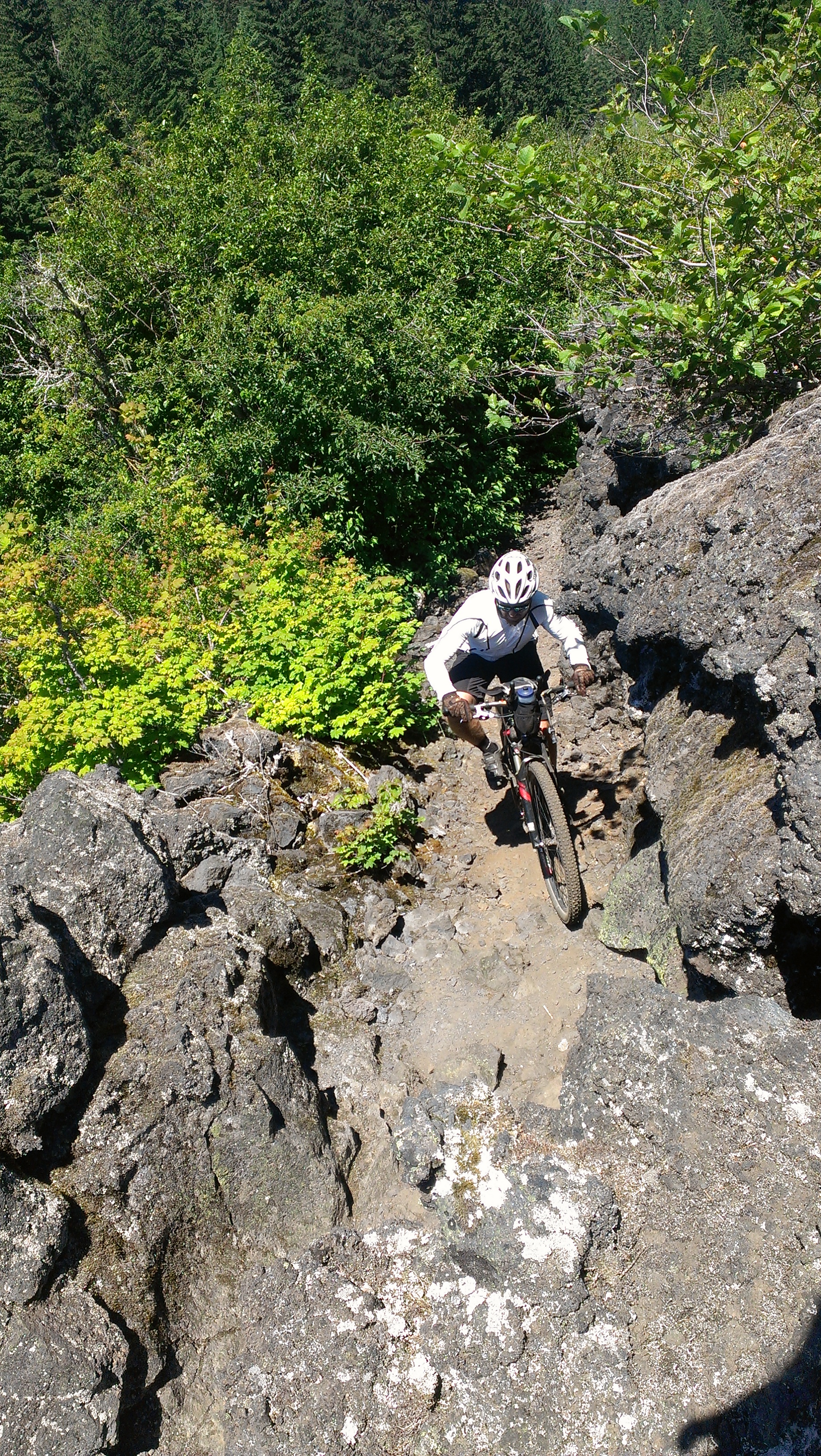
Since we were doing the rest of the McKenzie as an out and back, we ditched most of our gear and headed upriver with high spirits and light(er) bikes. The trail did not disappoint with challenging lava-rock sections, short climbs and of course more flowing twists and turns.
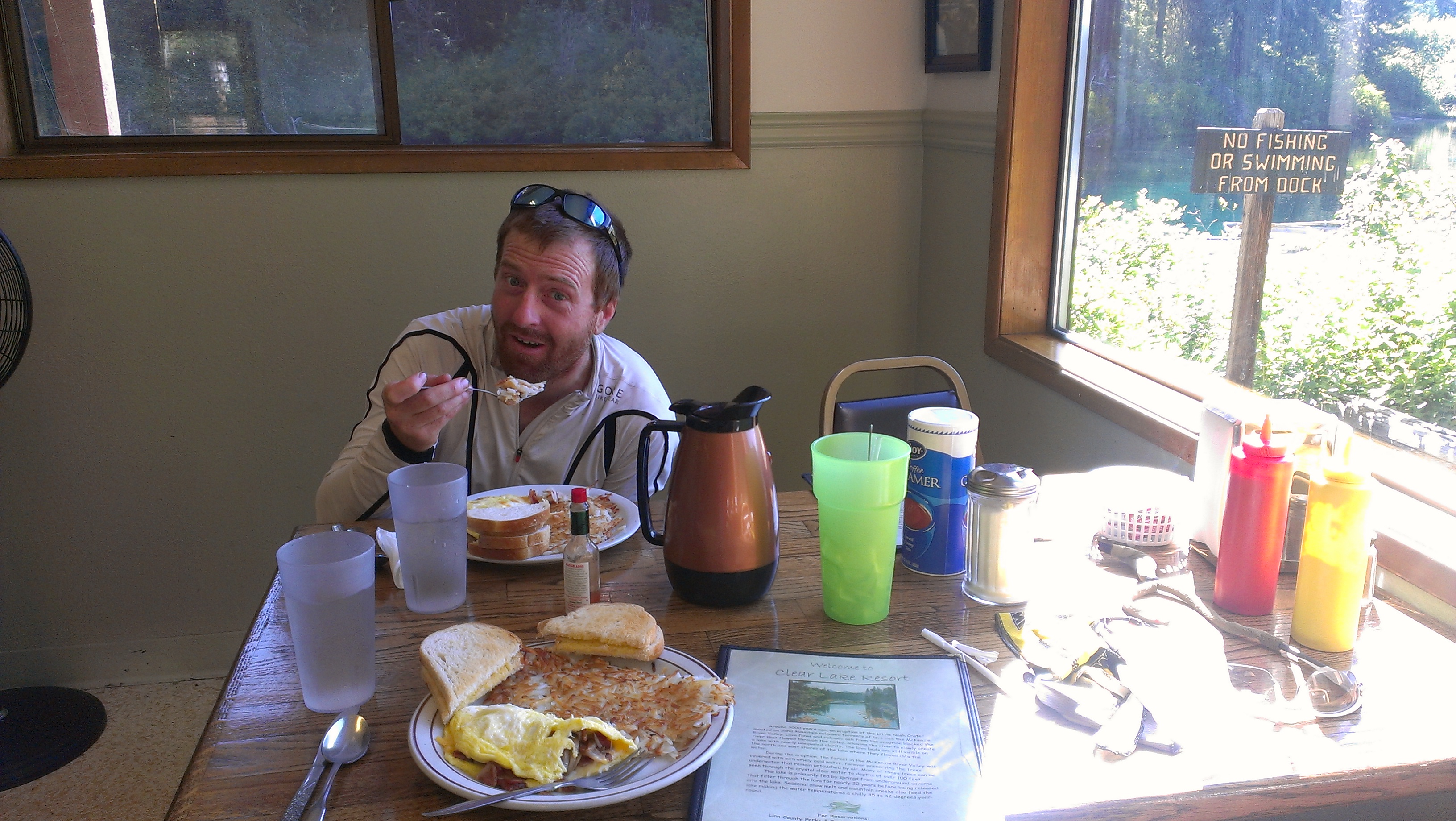
At Clear Lake (fascinating aquifer) we discovered that the little resort made breakfast. We needed no convincing when we smelled the fresh Marion Berry pie in the oven.
3 egg omelets and a huge helping of pie-a-la-mode each please! Mike’s rule of always trusting a fat cook rang true as we devoured our meals and admired just how clear the lake is.
A quick ride past the lake and we were at the trailhead for the shuttled riders.
We turned around and headed downhill, this time around the east side of the clear lake which we had read was more challenging. Challenging is the right word as there are several lava flows which Mike bounced through on his circus bike. It was scary and amusing to see all of the aluminum stripes on the lava rocks from other bikers…. stay focused!
Going down this time, the trail flew by and before we knew it we had grabbed our gear and were at Belknap Hot Springs. There, we met another bike tourer who had just ridden from southern Florida. His journey made ours seem pretty trivial – great perspective as my energy and motivation was dropping.
We made another mandatory ice cream stop and started up the McKenzie Highway. I had a lot of anxiety built up about this stretch because of the climb (4000 feet), potential mosquitoes, and probable heat. It ended up being waaaayy easier than either of us had anticipated. We accidentally did it at the perfect time of day so that it was mostly shaded. There was a light breeze up high that blew the mosquitoes away. And the climb was so gradual it was more relaxing than grueling.
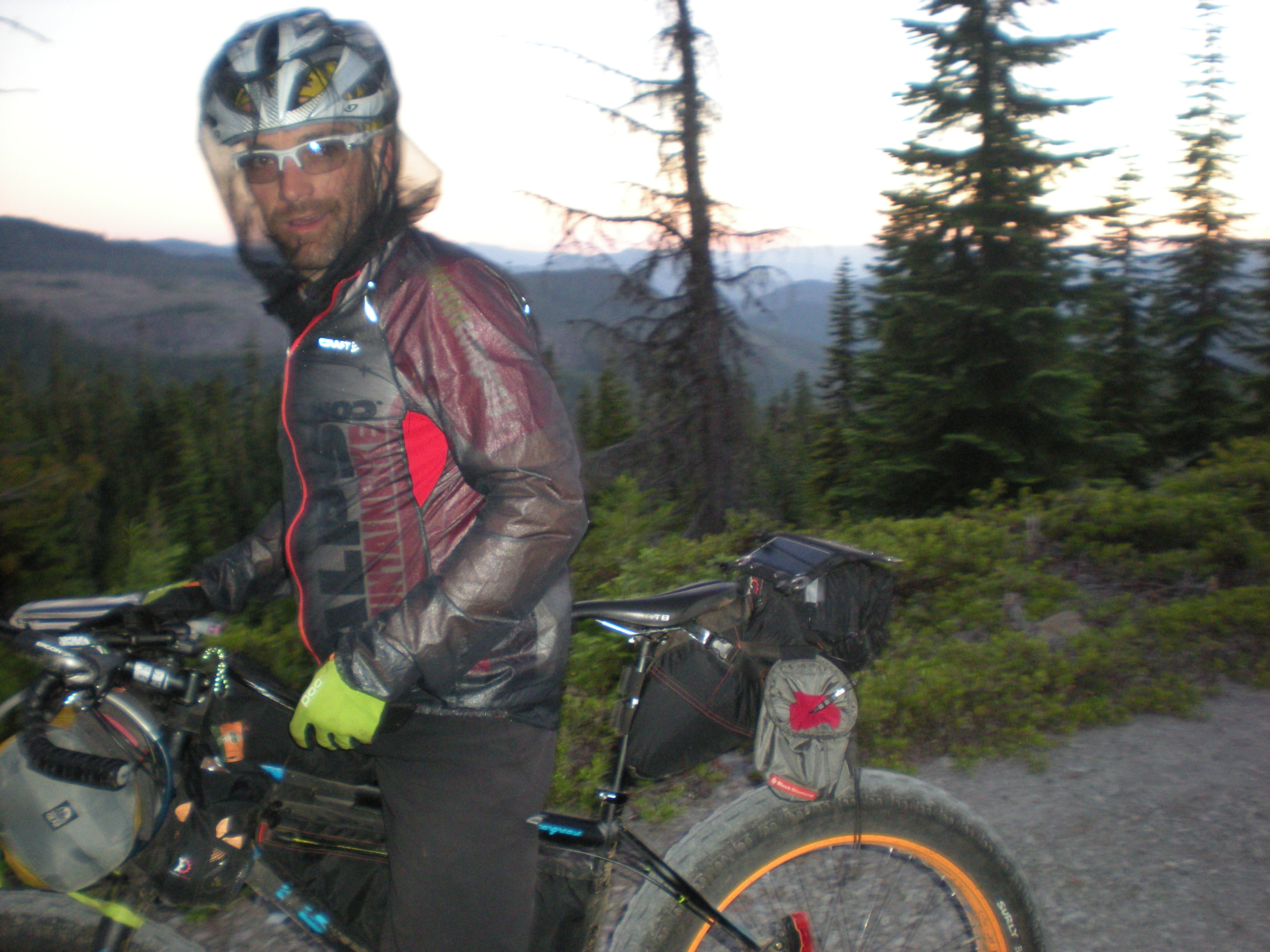
On McKenzie pass there is an observatory which someone had told us was a cool place to camp. It was a little too windy so we decided to head down to Sisters. On our way out the ump-teenth person asked about Mike’s fat-bike with the usual questions (where’s the motor?, is it heavy?, why?, what’s the advantage?, why?). These questions had become routine and Mike handled it with a smile every time.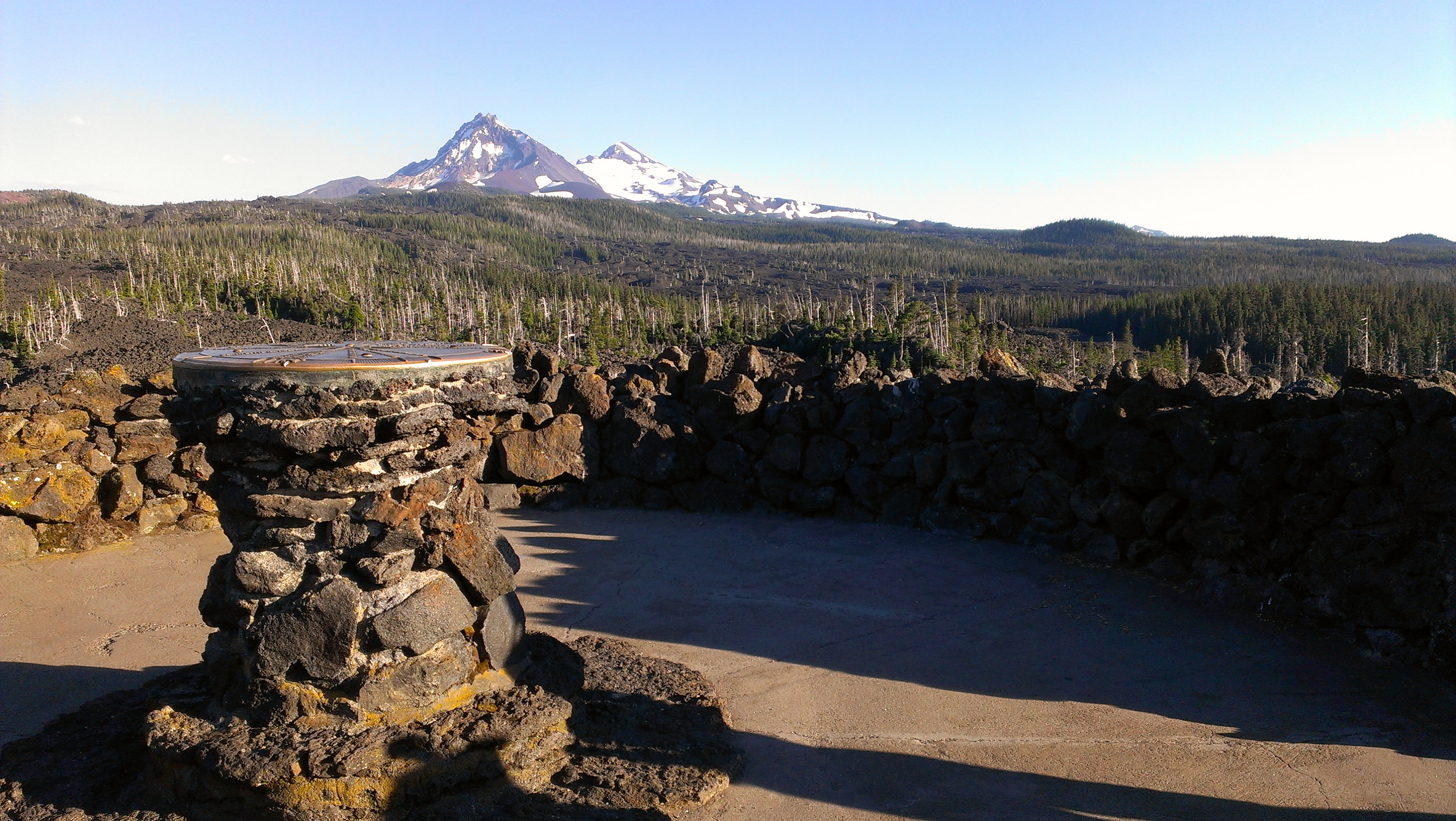
Dropping down the east side of the range it is remarkable how fast the air gets arid and the vegetation changes to high desert. Amazing ecological diversity in Oregon.
Once in Sisters we grabbed some extra food and gatorade then quickly decided we didn’t want to spend the night in town. So we rode out of town with the sun dipping and jumped on the Metolius-Windigo once more. About 10 miles from town we camped.
Day 6 – 77 miles
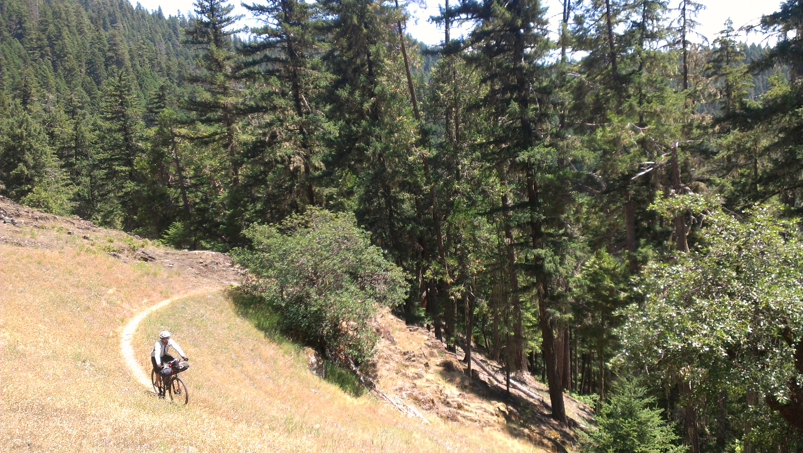
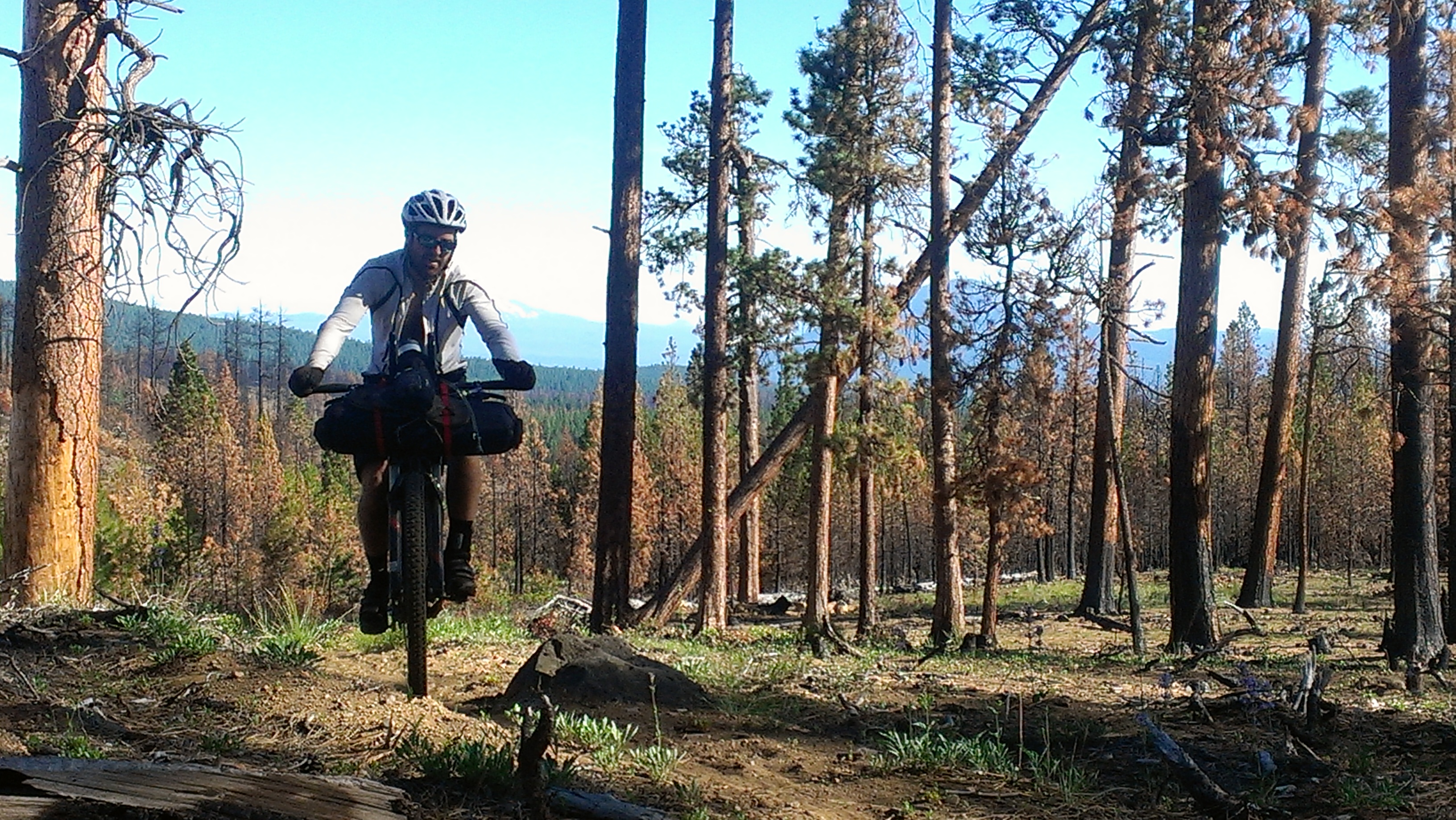
I woke up pretty sore, but just knowing it was our last day was all I needed to get motivated. The northern part of the Metolius-Windigo proved very different than the southern stretch we had ridden 6 days prior. Much more dry and loose, it seemed to be used more by horses than bikers. With tough climbs and stretches of hike-a-bike I was instantly reminded that it was not over till the fat lady sings, and neither of us were fat ladies and neither of us could sing. Sure is beautiful country though.
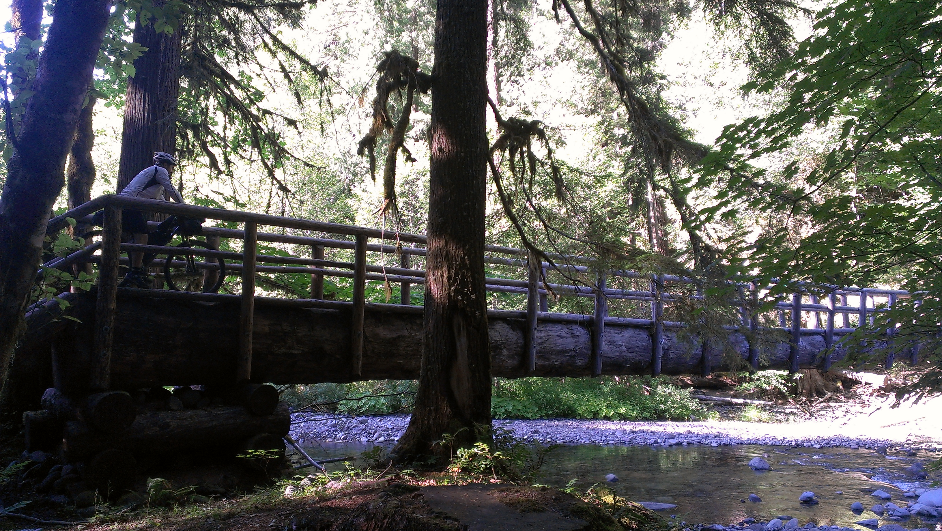
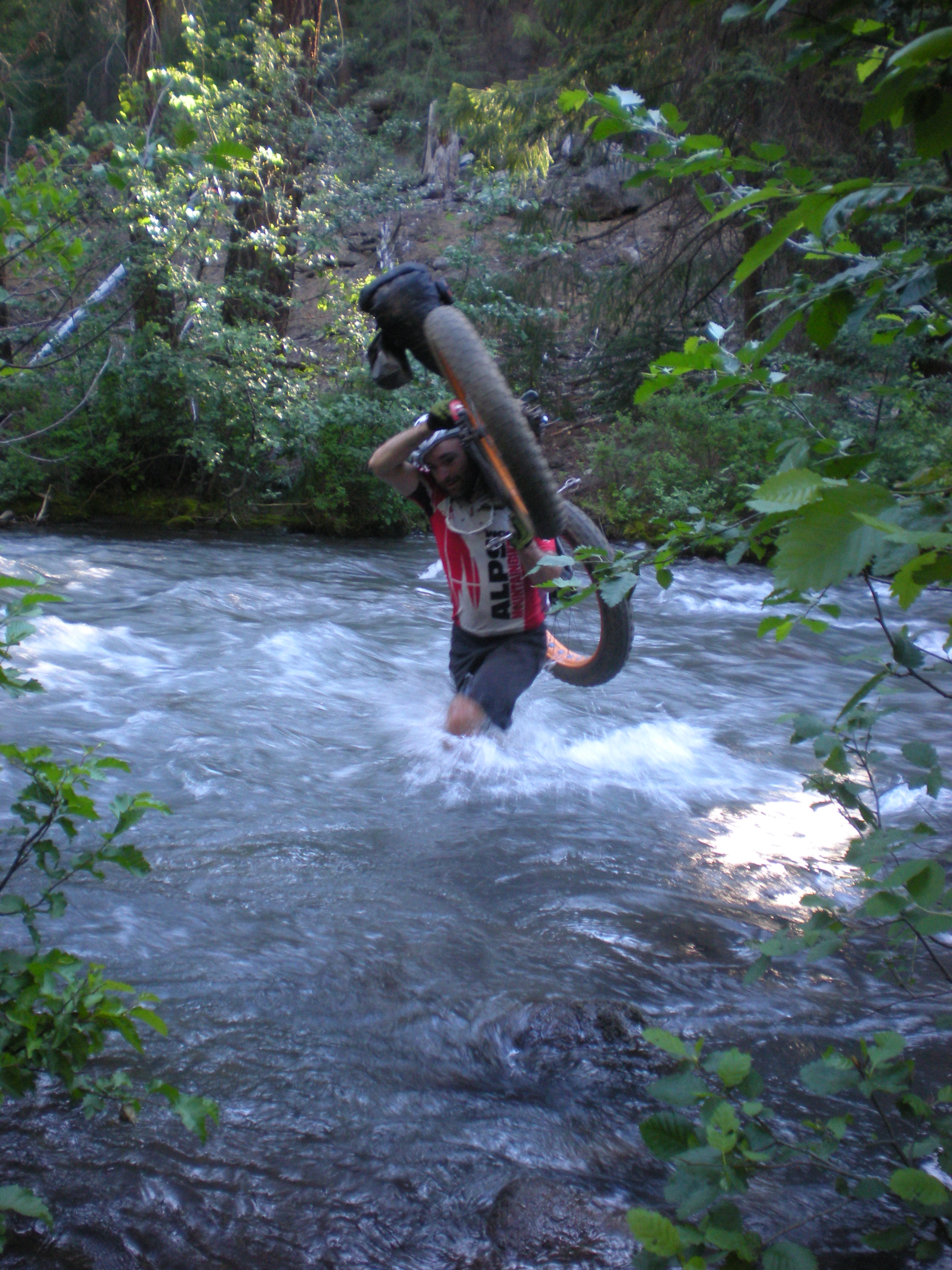
One other thing we learned the last day, if a trail is used primarily by horses – it doesn’t mean it has bridges…
After the Metolius-Windigo, we jumped on the Mrazek trail again. I probably would have been satisfied just riding down Mrazek to Bend as I was pretty “over it” at this point. However we had discussed ending on something really fun and it was agreed for days that the trail to end on would be Whoops. Begrudgingly I went along and we dropped down the farewell trail and crossed the drainage. After I had a mini-meltdown because we were climbing again, Mike talked me down from the ledge and we hit Whoops where as promised Mike lifted his fully loaded fat-bike into the air several times.
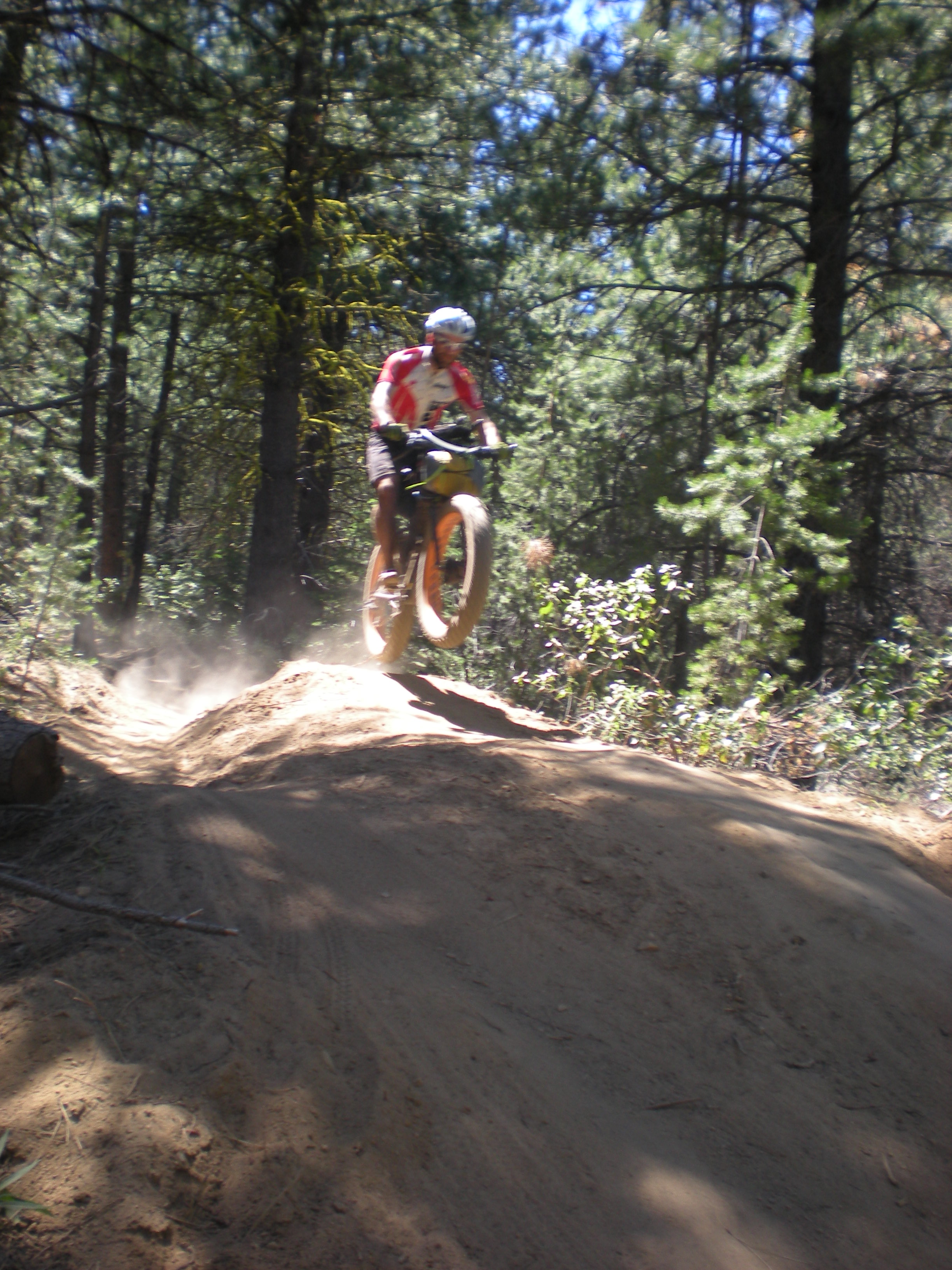
Wahoooooooo what a way to end the trip!!!
Day 7 – 44 miles
Overall stats –
GPS file links
http://connect.garmin.com/activity/341546499
http://app.strava.com/activities/66657348
Bossness! I wish I had those fat tires on my bike.
Nate Wilder
Aaron, dude, you covered some MILES! Keep stoking up the lost calories and enjoying no (Fast) mosquitoes where you live. Blue dot tracking was completely new to me, enjoyed your story telling and pictures very much. Awesome scenery, so much good about America, so much to explore. A real vacation, very diff from normal work days and that’s the point! BIG thanks to Paco. The bivy sack quote made me throw up a little, that lady’s vision of it, gag!
I like the 4 hour permit only parking sign where you ditched the car for 5 days. Nice touch. You ready to try using DEET now, or are you still carrying that organic BBQ sauce with you? Hell of a ride. You’ll be doing the great divide before you know it.
-Fister
This looks like the beginning of an off-road, bike camping, multi day RACE!!! similar to the Trans North Georgia, the Colorado Trail Race….. something to think about…..
Mike and Aaron….glad i stumbled across this. Fantastic ride report and i’m super envious of your ride.
later, Chad
Wow. I want to do this!
Great Job, Nice Ride. I’m thinking about taking on something like thing this would you have a checklist of items that I’d need to aquire to take on something like this?
You guys are crazy! Great write-up!