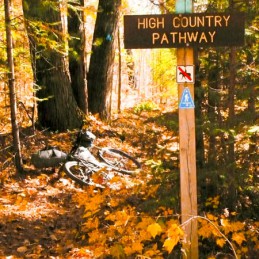
Midwest USA, Trip Reports » Michigan’s High Country Pathway
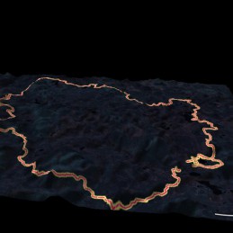
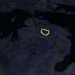
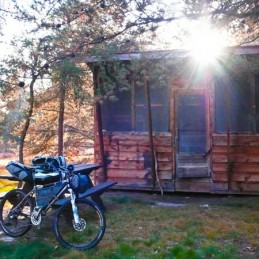
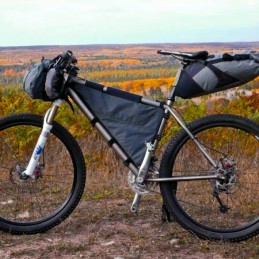
I decided to ride Michigan’s High Country Pathway as a solo overnight bikepacking trip. This trail is an official IMBA Epic ride and it’s about 80 miles or 125 kilometers in length. It is also a backpacking route, so there are quite a few amenities for the overnight bikepacker. At least three or four drive-in campgrounds and many tent sites along the way. Strategically, the route is a giant loop, so it’s perfect for a solo rider with a free weekend. You end up right back where you started.
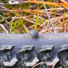
I passed through the area back in May of this year and had a little chance to sample the trail section along the southern part of the loop between Pigeon River and Rattlesnake Hills (in the counterclockwise direction). I really loved the trail but didn’t have time to do much more than a brief recon mission. I rode as far as I could get on the singletrack and then tried to short-cut straight to the car on forest roads. Unfortunately, while taking that shortcut back to my vehicle I also discovered that the primitive roads in this area are much harder to ride than the singletrack, as they are surfaced with soft, deep sand.
During the early summer, I also found that the trail was quite overgrown and I resolved to return when the weather was cool enough for longer clothing layers (to add protection against scratchy, overgrown trails).
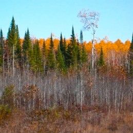
So this year in October, I headed back to finish up the previously unfinished business. Shorter daylight hours turned this from an epic, all-day ride into an overnight trip with two nearly full days of pedaling. I also decided to ride the loop counterclockwise, to make it all-new.
I started the journey at a parking area across the road from the Pigeon Bridge campground on Sturgeon Valley Rd, near Vanderbilt. The campsite has a hand-pumped well for drinking water and washroom facilities.
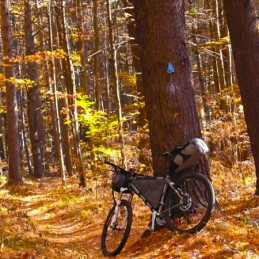
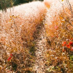
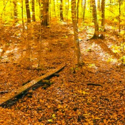
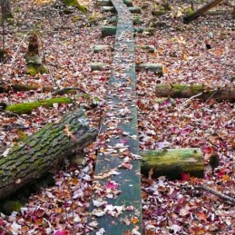
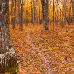
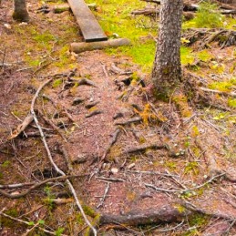
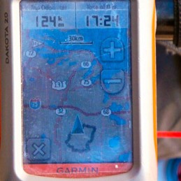
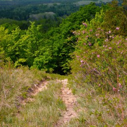
Riding north from there, the trail is well-maintained and pretty wide until you reach the end of the Shingle Mill trail network. From this point on, the trail is extremely faint and pretty wild, with lots of overgrown areas. It has a real backcountry feeling. The trail tends to be well-marked with blue blazes, but I did make a few minor wrong turns in various places and was very glad to have a GPS along for the ride.
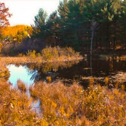
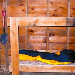
I “discovered” that a scout troop has built a shelter on the western bank of Black Creek, which is pretty near to a natural “half-way” point. The shelter had 4 bunks and a couple of picnic tables and a fire pit with a bit of wood. The creek has tons of convenient water. One side of the shelter is screen mesh, so it’s pretty breezy, but would offer great shelter even in the rain. I spent a great night here.
The logbook in the shelter was an interesting read, and quite a few people mentioned finding deer-ticks (which can carry Lyme disease), and I also found a tick walking around on my neck near my shoulder.
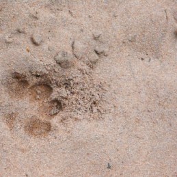
I heard a lot of coyotes howling and yipping during the night, and woke to a still-damp footprint pretty near the campsite. Pretty cool.
The terrain gets a lot hillier near the Rattlesnake Hills section, but I found that coming from north-to-south, the grades were pretty enjoyable with no hike-a-bikes. The slopes are much steeper in the other direction!
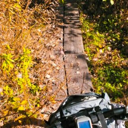
The trail on this route is overall pretty slow-riding, and the soft and bumpy terrain takes a lot of effort, and you’re constantly smashing through bushes and branches. Much of the trail seems designed like a XC ski track, with a lot of wheelbase-sized rollers and undulations, but all the while nearly arrow-straight.
There were a few clear-cut sections and a few downed tress as well. The trails tend to be pretty clear and well-marked around the cut areas.
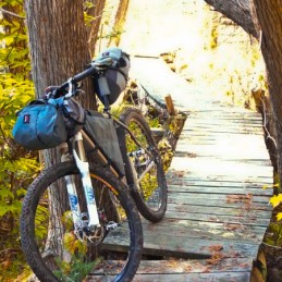
I was surprised by how slow-going the progress was. It probably took around 15 hours to do this ride fully-loaded. I suspect that it would take around 11-12 hours for a fast rider without overnight gear in good weather. This route is almost 100% primitive singletrack, with almost no road or doubletrack at all. You probably cross a road every couple of hours of riding.
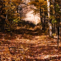
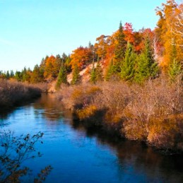
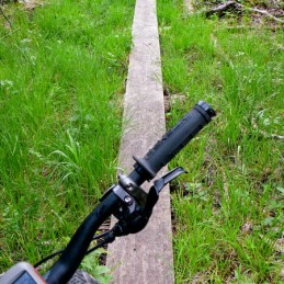
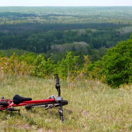
Although you’re generally hanging around under a canopy in the woods without many open clearings or distant vistas, the trail is pretty interesting and still very, very scenic. You’ll ride through some old logging town ruins and you’ll do a stretch along an old railway bed, and there are lots of amazing changes in the nature you’re within. The old railway bed has been totally swallowed back into the forest, but you will subtlely feel the rhythm of the railway ties which are now grown back under the surface the ground, pretty amazing.
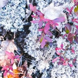
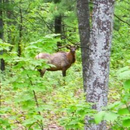
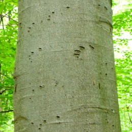
I’ve also included a few photos from the trip in May showing some bear-claw marks in some tree-bark and an Elk!
Fun ride!


That’s great! Sounds like you made the right choice to go now. Where is this trail?
Awesome right up and even better pictures.. thanks for posting
Is there a good map of this or GPX? I can’t find any info on it other then the tiny bit of info on the IMBA website.
I assume it is in the UP?
You can find this trail near a small town called Vanderbilt, Michigan in the Lower Peninsula. Information and maps are readily available in the area at the info centers, rest stops or park offices. They say the best time for elk is during the rut between mid-September and mid-October. You can get up to the minute herd location info from the local info spots as well. Send me a message in the forums and I would be happy to share a GPX.
Appreciate reading of your journey and seeing your pics. I backpacked the loop 20-23 Sep., ’91. There weren’t many bicyclists at that time and the scouts hadn’t built the shelter yet. I got off work in Ann Arbor at 2 a.m. on a Friday and drove to the north part of the loop and parked the car near the Black River. I hiked counterclockwise and spent first night just north of Pine Grove S. F. campground; spent second night at trail junction to Town Corner S.F. campground; spent third night near the TV tower not far from Clear Lk. St. Pk. I made it back to the car about 6 or 7 Monday night. At that time the only part of the trail not well marked was on the east side of the loop and east of Hwy. M 33. Saw rainbows on two occasions on Monday morning and a double rainbow Monday evening on my drive home on I 75 just south of Gaylord. It was an excellent trip and easy on the budget. I was 42 then and my final backpacking trip was last year, having inherited arthritis from my grandmother.
nice write up & great photos.
Here is the link with a map for the Michigan North Country Pathway
http://www.upnorthtrails.org/trails/high-country-pathway.html
I plan on hitting this trail up for my first year of bikepacking,
thanks for the great read and photos.