Australia / New Zealand, Trip Reports » Crossing Tasmania
The Opportunity
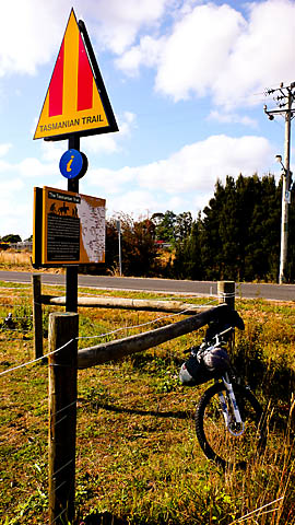
I’m a Canadian mountain biker whose family roots are in Tasmania, Australia. For January 2010 my family announced a reunion near Devonport on the north coast of Tasmania. I was excited to note that Devonport is also the gateway for the Tasmanian Trail, which is billed as a long-distance off-road cycling route across the island.
It was too good an opportunity to pass up, so I arranged to combine the reunion with a ride of the Tasmanian Trail.
Getting Ready
Beyond learning of the existence of the Tasmanian Trail route, it was pretty hard to find a lot of detailed contextual information about this ride on the internet. I had read through the official website, but during the Sept-Dec period of 2009 the association had run out of printed Guidebooks and I had been contacting bookshops over in Australia looking for a copy sitting on a shelf somewhere, to no avail. I read through this wiki online, and read this trail report . That was about the totality of the written information I managed to find. I had found a GPS file as well, linked here and here. (Now, there is this page as well, which I didn’t find until later.)
Almost at the last minute, I finally managed to acquire the Tassie Trail Association’s latest Guidebook which was hot off the presses in mid-Dec 2009, only about 6-8 weeks old by the time I was due to hit the dirt down under. Currently (in early 2010), the Guidebook is now offered as a digital download, which was very convenient format for me as a purchaser living in Canada. No need to ship a physical book, and I had the comprehensive information within a day or so. Great for things to be so immediately accessible since time was getting tight in advance of my departure.
The Guidebook is put together like a giant cue-sheet, listing turns, distances, and notes from a north-to-south ride direction. Also included are some 15 or so pages of maps.
I pored over the maps and directions for a while and then spent the better part of a day transferring the latest Guidebook information to Topofusion which I used to make a detailed route map based on all the information (cues, maps and GPS coordinates) within the Guidebook. Some of the details seemed a bit vague, but I assumed that everything would fall into place once I was doing the ride. Finally satisfied, I uploaded everything into my Garmin and packed my bike stuff.
Then, I left Canada with an excited feeling for the adventures ahead.
Riding to the Ride
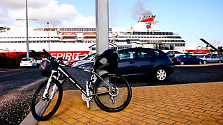
After some airline shenanigans and a couple of days in Sydney, I flew into Tasmania, landing in Hobart, at the south end of the island. (Note that Hobart is some 500km from the start of the Tassie Trail.) In terms of transport, you have other more efficient options that would put you closer to the starting point…however, I had some devious plans in mind.
While in Hobart, I took advantage of the opportunity to stash some unneeded baggage at the hostel, where I put items like my bike case into long-term storage until I arrived back after the ride.
In Hobart, I met both of my brothers, also arriving early for the reunion. We got our bikes ready to ride and set off. Together, we toured up the east coast of Tasmania along the Giro Tasmania road touring route which is an all-pavement ride. I’m not much for road-riding…don’t have a road bike, but it was a fun trip with my not-so-hardcore brothers, and not too challenging. We traveled as far as Launceston in the counterclockwise direction, where we rented a car and went to our reunion.
After the reunion and a few days spent with family, I was now in Devonport and packing up for the trail ride. My brothers and I separated to follow individual plans, and I would be riding the Tassie Trail with no support, no backup and totally solo. It felt pretty committed at the time.
I spent my last night in civilization at the Alexander Hotel opposite the ferry dock on the banks of the Mersey River in Devonport. The Alex has hostel-style accomodations, and it has the virtue of being next-door to the Tourist Information centre, which is also the Tassielink bus terminal. When the Info centre opened at 7:30AM, I popped over with a bag of things I wasn’t going to be needing for the trail, and dispatched them to the Hobart bus terminal for the cost of $10, where the items would be waiting for me when I arrived in Hobart after the ride. Then, I jumped on my bike and rode to the trail.
Tasmanian Trail
One planning challenge I was facing was estimating the time I would need on the route. With all the travel arrangements and the time off making me have to plan every detail, it was important to me to carefully budget the right amount of time I would need on the route. I took a wild guess that I’d be able to tackle about 100km (65mi) a day. So for the whole thing, I was hoping to get through in about 5 days (480km + options / 300mi) plus another 1/2 day to shuttle back into Hobart from the trail’s conclusion at Dover on the south coast. This sounded like approximately 6 days total, and I budgeted 7 days to have some flexibility.
The trail is set up with 14 campgrounds, roughly spaced at around 30km (20mi) intervals. I was hoping to hit every 3rd or 4th campsite as I made my way south.
The weather for my time on the trail was warm to hot during the day, with daytime temperatures ranging from low 20’s to low 30’s, bright and sunny with nights getting down to around 5 degrees. (70-90F, with low of 40 overnight) Some days had a strong wind, others were very calm. This stayed constant for the time I was riding. I spent time in Tasmania in December of 2005, and was caught in a summer snowstorm in the mountains, so I realize that I was really lucky with dry hot conditions.
I had no mechanical or bike problems, save a GPS glitch that I’ll talk more about.
No issues with my physical health, except for some sunburning which is almost impossible to avoid under the ozone hole.
The route is on varied surfaces. Broadly, the classes are:
- paved highway (major 2-lane road)
- paved road (quiet town streets, tertiary paved roads)
- gravel road (2wd, country roads)
- graded /surfaced logging road (4wd)
- bush track (ungraded / unsurfaced double track)
- logging skid trails
- wide path / singletrack
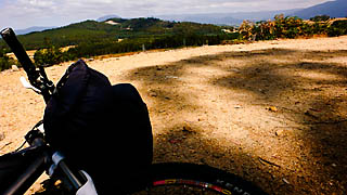
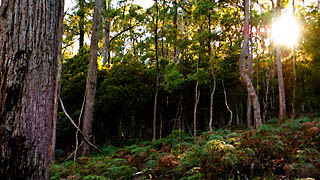
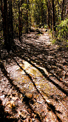
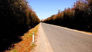
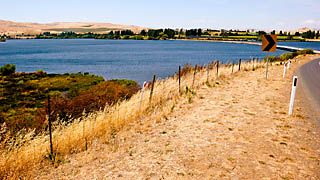
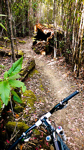
Day 1: Devonport to Montana Falls
Starting at the ferry terminal, I found the first blaze and headed south. The route took a very scenic river’s edge road into a small town called Latrobe, after about 1/2 hour. Here was a big marker showing the start of the route.
A couple of zigs and zags and I was heading into farm roads with very gentle terrain. Route markers were seen extremely seldomly, even at intersections. A couple of rises and the gravel farm road I was following came to a gate where it entered a forestry area with roadways branching in all directions.
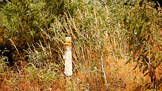
I looked high and low for a blaze but couldn’t find anything. Using my GPS I decided that the straightest, most heavily traveled road looked to head in the approximately right direction, and chose that road. After another 15 minutes I came into a Y-intersection and saw a wooden post — around the back of which was a blaze facing people coming from the south — I knew I was at least on the right road. The road I was on dead-ended at a farm road in a T-intersection, and a blaze on the far side indicated that the trail continued straight across.
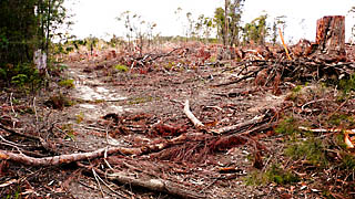
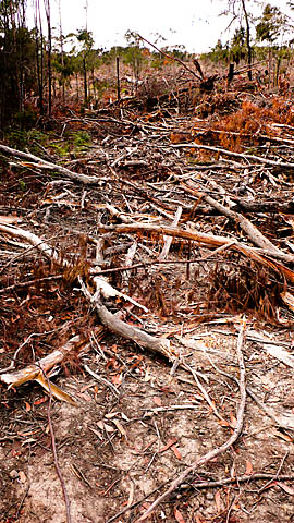
Or rather, the trail would have continued, if not for a giant clear-cut. After clambering through slash and broken treetops for quite a while, I managed to locate the trail tread where I noted that there was some evidence of about 5 bike tire tracks in a damp area, and continued on.
The next portions of the trail were on country roads and the trail passed through some farm areas and a couple of very small towns as it wound through the countryside.
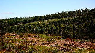
Sidebar: Tasmanian Forestry, Changing Forests and The Trail
This is as good a point as any to bring up Tasmania’s forestry operations: It just so happens that the Tasmanian Trail suffers badly from a strange convergence of factors. Most of the trail is either on public roadways, or in State-managed forestry tracts, or along Hydro (electrical power) corridors.
From a mountain biker perspective, the “good stuff” is all in Forestry areas. It’s “ok” on the Hydro corridors. Everything else is road.
Nothing has changed in the Hydro areas or on the roads. But everything that is really “off-road” is totally gone.
Unfortunately the Association that created the trail didn’t blaze the trail according to any standard that I’m familiar with. No markings whatsoever was the default.
For all practical purposes, the trail is given by a bunch of lines on maps, and the only navigational method is to follow the cues from the directions within the Guidebook.
Many of the other trails I’ve been on that pass through heavily forested areas seem to take the approach of marking blazes that are sufficiently spaced apart so that a trail user is always able to see the next blaze when beside a blaze. I can’t think of any real reason why this wouldn’t be called for in Tasmania as well. Also, I can’t help wondering if more blazes might have prevented some issues from happening over the dozen or so years since…
Massive amounts of forestry operations have conspired to add new roads and also to demolish huge stretches of forest and long intervals of the trail as well. When the guidebook says “take the second right turn”, you generally have to worry about whether anything has been changed since the book was put together.
End result: the Trail has become weighed down a lot by problems, errors and changes, and the Guidebook doesn’t reflect much of change that has happened out there.
This constantly shifting forest terrain is a shaky foundation. All the changes compound the navigational hassles for trail users because whenever the logging has come through, things have never been left in a state where the original route remains clear and passable. That’s universal.
Depending on the size of the timber cutting operation, the more extensive the forest changes the less likely you are in practise to be able to find the continuation of the route after the cleared areas. Many of the clearing operations have been cut clear, covered in debris, burned, reseeded and have entirely new generations of plantation trees growing up in the path of destruction.
You tend to run into all these confusions all at once: new roads, removal of old roads, no blazes, regrowth, debris, etc. In essence, there’s an entirely new face on the terrain, and where the trail once one, it has completely disappeared.
Staying on the official route is an impossibility, even going into cross-country off-trail mode and simply following the GPS line no matter how tedious or difficult, there were lots of places where the impasses had caused the remnents of trail to be abandoned long enough ago that it wasn’t passable even if it could be found. Maybe totally overgrown or debris-covered or covered in deadfalls and branches.
It’s clear that there has been apparently no official policy to put foresters wise to the existence of the route. Given that there are no blazes (which is a nightmare for trail users anyhow), you also are left to wonder if having the blazes there would have had some effect for the foresters. Even without an official policy of preserving the trail, you would hope that savvy foresters may have realized by their own wits that the trail shouldn’t be covered in treetops and branches and they may have made efforts that left the trail itself clear when clearcuts and forest operations were concluding.
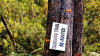
The effects of this disarray on the trail user comes down to the specific ways that this situation is managed by the trail association. The Guidebook includes a trail “report card” where you’re supposed to report route issues back to the association. There are several mentions in the written material about the possibility of encountering signs indicating re-routing the trail, or about encountering active logging operations. These clues taken in tandem with my experience “out there”, I would say that the management approach is pretty laid-back and they pretty much acknowledge that trail users will run into things happening. The association is just passively collecting reports of issues and tackling things in spots.
It’s abundantly clear that there isn’t a policy of actually going out and checking on things in any kind of proactive and comprehensive sense.
Nothing I read about online really could have prepared me for the extent of the difficulties I encountered. Looking at the Trail Registration books where riders register as they pass along the trail, there might be just 5 parties using certain sections of this trail each year. I suspect that there’s no real feedback available to reach the Association. It’s safe to assume that there’s probably a 10-year backlog of major changes that nobody has been keeping on top of really at all.
End result: entire chapters of the Guidebook are now basically in error, almost 100% wrong from first to last. It’s crazy. I’m still trying to work out a constructive way of sorting out how to report back to the association, but the number of issues are so numerous as to be almost total. In some ways, the association might as well start over with anything in a forested area, and I’d even recommend a new approach to the whole idea of how to do it.
The official route is so emphatically wrong in so many ways that it seems best to think of the Tasmanian Trail as a kind of elaborate hoax on certain levels. You could tell by regrowth and various signs of decay that the Guidebook hasn’t been right or accurate for 10 years at least.
From what I could tell, the experience I encountered within the first couple of hours on Day 1 on the route was a the experience of the whole Tasmanian Trail, in a small capsule. As the route got further from the paved highways, the Guidebook became less and less accurate. In fact, the Guidebook is totally nonsensical because of the way the direction are given without proper names and unambiguous details. There were so many headscratching moments where only my GPS map image itself could be trusted, and most of the “ride” as I completed it was just made possible by winging it more-or-less correctly based on gut-instinct guesses and the satellite nav and random luck.
The wikitravel page for Tasmania states:
Exploring the forests can often lead to a maze of forest roads. A GPS can come in handy for finding your way out, but beware GPS maps are not always up to date and following them blindly can add unnecessary time to travel.
In some senses, this is more appropriate travel information than all the information within the Tasmanian Trail guidebook. Without a real policy in place about logging operations or some method for actively keeping the route open, the Tasmanian Trail is routed through lands which prove that the idea for the Trail is an act of pure Sisyphean folly.
I wish I had been able to ride this Trail when it was first put together. I bet it was amazing for a season or two. Entropy is unfortunate, and the entropy has hit 100% of the forests I rode in. Yes…ALL.
I should mention that I was never really lost or disoriented while on the route — I always knew exactly where I was. What felt “lost” was really just in the sense that I was constantly frustrated by trying to keep along or in a trend relative to the official route. I think this feeling of being dead-sure on my location led me into further and further layers of doubt about the current level of organization behind the route.
Whenever you read in a trail report about users spending time being lost on the Tasmanian Trail, you can safely assume the users are right where they have been told to go, and that it’s the trail itself which has disappeared. It’s not otherwise complicated to keep moving along the route. The problem is the route itself is gone, or the instructions make no sense. As I was traveling with three or four layers of redundant navigation, the situation became abundantly clear to me that the problems are that the Guidebook and maps do not jive with what’s really happened, and that the trail route doesn’t exist any longer in any of the forested sections.
While I enjoyed the riding in many ways, I think there’s some fair criticism for the association here. In one sense, the major job for the Association is just to identify the route and marking the route, the Tasmanian Trail is a failure to the point of being a bit dangerous, especially for self-supported riders in some more remote stretches. There were many difficulties and risks that I encountered by trying to rely on the Guidebook’s information that I’m confident wouldn’t have happened if I tried to figure things out for myself using other resources. The Guidebook was a source of inspiration, but not at all useful as a source of navigation.
Day 1, continued
Anyhow, back to the ride…
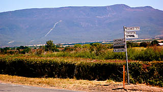
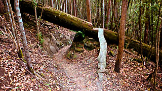
The rest of the first day consisted of a couple of passes through some dirt-surfaced forested areas but was mainly spent on paved and gravel roads and built-up logging roads. All kinds of oddness happened whenever the route strayed far from the pavement. Just for example, one moment of strangeness happened at one point as I was coming to a T-intersection with the route I was supposedly following along. Apparently this “re-route” wasn’t marked with a junction along the path I was traveling earlier, yet the sign was erected in a position where it seemed as if they expected you to encounter it from exactly where missing the junction would have brought you?!? (Like, “ha-ha, just letting you know that you missed the route back there”.)
Here’s the sign which I rode up to from the position that the photo was taken from. I was riding a blazed route and just reached a ‘T’ with the route I’m supposed to be on?
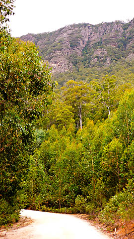
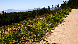
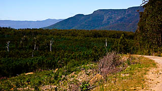
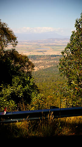
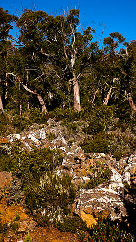
The route entered the Gog Ranges, and there were some amazing views offered from all the clear-felled areas.
The Gog Ranges and Beulah woods is a grid of plantation forest lots with all kinds of missing clear-cut gaps like a hockey-player’s teeth. The track was largely surfaced with white quarried gravel and had cliffs and mountains towered above, while passing through rolling hills. Just spectacular.

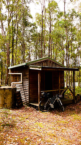
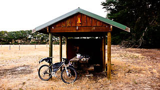
By this point I had passed the first couple of campsites and had been able to take a look, and now I reached the third, which was a big improvement, although a bit dilapidated. In consists of a small shack in the woods, pit toilet and water tank. Things here were in very rough shape. Mattresses inside the hut were chewed apart by animals and piled on the floor in a heap. There was no latch on the door, which swing to and fro with no way to keep it closed. I moved on, finding it all vaguely unsettling.
About halfway to the next campground I got fairly confused. From a gravel road, the instructions were to take a bush track entrance to the left 100m before the first corner in the road. There were some 1/2 dozen roadways clustered around 50m before the turn, and nothing 100m back. A bunch of signs marked out ‘private property’ and ‘do not enter’ and trees had be brought down to close off some of the bush tracks. I explored the un-signed openings for quite a while riding into and out of the forest.
I was very concerned with finding the water source and didn’t think I could get as far as campsite 4 before dark. I was also pretty dehydrated. A seat-of-the-pants reroute around this area would be a risk, so I really couldn’t afford to not find the trailhead for this section, and the hour was getting late.
Reading ahead in the Guidebook, I noted that the trail was supposed to veer to the right just near the Montana waterfalls, which was a nearby geographic feature that showed up in my GPS (I was using the very good free Skonkymaps base map). I ended up riding several hundred metres just dead-reckoning the direction across private property simply following my instincts and a faint track. I eventually found out that I was on the correct route after all when my GPS trail and my position converged, but it was obviously long-“closed” with many trees felled and roadblocks created by a bulldozer. However, I popped out near the falls exactly where the route indicated I was meant to be — so this was long ago the route.
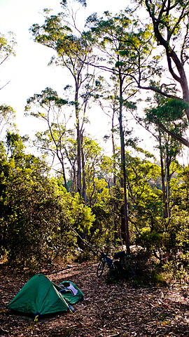
So this was about 90km in for the day, I was feeling pretty tired and a bit off, so I set up a rough camp beside the waterfalls. The Guidebook said that I should have done about 6 to 800m of climbing, but it was more than 2000m (6500′), almost all of which at unimaginably steep slopes that would be instantly eroded in a typically Canadian rain (…but there were no ruts or washouts in the more arid conditions, just really steep with a heavy load).
Day 2: Montana Falls to Arthurs Lake
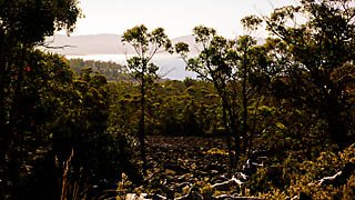
Day 2 started with a great sequence of forest riding that was a real highlight of my trip. The first section was a continuation of the Montana area forests, and miles unfolded with beautiful forest scenes.
The miles came easily as the rolling terrain flew past. I then rode up to the supposed location for campsite 4. There was a guy out doing some farm work and went over to him and asked for directions. He seemed concerned that I was on his property (“this is our land, you know”), and unaware of the existence of the Tasmanian Trail (which apparently according to the Guidebook maintains a campground on his property?!?). He was nice and gave me some directions.
The Guidebook of 2010 states:
The boys of Ashley Dentention Centre located at Deloraine maintain this section of the Trail. In late 1999 they plan to upgrade the campsite for your convenience.
This is laughably out of date, clearly has not been reassessed in 12 years. This campsite consists of a field where the guy who owns it doesn’t know about the trail. (However, if you continue past this point, you’ll find a nice paid campground with a shower block somewhere near Quambry Brook, perhaps 25km further along — it is directly on the route by not mentioned at all in the Guidebook.)
The sections following on as the trail climbed up into the Cluan Tiers were lots of fun, and memorable riding — some hard climbing here with a bunch of the Cluan Tiers covered in deadfall and other sections are bouldery and eroded from 4x4ing. I found the approach that worked was to just relax and take the best looking option at each intersection, and you’ll muddle through, or at least I didn’t find any dead-end roads here — the network is almost a perfect grid somehow and was totally logical in its interconnections.
After a long climb over some gnar, finally a long uphill on a gravelly logging road and finally breaking out of the forest into a clearcut offering a view.
This is the direction I’m heading in:
From the Cluan Tiers, I descended a very steep slope down into Myrtle Gulley. At the very bottom of this 5-700′ pitch, a temporary metal gate had been erected across the path. A huge ‘no trespassing’ sign was there, along with a logging operation notice. I was faced with making a U-turn and a huge hike-a-bike climb backwards on the route up to the ridge I had just abandoned and then fumbling way way over to hopefully get off the mountain via some unknown alternate route, or…better yet, simply ignoring the sign. I hopped the gate and rode through an active logging operation, getting yelled at but not stopped as I whizzed between bulldozers and bombed down to the paved road. Why couldn’t the closure have been noted at the top of the road, back at the fork, before I had committed to descending all the way off the mountain? Incidentally, this section would be nasty and unrideable heading north, but the cliffs and rainforest are spectacular here and might make the uphill trudge somewhat scenic.
I then had a chunk of road riding to do. The headwind was around 50km and steady, no gusts. I had reached far enough south to be almost now at the central plateau, but needed to jog over some 20km to reach the gap where the trail ascends. I was using the alternate route through Poatina, which avoids the cattle driving track, as recommended for bikes.
Here you can see the Cluan Tiers (right) height in comparison to the Central Plateau (left). The Plateau is about twice the height:
The wind in this section was brutal. It was hard to keep moving at all on all the gentle rises, and 5% grade downslopes couldn’t be coasted down even with my heavily loaded rig, I would literally almost stop moving completely.
You can see the hydro pipe (white line) dropping down from the Plateau to Poatina. I will be passing through the gap at photo-right:
A few moments later, I crossed the tail flume from the Hydroelectric generating plant, there’s the gap in the distance, straight above the flume:
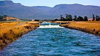
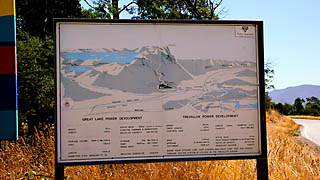
A roadside diagram shows the hydro projects and explains the scheme. The trail follows a lot of the Hydro-owned lands around these projects, so this is all the upcoming riding as well. From Poatina, we’ll ride up the plateau, pass beside Great Lake, to Arthur’s Lake for a camp, then along canals and flumes for a section, then off the plateau at the other side. The water from Arthur’s Lake is pumped into Great Lake via a flume.
This tall hedge finally blocked some of the horrible winds.
I stopped at Poatina to refill my water. There’s a very tiny convenience store which sells junkfood and drinks and ice creams. Water is to be had at a public restroom. With a bit of hesitation, I started this brutal climb. The climb is paved all the way up, and it’s about 4000′ elevation in under 6 miles, with the pitches on the bottom half being fairly easy, and then things steepen up on the top sections staying around 15% between the hairpins.
I felt almost like I might be forced to hurl my bike, like in this comical road-sign diagram. 🙂
Passers-by were giving the thumbs-up and honking encouragement. I guess it looked as bad as it felt, but nice to get encouragement.
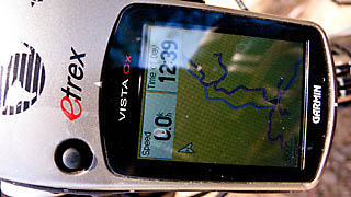
About halfway up, my Garmin Etrex CX popped up a window reporting that the batteries were low. Usually the unit shuts itself off gently about 1/2 hour later. As I looked at the screen, it flickered off within seconds. I stopped the bike and popped in new batteries, and went to turn the unit back on, but it was powering up and powering off about 1 second later. I fumbled around with different batteries and eventually racked my poor brains for the reset key press sequence. I managed to eventually recall the right buttons and got into the self-test screen. After a lot of messing around trying different things, I eventually worked out that my expansion card itself was hosed. Without the card (and hence no topographic basemap/roads showing), the unit was navigating and recording details. With the card in, it wouldn’t boot up.
I had loaded the Tassie Trail route file into the unit’s ROM, so at least I had my breadcrumb trail to follow on a completely blank display. Now my knowledge of the terrain and context was limited to the backup paper maps I was carrying. Given the navigational hassles, this was a little upsetting, but not a total show-stopper.
(Incidentally, loading the route into the Garmin with Topofusion was the best thing I did heading out.)
The climb continued, and it was brutal. Looking down at the valley, from halfway up:
Looking up at the climb still remaining, still a whole mountain left to scale:
The cattle track that I was bypassing:
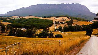
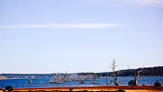
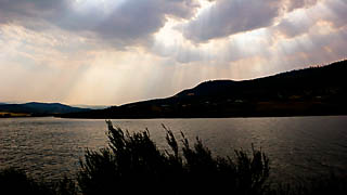
Finally, I managed to get on top. One of the more challenging climbs I’ve ridden. Filed under “doozy”. A view of Great Lake, where my family vacationed when they were growing up.
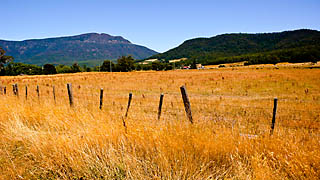
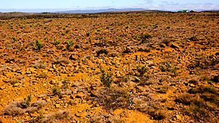
Tasmania is geographically interesting. In North America, all the mountains are folds from tectonic processes, so the mountains are sedimentary rock, and all the alpine areas are pointy mountains.
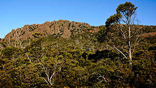
In Tasmania, the higher terrain is volcanic. The higher terrain is all bouldery like a bunch of broken crystalline forms, and areas like the Central Plateau are vast plains that I guess were lava flows or lava lakes at some ancient time. But the vegetation is very sparse and alpine and the terrain is desolate as it is flat:
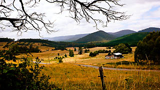
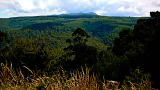
However, all the sub-alpine, lower areas are full of rolling hills, lush vegetation and lots of climbs:
All kind of backwards…climb up to get above the hills. The plains are up top, the hills below.
Anyhow, it was getting late in the day, and the wind and some earlier navigational glitches had added several hours to my day. From the top of the climb, it was still another 30+km to the camping area. Luckily, a small tailwind was pushing in the right direction, and I made it in just before dark. I was totally shattered from the day’s exertion, and had elevated heart rate and no appetite. I felt pretty much like garbage.
(I haven’t mentioned much yet about dehydration on the ride, but I’m sure I have Kidney stones by now. I never peed clear the whole time and I was constantly thirsty and headachey, and I just didn’t find as much water as I needed to en route. Every chance I had, I filled up and was constantly running out. Also, note that I’m also like some camel normally — I rarely run out of water on rides, even in the hottest weather. But it was common to have to cover 6+ hours between water sources on the Trail, and these refill points were not indicated on maps or in the Guidebook, so it was hard to budget the water while riding.
Likewise, the first true food resupply point that I reached that had any grocery items of note was at the end of Day 3, 250km into the ride. Plan accordingly to haul these necessities. Carrying 4L (1 gal) wasn’t enough capacity. Better yet, get yourself a support vehicle.)
Given that this is ostensibly a hiking route as well, I should mention that I have no idea how someone could hike the official stage from Bracknell to Arthur’s Lake in a day– it’s 70km between these adjacent camps and 5500′ of climbing, with no water past Poatina. I could barely manage to cover this stretch with all the mechanical advantages of a bike.
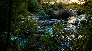
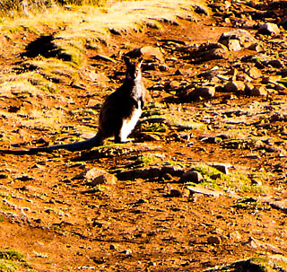
Arthur’s Lake was very scenic. A kangaroo raided my unfinished dinner in the middle of the night, and I saw a lot of animals at dusk as I arrived at the campground. This campground closes for the year at Easter, by the way, and once it’s shut down this would mean that this stretch would have zero official camping services for over 150km of hard terrain. Riders tackling this outside of the Australian summer be warned.
Rough track leading into the Fisherman’s campground at Arthur’s Lake. Plenty of wildlife here:
Days 3 and 4: Arthur’s Lake to Hobart
The rest of the route has been covered before here. Note that the other write-up is in reverse direction to the way I was riding, but it’s very complete and I don’t have much to add.
Just as told in the other report, I too cycled south from Arthur’s Lake to Ouse without finding any substantial portion of the forest routes:
- From the north, I couldn’t find a way into the “Pine Tier” section. Other riders from the north ended up lost in the same place. What’s upsetting here is that there are meant to be two entry points — either you can take the top entrance leading south (which I found, but was unable to follow through the peat bog) or you can pick it up again at Roscarborough Rd where the track recrosses the Marlborough Hwy from south to north. Roscarborough Rd is clearly signed and totally deadends both ways. Thus, the Tassie Trail must really use some other road than the one named and shown on the map, but without blazes and with few possible roads that make complete roads crossing (and certainly none in the general area of the the crest of the hill) there’s a clear error or omission in what should be a simple instruction. In fact, this could be solved with a single blaze at the correct road.
- Like the other report mentions, the entire Mount Bethune area west of Ouse seems to be un-navigable along the forest tracks. This other party seemed to take the road “alternate route” option and get through, but it’s all hiking I guess? I think the Guidebook calls this the “Flood” option for when the river cannot be crossed. Go that way and don’t bother with the forest route, it’s not there at either end.
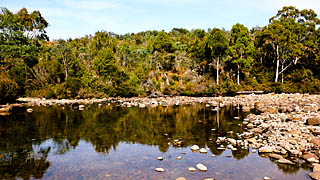
- I camped in the official campground at Ouse, which has no running water or toilets and has been vandalized.
Incidentally, if you’re looking for a functional campground in Ouse, there is camping in-town where the Lyell Hwy crosses the Ouse river (with running water, shelters and picnic tables at every site) and which even has a paddock for horses. There’s more camping at Repulse Dam (no facilities, but a really nice swimming hole under the bridge and head upstream) or you also camp in the campground beside the Lagoon on the Derwent River just south of town (with its toilet block). All of those options are within a few kms of the old and busted Tassie Trail site in Ouse, and have better amenities.
Repulse Dam:
Lagoon:
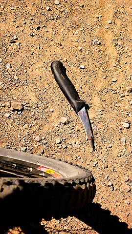
I ended up ultimately bailing out of the ride not far from Ouse. In the photo below, I’m meant to be following the blue track, where the Guidebook gives a GPS waypoint coordinate and says “take the bush track on the left”. With ostensible sub-1 metre accuracy, I pinpointed the turn’s waypoint from the Guidebook as being exactly in-between two bush tracks that were both candidate “left turns”. There were 5 potential directions to go in, and after exploring for more than half a day, I will confidently assert none of these options avoided clearcuts, deadends or other show-stopping nonsense. “None of the above”.
One deadend had a bloody knife on the trail, and no kidding, the blood was fresh and there were bloodstains in the dirt and bloody rags all around:
The trail that led to the “turn” had an obscure blaze in the bushes, but I rode a couple of hours wandering into and out of various tracks without seeing an official junction or a blaze…
Another turn, and I was face-to-face with one of these guys, which reared up. It’s just a deadly Tiger Snake that I’ve angered:
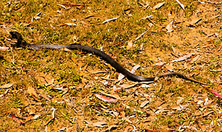
(I saw every kind of Tasmanian snake, and at least once a day, and all of them fairly close.)
I sat down and grabbed lunch and pondered. I was 5 hours into the day’s riding, and I hadn’t made 10km down the route. I flipped through the remaining pages of the Guidebook. From Ouse to New Norfolk was almost all road, except for the forest puzzle I hadn’t solved. From New Norfolk to Dover, it was almost all bush track and forest road. I was racking my brain trying to think of any preceding section of the trail that had actually worked out in any way that resembled the maps and Guidebook. I couldn’t think of one single area, in the past 350km. I felt that all the trail between New Norfolk and Dover was likely to be a bit suspect just by extension of the rule that the more primitive the track, the less accurate the Guidebook.
I decided to ride the gravel/paved road to New Norfolk and do some heavy thinking on the way.
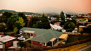
In New Norfolk, the air was filling with smoke:
I knew that there was probably a good 100km+ of trail left to ride and at least one more night on the trail, and another day to get to Hobart after that. I didn’t have much faith that things were going to work out very smoothly. The maps didn’t show any really convenient Plan B if I hit major snags — hardly any road options to use if the trail was in shambles I needed to bailout to keep on schedule. I just had a feeling that if the route was impassable anywhere after going over Wellington Range, I could have major issues staying within my desired window of time. This was weighing on me a bit, especially considering that I had no option but to arrive in Hobart under pedal power, on time.
Beyond the practical/timing stuff, the ride that was achievable under the circumstances was not really that much fun — I had really hoped to get off the beaten track a lot more. The Tasmanian Trail is a 50% gravel, 50% paved tour once you edit out the missing forest sections. Not quite as rustic as I was hoping…
After some more deliberations and a cold drink or two, I headed to Hobart instead, taking the A10 along the Derwent and then onto the Inter-City bikeway. It appears I’m not the first to “run out of time” on this stretch.
A confirming supernatural sign emerged as it turned out that there was a major bushfire in the area west of Ouse — right where I had just been riding around in all morning looking for forest tracks. Here’s an apocalyptic smoky sky heading into Hobart, and the fire is some 80km off in the distance:
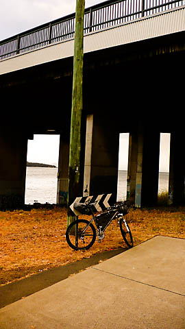
Here’s my bike under the iconic Tasman Bridge, at the other end of the island from the Devonport ferry. Tasmania, crossed.
Total riding was 445km (275mi) in four days, with around 50km (30mi) of that distance being the exit route I used to get from the Trail into the city of Hobart. Thus I did the northern 375km-400km (250mi) or so of the official Trail. About 6805m (22,326′) of climbing, most of that in the first 2.5 days.
As a postscript, Hobart has some great technical singletrack riding on Mount Wellington, which I would whole-heartedly recommend for anyone visiting that area:
Conclusion
I had a lot of fun touring around, but it didn’t really feel like a mountain bike trip given all the long road sections and the disappointments off the major roads. The trail passes through an amazing part of the world…the scenery and the terrain are fantastic, and the terrain is physically challenging.
Allow a lot of extra time for navigational snags. Take paper topo maps and treat the official Guidebook as a “thematic inspiration”, not an authoritative source of information, almost none of it checks out on the northern 3/4ths of the route.
Tasmania is an amazing place to visit, and a great place to bike.
What a depressing read, and I’m guessing, ride. Sorry to read it, but good job persevering and writing it up as a cautionary tale. I hope your next bikepacking trip is a big success.
BTW I think your write-up is now the unofficial guidebook to the trail.
Way to be prepared and make good choices (and not be on the receiving end of the knife, ARGH)
Wow, this makes me embarrassed to be Australian. Tasmania is beautiful – such a pity no one with the means wants to put in the effort to make it safer to experience.
That was awesome, even if it was not as out there as you hoped, the pictures were fantastic, and you seemed to really keep your cool with all the BS. Thanks
I’m still giggling from reading that:) I did it in Jan 09, it’s on the wiki as thefunkyreport. Well done on some of those mileages firstly, Montana Falls to Arthurs Lake is an epic day, although you coulda breezed the Caves Track with that lightweight setup 😛 Interesting to see it must be more than 10,000m vertical all up.
Agreed the trail was often hard to find, and depressingly in logged plantation far too often, but still, I didn’t find I had to backtrack that often, even if I too would have loved more markers. Being prepared to work with a compass and from contour lines on the dotted topo maps is the most reliable method when it gets iffy.
I missed the forest entry after Repulse too, and was most of the way back down to the river valley before I realised and couldn’t be arsed backtracking, skipped Mt Bethune too, and also couldn’t find Pine Tiers to save myself. The section heading from Bronte Park to Ouse past the lagoons and falls was as mapped though, lovely dirt roads and tracks which can’t be logged out so can’t have changed much. The bits you skipped from New Norfolk to Dover was definitely some of the nicest, more remote riding of the lot, loved the rough Jeffrey’s track and some lovely tracts of pristine forest above 1000m, and good varied terrain and views there and lower down, although from Geeveston the last section was once again a bit of a guessing game in everchanging logged plantation forest.
Sorry you didn’t enjoy it more, but all said and done, I’d still recommend the effort to anyone interested, sure it’s not singletrack nor wild like the west coast; and the trail can be a mystery in active logging areas, but I found the vast majority is as mapped and still doable for the most part even without gps, although definitely handy to have it to turn on when you’re really bamboozled. And yeah forget the camping spots in the book, mostly farces even when they exist, that ‘reform boys’ moto x track is a classic aussie gag, but camping by the creeks, rivers and lagoons when you hit them is the go, yes the little towns all have a park with a toilet that they happily let you camp in. And take two days food and water everywhere. If you’re happy to wing the odd bit, miss the odd bit, and mix it up with some side trips into various national parks along the way (which aren’t included on the trail because horses can’t go in them) and it can be a challenging and interesting trip.
And yes my replies are much like my ‘packing really.
The kitchen sink does come in handy on occasion.
Hi there,
This report’s scared me a bit. My partner and I were planning the ride for late Jan (2011) and while we’ll have a GPS, I was relying largely on the Tas Trail guide book. I’m now trying to collect actual GPS logs from as many people as possible to ensure we make it through okay. Do you still have the track logs from your trip and are you willing to share?
Forgive me if they’re already on the website somewhere and I’ve missed them.
Cheers,
Kym.
love bike riding in tasmania
I was planning to do the Trail late august this year, but read too many reports like this (great report, thanks for taking the time to post so much detail) that turned me off. Don’t get me wrong, I enjoy a navigational and terrain challenge, however I was going to do the ride as an Audax Raid, so it was imperative to stay on the trail and adhere to checkpoint cutoffs to maintain the integrity of the Raid. Add in the variable of constantly changing areas with logging activities (and the similarly depressing outlook in these areas) – it just looked like a frustrating experience. I think the Trail association have a big job ahead of them, given the logging coupes that the trail encroaches on or traverses through, the forestry workers do not consider much when carrying out logging activities. I think the PDF version of the Trailbook is a big leap forward, enabling up to date reports of conditions, on your kindle or smartphone etc (but reliant on technology can be a step backwards too). One day.
Forgot to add, there are quite a few good contacts on the Bushwalk Tasmania forum, lots of local knowledge from people who live in the area and regularly use it.
The stone, carefully packaged and packed in dry ice, made the third leg of
it’s 500 mile journey from the freezer of it’s finder after a brief
stop at the stop sign. You then proceed up the
stairs of the tower to kiss the Blarney Stone for good luck.
They staved off elimination on Saturday beating south dakota k12 webmail State 4-3
in a 13-inning chess match at the Eugene Regional.