Routes » Ring the Peak
Overview
Ring the Peak is a fully signed and mapped route around 14,110′ Pikes Peak, near Colorado Springs, CO. Currently the trail is 80% complete, but 100% open to bikes! More singletrack is under construction by the Friends of the Peak, but on bike the 20% road detours are easy and fast.
Route Details
At only about 70 miles long, RTP can be done in a day. But it’s a long day, and you’ve got to suffer to complete it. With plenty of camping opportunities in the National Forest (including developed campgrounds such as the Crags CG), it’d be easy to break it into two days. You could even use Manitou Springs as the mid point, staying in one of many motels in the area.
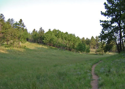
There is quite a bit of singletrack on this route, and most of it is between 9,000 and 10,000 feet. The high point of the ride is about 11,200′, just near tree-line. Thunderstorms are definitely a concern, and they can happen any time of the day near Pikes Peak.
Sections of the trail can be pretty steep and rough. Solid bike skills are needed, and an ultralight bikepacking load would help reduce the amount of bike pushing.
The Ring the Peak website contains a wealth of information on the trail. Everything from access points to conditions is covered there. For a cyclist’s perspective on the trail, see the Trip Reports section.
Besides the main RTP loop, there are other side trails that are worthy of exploration, with or without camping gear. RTP has several “spokes” that connect to the top of Pikes Peak itself. Climbing Pikes Peak is an unparalleled experience, though only the Barr Trail is recommended for bikes.
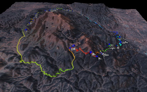
GPS Data
Trip Reports
Ring the Peak in a day by Scott Morris.
Ring the Peak in a day trip report by Marshal Bird (scroll down in thread)
Cycling Pikes Peak – one of the “spokes” on the RTP route.
Group singlespeed / fixed assault on Ring the Peak.
Links
Official Route site: http://ringthepeak.com/
Friends of the Peak – advocacy group responsible for constructing and maintaining the RTP trail.
Marshal Bird’s description of the trail – from a cyclists perspective
It looks like the Ring the Peak loop may stay incomplete, and more a cyclist’s route than other forms of recreation. Here is an article on the lack of progress of late:
http://www.gazette.com/articles/remains-95789-circle-ring.html
Anyone that has been in Colorado Springs for a few years will understand how local utility politics have blocked recreation on parts of Pikes Peak for years. Just more of the same if you dig a bit past the enviro angle of this particular article.
Anyway the small section of RTP that they do intend to link, which appears to eliminate the need to ride on hwy 24 is actually all that needed to make RTP a much better biking route.
Definitely an epic! Great way to see all sides of Pikes. Here’s another trip report to add to your list from when a buddy and I rode it in July 2006. http://www.jeffkunkle.com/Ring%20The%20Peak.htm
I did the loop in two days. It was fun(ish). It had too much road (I’m allergic) and too much HAB for it to be really fun, but it was totally worth it. Also I really don’t like the Buff creek type of pea gravel surface since it limits speed on the downhill. According to comments about some GPS estimate 12,000 vertical. My estimate was 8,000 based on how it felt and counting contours on the map. I would suggest riding it in the fall for Aspen season. I did it late fall and it was cold, and not as pretty, but it did mean that the dirt roads were all empty because the parks were closed. Bring your GPS (or maps). The trail is marked really well in some places and not at all in others. My estimate was about 2200 vertical of required HAB, all very steep. The GPS track led me up Rattlesnake gulch out of Manitou Springs. It looks like there is another trail that might be ridable as opposed to miserable steep HAB and a local suggested doing it.
I credit card toured it in two days, which makes an epic ride totally reasonable. Two 35 mile or so days. I would suggest splitting it up more like 50 one day and 20 the next since downhill is a lot easier than up hill and most of the downhill is in one big chunk on the south side of the mountain. I would not do it in one day unless I was an RBA (registered badass) or a masochist I started on the West side Saturday morning, stayed in Manitou Springs, then biked back on Sunday. My (lousy) times were 6 hours on Saturday and 10 on Sunday. It could be done significantly faster than I did since I am slow and was not in a rush, especially on Saturday.