Routes » Kaibab Monstercross
Overview
Originating as a self-supported, one day mountain bike race, this 130 mile loop on singletrack and dirt roads take in the best of the Kaibab Plateau south of Highway 89a and north of Grand Canyon National Park. It includes the Rainbow Rim trail, and the best parts of the Arizona Trail, as well as some seldom traveled roads to link them together. It’s a tough cookie as a one dayer, and would make an equally rewarding multi-day trip.
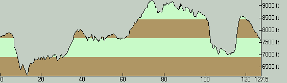
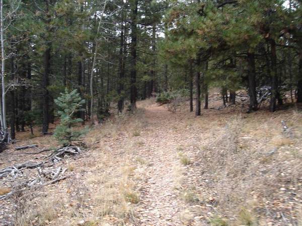
The profile reveals the routes variety and challenges. That almost 14,000′ of gain! The initial big drop is on well developed gravel, but soon the route turns onto FS road 423 and enters a zone of transitional flora, with mixed pinon, juniper, and pine country. This stretch, combined with the scenic climb back up a small canyon on FS 425 and 272a, gives one a first hand view of the changes wrought by the Kaibab upwarp. Similarly, the drop off the east side of the plateau, and the rather nasty climb back up around mile 118, takes one through a p-j forest, and then a moonscape of burnt trees from the Warm fire of June 2006. The proliferation of snags, when combined with the flowers of late spring and early summer, provides an aesthetic riding experience.
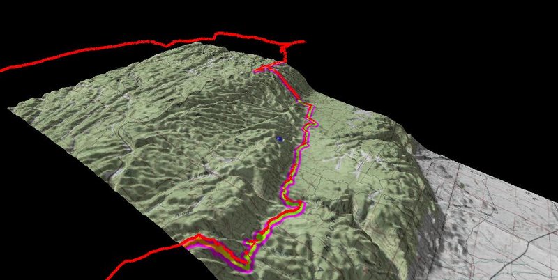
This 3D view of the aforementioned section shows well its difficulties. Only the strongest riders should expect to ride much of the climb back up to the plateau.
It should be noted that this detour exists for a reason. The AZT is closed several miles north of FS 213, as it passes through the Warm fire burn, with much exposure to falling trees. As of June of 2008, there was no anticipated date for its reopening. This section of trail is quite close to the road, and always paled in comparison to the outstanding meadow and forest riding to the south. Either take the aforementioned detour, cross the paved Highway 69 and find your way on other dirt roads, or take 69 itself.
Logistics for the multi-day rider do present some challenges. All of the terrain mentioned is USFS land, and as such camping is free anywhere, and excellent sites abound. Water is the primary challenge. The Kaibab Country store, located around mile 80 as mentioned in the cue sheets, is open during the tourist season (mid May to early October) and has basic supplies. The GCNP North Rim tourist complex holds similar hours, and has the same plus a nice restaurant, bar, and cafeteria. Other than this and Jacob’s Lake, there are no other traces of civilization. Surface water is rare, limited almost totally to cattle ponds and naturally occurring lakes. Neither of these are likely to offer an especially visually appealing source. Reliable ponds are found chiefly along the stretch of AZT between the park boundary and the burn area. Other sources may exist, but cannot be confirmed except by first hand investigation. Do your homework, and be prepared with lots of capacity.
On an average year, one can expect the route to free enough of snow to be rideable from late April or early May until early November. Even in summer night temps can be chilly, and day temps are typically quite pleasant (by Arizona standards) even during the afternoon. The fall foliage in early October is quite spectacular. It’s one of the more unique pockets of the American Southwest, and highly recommended for exploration.
Trip Reports
Brian Blair’s second place ride in the 2008 race.
Mary Collier’s 2007 race report.
Dave Harris’ 2007 photos.
Links
Kaibab Monstercross Race. The race blog contains rough cue sheets for finding your way. Combine these (remember that the mileage is approximate) with the USFS North Kaibab district map and you should be good to go. There are plenty of variations and explorations possible, too. Looping south on the Point Sublime road to the North Rim Lodge would be a fun and scenic way to add a resupply point (good pizza and beer on the porch, with priceless views of the canyon), and would allow one to ride more AZT north.
Anyone know the current conditions of this trail? Thinking about doing it as a multiday in mid July. Availability of water? Daytime temps? Thundershowers?
Hey Paul (or anyone),
Did you do this? We are thinking of doing it late August.