So! I'm back from riding the NCT in lower Michigan!
Just got back yesterday afternoon after riding / walking / scouting the last few sections of the NCT from Yankee Springs south to the state line and home. Road/walked straight through the night getting in 170 or so miles.
All I can say is it was quite foggy on the St. Joseph river at 4am.

I owe a complete breakdown, pics showing maps with open biking sections, notes on terrain, conditions and workarounds, but first just a summary.
In short the LP portion of the NCT was wonderful with a few exceptions.
Probably 90% of it just the sort of dirt roads, gravel grinding and huge amounts of single track you'd want if you were going to make a "Trans Michigan Adventure Trail" or do a "Trans Michigan Unsupported Race"
I did NOT get all the way up to traverse city and mackinaw... nor did I ride every single piece of single track down to the southern border. In short because the few pieces of single track in southern part of the trail is either underutilized / overgrown... used by hourses or worse.
Overall was a lot of fun despite the unusual amounts of rain and cold weather we've had since the 13th. I don't think it got into the 60's but maybe one day. Most days were in the 40's and 50's.
== Manistee National Forest area ==
The single track open to biking through the Manistee national forest was amazing, magnificent, varied and abundant!
It is there I really slowed down and enjoyed myself, I even got off the bike and walked for a day with a fellow hiker.
I road three or four straight days of single track in the Manistee National forest region. I'd say as many as 200 miles though I'll have to go and total it up. Perhaps it just felt like 200 miles since singletrack is much slower then the gravel grinding I'm used to.
If we were going to do a Trans Michigan Un-race I would likely focus on the Manistee region. It's simply wonderful.
But I would NOT focus exclusively on the single track. There's way more to the Manistee region then just excellent single track.
The only sections of the NCT not open to biking in the manistee have SUPERB and straightforward dirt road workarounds. Indeed I really really loved the seasonal dirt roads in the Manistee region. They're magnificent.
One could easily put together a 300-500 mile loop that just highlights the superb single track and dirt roads in the manistee region.
I think what amazed me most was not just the abundance, but how varied the single track was in the manistee.
Tons of technical up and down stuff with switchbacks along the maninstee river... killer but all very ride able if you have a low enough granny and enough stamina.
Tons of flowing single track through open regions bouncing back from being clear cut which I thought were absolutely wonderful.
An amazing boardwalk through high open marshland.
Some ridge / bluff running along the Manistee.
I fell in love with the Manistee region back when I did some snowshoeing along it some ten years ago... but somehow my expectations were met, exceeded and then overwhelmed.
== south of grand rapids Michigan ==
To the south though there were some jems in the Yankee Springs / Augusta / Fort Custer regions in the form of dirt roads and a tiny bit of single track was not particularly cut out for just wholesale unsupported racing.
The southern region was an "adventure" of a different sort. In Jonesville / Hillsdale it goes right through the city and I rolled right by Walmart and other fine modern shopping institutions on crappy suburban bike paths.
South of Yankee Springs I bushwhacked trail through briars and over logs and had to go through the brush around log jams as the trail was so under utilized. Keep in mind this is fall. I can't imagine how impassible this section is in mid-summer.
Coming south into Augusta / Battle Creek I road miles of grassy farm fields, well marked, but with narry a track worn through them... which I actually really enjoyed because I spend so much time riding by farm fields it was an interesting perspective to ride through the back fields... if a little rough and slow.
As I approached Fort Custer recreation area, I did miles of horse trail... of the worst variety... if not churned up sandy, then mud... and often vary rutted and washed out. And the horse poop. Only to be dumped onto a closed out wash covered over with briars I needed to hack and push my way up before the trail popped out on a road and I finally got out of that mess.
Of the whole trip the only parts I would not recommend are the Norris Road area of singletrack south of Yankee Springs as it's very overgrown and almost completely unmaintained.... and the horse trails north of Fort Custer. These both have absolutely superb dirt road workarounds.
A finall word on what is and what is not bike-able.
The map guy at the NCT headquarters in Lowell gave me a zerox of the manistee region showing what was open and not open to biking. It was wonderful and accurate as I could easily do an alternative dirt road route and return right to the singletrack. I do wish they'd mark which portions are bikeable and which are not on the wonderful official NCT maps though.
What I've found is that there are standardized stickers at trail heads and road crossings for the NCT that say (to paraphrase) "this trail is for hiking only, motorized wheeled vehicles or any other use is prohibited".... this has absolutely no bearing on wether the trails are bikeable or not. In the manistee region biking / no biking stickers were present about 90% of the time, but I couldn't always be absolutely certain what was open and what wasn't until sometimes after I got into it.
Also... for the most part State Game areas are NOT open to biking.
When riding by / through the Barry State game area and Yankee Springs there were absolutely NO signs for / against biking on the NCT. Perhaps they just don't care... since the low amount of traffic on the NCT obviously hasn't had much impact. Or perhaps it is all supposed to be closed and they just assume that the standardized NCT sign means no biking. However... I didn't see one...ZERO no-biking signs in the area... nor any real errosion problems. Which is odd because yankee springs is a huge hot bed for mountain biking and one of the most heavily used and heavily marked and maintained mountain biking systems in the state. The NCT would criss cross mountain bike trails in Yankee Springs regularly... but it was quite obvious to me that the high bike traffic stuck to the mountain bike specific trails.
As with Yankee Springs so to as I traveled south. There were just NO pro-biking or no-biking signs on singletrack. Perhaps this was because they just figured "why would anyone bike this".... and indeed with barely tracks worn through fields... and fence crossings and the like... most people probably wouldn't think to bike it. But I did... and I enjoyed it all... for the most part.
Oh... some pics follow... many, many many more are still on the camera. These are just pics snapped with my android phone.
 Twin lake campground, it was hard not to call it a day here
 by
mmeiser2, on Flickr
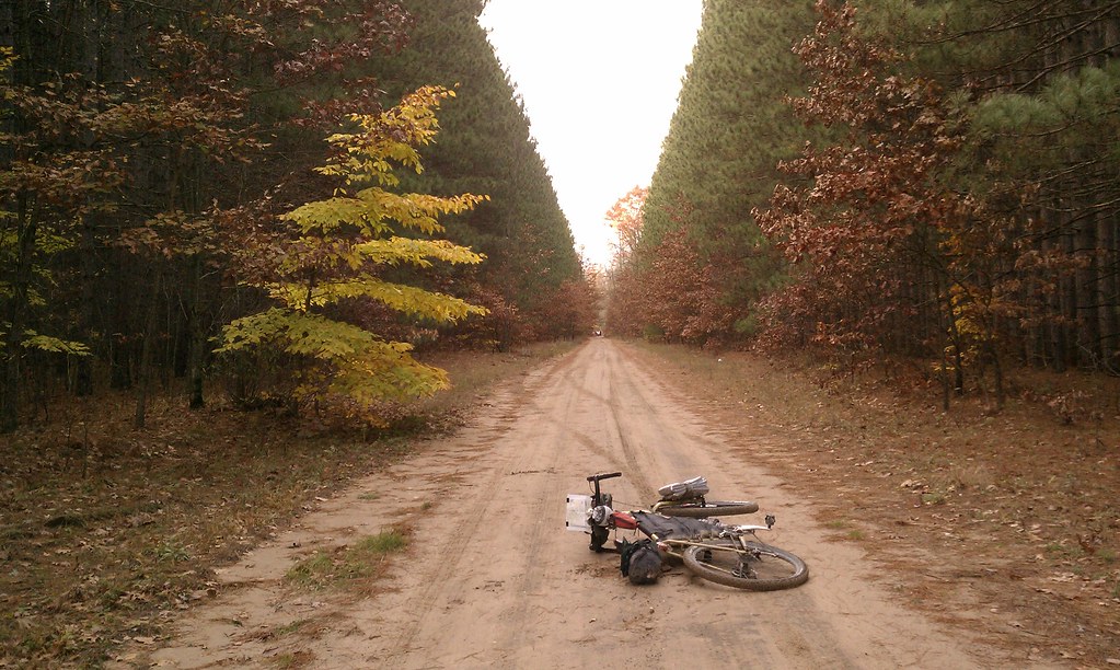 Pine alley
 by
mmeiser2, on Flickr
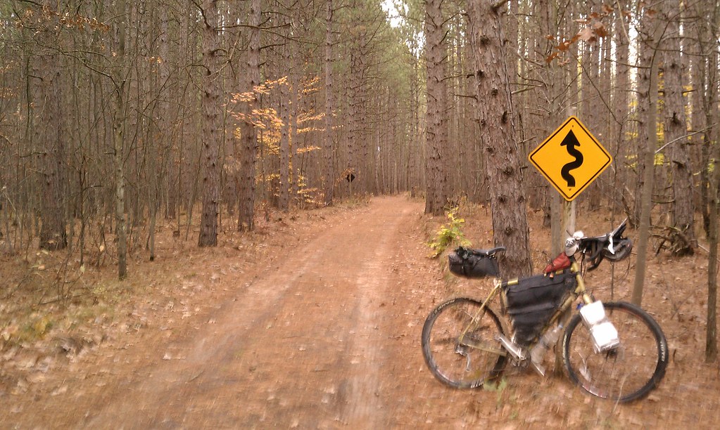 Fargo country
 by
mmeiser2, on Flickr
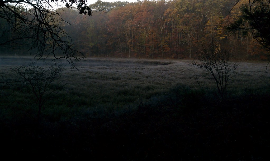 My breakfast view on the North Country Trail
 by
mmeiser2, on Flickr
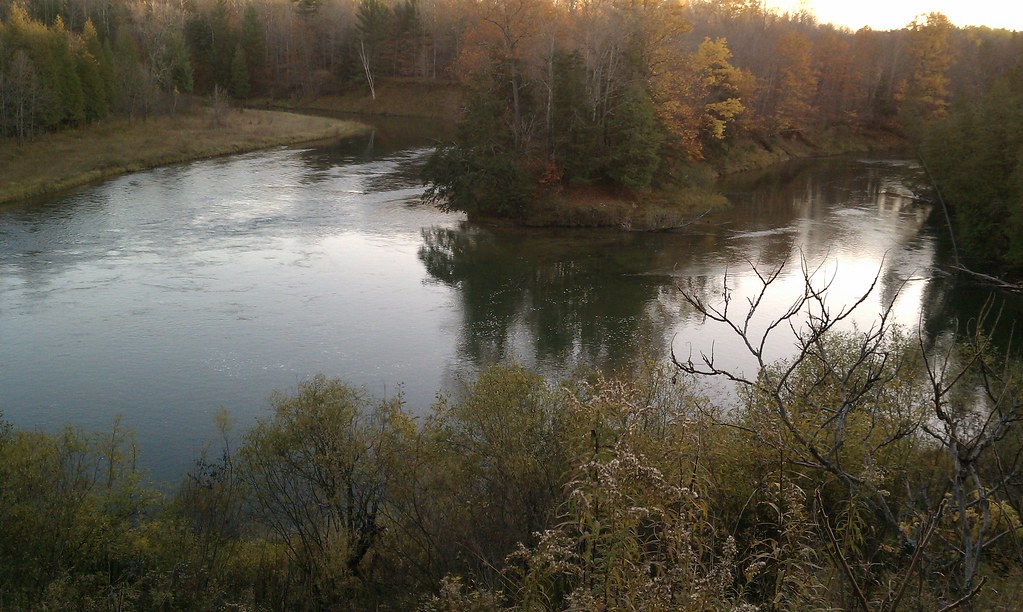 Yester-evening on the Manistee River
 by
mmeiser2, on Flickr
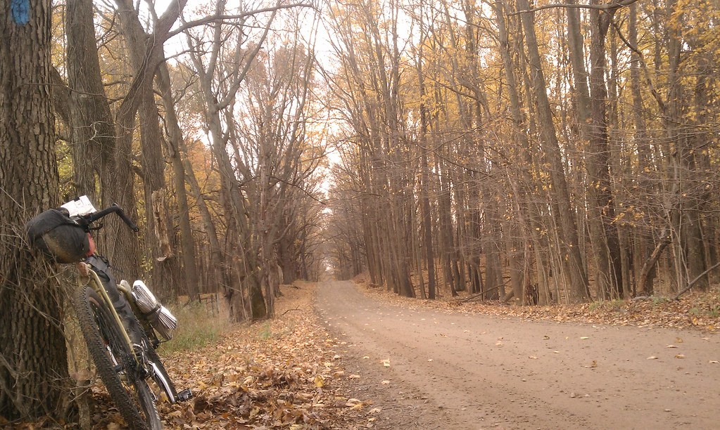 Almost home
 by
mmeiser2, on Flickr
Note the blue blaze in the top right of the pic above... this is part of the official NCT route.
Many more pics, and perhaps even some videos will follow.


